Difference between revisions of "2008-07-24 47 -122"
From Geohashing
imported>Thomcat (Failed again *sigh*) |
imported>FippeBot m (Location) |
||
| (3 intermediate revisions by 2 users not shown) | |||
| Line 10: | Line 10: | ||
Near the Crescent Lake Wilderness Area | Near the Crescent Lake Wilderness Area | ||
| + | |||
| + | == Participants == | ||
| + | *[[User:Thomcat|Thomcat]] | ||
==Expeditions== | ==Expeditions== | ||
| Line 26: | Line 29: | ||
</gallery> | </gallery> | ||
| + | [[Category:Expeditions]] | ||
[[Category:Expeditions with photos]] | [[Category:Expeditions with photos]] | ||
| − | [[Category: | + | [[Category:Coordinates not reached]] |
| + | [[Category:Not reached - Mother Nature]] | ||
| + | {{location|US|WA|SN}} | ||
Latest revision as of 06:05, 7 August 2019
| Thu 24 Jul 2008 in Seattle: 47.8198042, -122.0199890 geohashing.info google osm bing/os kml crox |
Contents
About
Near the Crescent Lake Wilderness Area
Participants
Expeditions
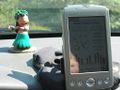
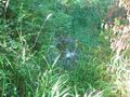
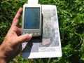
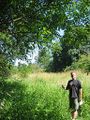
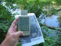
Thomcat
Wasn't sure from the satellite map, but the terrain map tells the story. I parked by Crescent Lake and hiked in a ways. Had to backtrack a few times for dead ends and water features. Eventually, I ran into a Riley Slough. The only way anyone was getting to this geohash was with some sort of boat. On my way back, I hiked past a field of corn, only waist high currently.
1,959 meters away
1,196 meters away
963 meters away


