Difference between revisions of "2008-08-06 53 9"
(iPZe5u <a href="http://ukoubfqesykc.com/">ukoubfqesykc</a>, [url=http://wjmorqwmszvc.com/]wjmorqwmszvc[/url], [link=http://svcbaedvghaj.com/]svcbaedvghaj[/link], http://haqwxsmuktqd.com/) |
imported>Jiml m (I wish I didn't have to be a spam killer - that is what I'd truely like to be...) |
||
| Line 6: | Line 6: | ||
}} | }} | ||
| − | + | ==About== | |
| + | *Coordinates: 53.69556107480375, 9.685621951261334 | ||
| + | *Near town: Pinneberg | ||
| + | *Surroundings: Fields, a small forest, a pond and a churchyard | ||
| + | *Weather: Cloudy, extremely muggy | ||
| + | The hash is on a field in the corner of a copse near "Tornesch" | ||
==Expedition== | ==Expedition== | ||
Revision as of 05:14, 28 January 2010
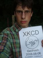
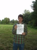
| Wed 6 Aug 2008 in 53,9: 53.6955611, 9.6856220 geohashing.info google osm bing/os kml crox |
About
- Coordinates: 53.69556107480375, 9.685621951261334
- Near town: Pinneberg
- Surroundings: Fields, a small forest, a pond and a churchyard
- Weather: Cloudy, extremely muggy
The hash is on a field in the corner of a copse near "Tornesch"
Expedition
Hermann was there:
I started at about 17:00 heading north. I stopped by the old people's home I was forced to work for the civilian service. There was a barbecue so they gave me a rissole and a banana on the way (I feel like this is the first time the civilian service got me something positive). At the half of the distance I crossed a junction that connected a dead end to the main road. Nothing to it.
After 15km, I passed a group of buildings surrounded by a huge fence. It was a school, I guess, but it looked so dull that I wondered if it could be a prison. On the other hand every cardriver knows that children are dangerous and must be safely contained. Everyone knows the signs saying "Vorsicht Kinder"...
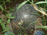
As I came closer to destination I found out that I forgot to bring my GPS. Having learned from my further expeditions I however had a map. I then found out that a new housing estate was built recently and they even had changed the name of the road I was looking for. Geohashing is much mure interesting when you are not sure where you are. Proceeding to the hash I stumbled over an abandoned gravestone family Fox's shallow grave. Near the hash there was a graveyard and a scrapyard. Obviously the scrapyard was used to get rid of old gravestones. I should have constructed a marker with the obsolete gravestones, bur unfortunately I forgot to build a marker in the first place.
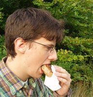
I reached the spot and took photos. I gathered some blackberries, looked for a nice place to picnic and ate them among the food I was given. The meatball was very wet and fungeous - exactly what old people like to eat. At least the sky looked impressive.
Technical details:
- Trip: 42 km
- Time: 2:05:23 h
- Mean speed: 20.1 km/h
- Geonad: approx. 0m
- Pictures
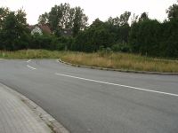
This "road" is approximately 15 metres long
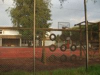
Is this a prison or a school?
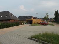
Newly built housing estate
A
gravestoneshallow grave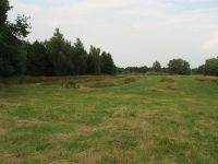
The field northeast to the hash

The pond east of the hash

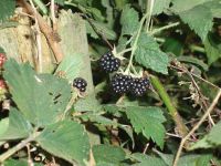
Mmmmm Blackberries...
Later I found out that one needs picnic utilities to apply for the Picnic Geohash Award
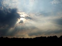
Impressive sunrays


