Difference between revisions of "2008-08-20 47 -122"
From Geohashing
imported>Thomcat m |
imported>FippeBot m (Location) |
||
| Line 42: | Line 42: | ||
[[Category:Expeditions with photos]] | [[Category:Expeditions with photos]] | ||
[[Category:Coordinates reached]] | [[Category:Coordinates reached]] | ||
| + | {{location|US|WA|SN}} | ||
Latest revision as of 06:34, 7 August 2019
| Wed 20 Aug 2008 in Seattle: 47.9932969, -122.0117545 geohashing.info google osm bing/os kml crox |
Contents
About
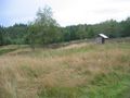
East of Everett, this property is for sale. Here's the zillow listing also. The hash point is within a fingerprint on the google satellite view.
Participants
Expeditions
Thomcat
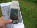
The bridge visible at the realty site was blocked with a gate, so I proceeded on foot. Probably for the best - the focus doesn't have the highest ground clearance.


The hike was uphill, and I never did solve the mystery of the fingerprint. If this land was cultivated at one point, it was quite a while ago. It also started to rain, but nowhere near Drowned Rat Geohash status. Certainly not for the Seattle graticule anyways.
biohazard t-shirt reflected
these noisy brutes wanted attention

my 18th successful hash!


I left a sign for anyone who came later, and headed out to beat the traffic.
