Difference between revisions of "2008-10-18 53 7"
imported>Arvid (another mine swept.) |
imported>FippeBot m (Location) |
||
| (9 intermediate revisions by 9 users not shown) | |||
| Line 8: | Line 8: | ||
==Plan== | ==Plan== | ||
| − | [[User:Arvid|Arvid]] didn't really think it through, but hey: a virginity! | + | [[User:Arvid|Arvid]] didn't really think it through, but hey: a virginity and a minesweeper chance at 105km! How hard can it be? |
==Achievements== | ==Achievements== | ||
| Line 18: | Line 18: | ||
==Expedition== | ==Expedition== | ||
| − | + | [http://maps.google.com/maps?f=q&hl=en&geocode=&q=http:%2F%2Farvid.org%2Ftracks%2Fgeohash20081018.kmz Tracklog] | |
| − | + | There was backwind on the way to the hash, and headwind back, as expected. (Yes, I did check the weatherforecast this time). Also: mostly sunny and dry (liars!). | |
| + | I left home around 11:10. Arrived at the road near the hash at 15:35. It was a dead end. At the start of the dead end there was a sign and some tree-stumps. I spent some time walking in the field, talking to the cows, and tagging the sand. I moved back to the tree-stumps, a couple with a dog came by. I made some more photo's and went back home around 16:05. Arrived home around 21:10. No problems to be mentioned. | ||
| + | The hash was in a field close to the Ems river, with some weird water around the area where the hash was. The roads in that area were mostly unpaved and hard to get through. On the way back I went the other way first, to the river. The road was betterto there. Oh, I missed a couple of roads on the way back. At the start of the return there was some rain, nothing soaking though. Later it got sunny again (as can be seen at the sunset photo's). | ||
| + | <gallery> | ||
| + | Image:2008-10-18 53 7-RES01934.JPG|Entering Deutschland. | ||
| + | Image:2008-10-18 53 7-RES01938.JPG|It's autumn there. | ||
| + | Image:2008-10-18 53 7-RES01940.JPG|Some house close to the hash. | ||
| + | Image:2008-10-18 53 7-RES01941.JPG|Sign with stuff I don't understand. | ||
| + | Image:2008-10-18 53 7-RES01942.JPG|Trusty (*ahem*) machine. | ||
| + | Image:2008-10-18 53 7-RES01948.JPG|Time&date. | ||
| + | Image:2008-10-18 53 7-RES01949.JPG|The "road" that led me to the hashpoint. | ||
| + | Image:2008-10-18 53 7-RES01951.JPG|Sky from the hashpoint. | ||
| + | Image:2008-10-18 53 7-RES01952.JPG|Success! | ||
| + | Image:2008-10-18 53 7-RES01954.JPG|Birdwatchtower. | ||
| + | Image:2008-10-18 53 7-RES01955.JPG|And another one. | ||
| + | Image:2008-10-18 53 7-RES01957.JPG|Nice sky. | ||
| + | Image:2008-10-18 53 7-RES01958.JPG|Nice sky. | ||
| + | Image:2008-10-18 53 7-RES01959.JPG|Nice sky. | ||
| + | Image:2008-10-18 53 7-RES01960.JPG|Nice sky. | ||
| + | Image:2008-10-18 53 7-RES02963.JPG|There were also cows nearby. | ||
| + | Image:2008-10-18 53 7-RES01967.JPG|Tagging. | ||
| + | Image:2008-10-18 53 7-RES01968.JPG|Tagging. | ||
| + | Image:2008-10-18 53 7-RES01969.JPG|Sign on the start of the dead end to the hash. | ||
| + | Image:2008-10-18 53 7-RES01970.JPG|Oh noes! | ||
| + | Image:2008-10-18 53 7-RES01972.JPG|Shrooms. | ||
| + | Image:2008-10-18 53 7-RES01973.JPG|The mighty Ems River. | ||
| + | Image:2008-10-18 53 7-RES01974.JPG|The mighty Ems River. | ||
| + | Image:2008-10-18 53 7-RES02975.JPG|Lots of stuff isn't allowed. | ||
| + | Image:2008-10-18 53 7-RES01976.JPG|Me cycling along the mighty Ems River. | ||
| + | Image:2008-10-18 53 7-RES01977.JPG|Sunset. | ||
| + | Image:2008-10-18 53 7-RES01979.JPG|Sunset. | ||
| + | Image:2008-10-18 53 7-RES01994.JPG|Entering die Niederlände again. | ||
| + | </gallery> | ||
[[Category:Expeditions]] | [[Category:Expeditions]] | ||
[[Category:Expeditions with photos]] | [[Category:Expeditions with photos]] | ||
[[Category:Coordinates reached]] | [[Category:Coordinates reached]] | ||
| + | {{location|DE|NI|EL}} | ||
Latest revision as of 00:27, 8 August 2019
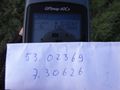
| Sat 18 Oct 2008 in 53,7: 53.0236881, 7.3062578 geohashing.info google osm bing/os kml crox |
Plan
Arvid didn't really think it through, but hey: a virginity and a minesweeper chance at 105km! How hard can it be?
Achievements
- Virginity taken (if there was no Ninja Geohasher).
- Cycled 211.7km
- Also crossed the border on a place where I didn't cross it before.
Expedition
There was backwind on the way to the hash, and headwind back, as expected. (Yes, I did check the weatherforecast this time). Also: mostly sunny and dry (liars!). I left home around 11:10. Arrived at the road near the hash at 15:35. It was a dead end. At the start of the dead end there was a sign and some tree-stumps. I spent some time walking in the field, talking to the cows, and tagging the sand. I moved back to the tree-stumps, a couple with a dog came by. I made some more photo's and went back home around 16:05. Arrived home around 21:10. No problems to be mentioned.
The hash was in a field close to the Ems river, with some weird water around the area where the hash was. The roads in that area were mostly unpaved and hard to get through. On the way back I went the other way first, to the river. The road was betterto there. Oh, I missed a couple of roads on the way back. At the start of the return there was some rain, nothing soaking though. Later it got sunny again (as can be seen at the sunset photo's).
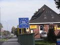
Entering Deutschland.
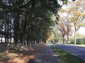
It's autumn there.
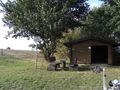
Some house close to the hash.
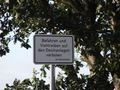
Sign with stuff I don't understand.
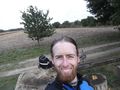
Trusty (*ahem*) machine.
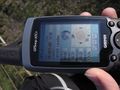
Time&date.
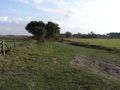
The "road" that led me to the hashpoint.
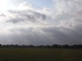
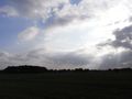
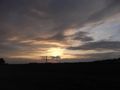
Sky from the hashpoint.
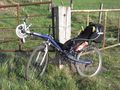
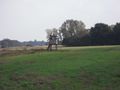
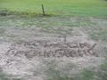
Success!
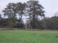
Birdwatchtower.
And another one.
Nice sky.
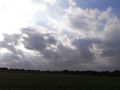
Nice sky.
Nice sky.
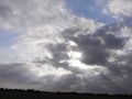
Nice sky.
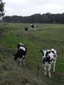
There were also cows nearby.
Tagging.
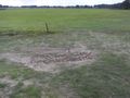
Tagging.
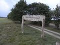
Sign on the start of the dead end to the hash.
Oh noes!
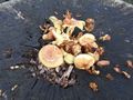
Shrooms.
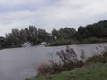
The mighty Ems River.
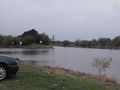
The mighty Ems River.
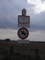
Lots of stuff isn't allowed.
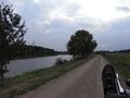
Me cycling along the mighty Ems River.
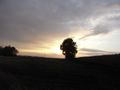
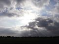
Sunset.
Sunset.
Entering die Niederlände again.


