Difference between revisions of "2009-05-09 50 -119"
From Geohashing
imported>Rhonda (→Photos: +some of Rhonda's photos) |
imported>Rhonda (→Photos: +Rhonda's pics) |
||
| Line 44: | Line 44: | ||
Image:2009-05-09 50 -119.gps.JPG|At the coordinates | Image:2009-05-09 50 -119.gps.JPG|At the coordinates | ||
Image:2009-05-09 50 -119.summit.JPG|At the top of the hill | Image:2009-05-09 50 -119.summit.JPG|At the top of the hill | ||
| + | Image:2009-05-09 50 -119.view-from-hashpoint.jpg|View from the top | ||
| + | Image:2009-05-09 50 -119.marshmallows.jpg|Snack time | ||
| + | Image:2009-05-09 50 -119.bumblebee1.jpg|A visitor | ||
| + | Image:2009-05-09 50 -119.bumblebee2.jpg|Same visitor | ||
Image:2009-05-09 50 -119.beartracks.JPG|A bear took this road too. | Image:2009-05-09 50 -119.beartracks.JPG|A bear took this road too. | ||
Image:S2020720-unknown-flora.jpg|Interesting plants | Image:S2020720-unknown-flora.jpg|Interesting plants | ||
| + | Image:2009-05-09 50 -120.ladyslipper.jpg|Purple flower | ||
| + | Image:2009-05-09 50 -120.regrowth.jpg|Google maps' friendly bright green | ||
| + | Image:2009-05-09 50 -120.skeleton.jpg|A skeleton | ||
| + | |||
</gallery> | </gallery> | ||
[[Category:Expeditions]] | [[Category:Expeditions]] | ||
[[Category:Coordinates reached]] | [[Category:Coordinates reached]] | ||
Revision as of 00:48, 12 May 2009
| Sat 9 May 2009 in 50,-119: 50.6692014, -119.0335969 geohashing.info google osm bing/os kml crox |
Logging road exploration. Deer skeleton, giant bumblebee, mosquitoes. Write up later.
Contents
Location
Up a hill, near a switchback on a forest service road near Mara Lake.
Participants
Planning
Expedition
Morning
Searching for the right logging road
Hiking up
Success
Walking down
Photos
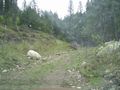
We tried some wrong roads
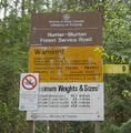
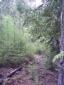
Then found the right road
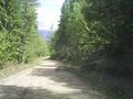
It was nice and wide
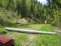
We stopped on a narrower road
Which Robyn didn't like much
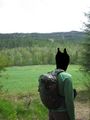
An unexpected meadow
Across a stream and up a bank
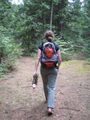
Along another road
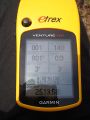
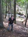
At the coordinates
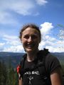
At the top of the hill
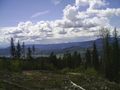
View from the top
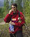
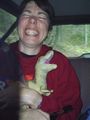
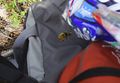
Snack time
A visitor
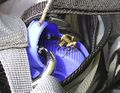
Same visitor
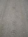
A bear took this road too.
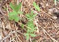
Interesting plants
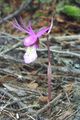
Purple flower
Google maps' friendly bright green
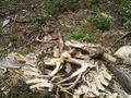
A skeleton


