Difference between revisions of "2009-05-10 50 -120"
From Geohashing
imported>Rhonda (created + sections) |
imported>Rhonda (→Photos: +Rhonda's pics) |
||
| Line 35: | Line 35: | ||
==Photos== | ==Photos== | ||
| + | <gallery> | ||
| + | Image:2009-05-10 50 -120.kamloops-rangeland.jpg|Starting up the switchbacks | ||
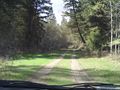
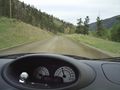
| + | Image:2009-05-10 50 -120.sebastion-creek-fsr.jpg|Steep, winding, good surface | ||
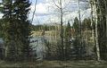
| + | Image:2009-05-10 50 -120.kamloops-lake.jpg|Kamloops Lake | ||
| + | Image:2009-05-10 50 -120.street-signs.jpg|Street signs?! | ||
| + | Image:2009-05-10 50 -120.cows-in-road.jpg|Cows | ||
| + | Image:2009-05-10 50 -120.red-lake.jpg|Red Lake | ||
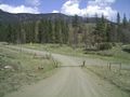
| + | Image:2009-05-10 50 -120.seven-lakes-road.jpg|''This'' was our turnoff??? | ||
| + | Image:2009-05-10 50 -120.7lakes.jpg|Robyn is not so sure about this | ||
| + | Image:2009-05-10 50 -120.rhondas-parents-following.jpg|But we have backup | ||
| + | Image:2009-05-10 50 -120.left-the-road.jpg|Time to hike | ||
| + | Image:2009-05-10 50 -120.tripod setup.jpg|Preparing for the group photo | ||
| + | Image:2009-05-10 50 -120.1of7-lakes.jpg|One of the seven lakes | ||
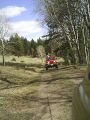
| + | Image:2009-05-10 50 -120.jeep.jpg|Jeep fun | ||
| + | Image:2009-05-10 50 -120.trex-navigating.jpg|T-rex wants out! | ||
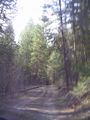
| + | Image:2009-05-10 50 -120.dirt-highway.jpg|Found the way out | ||
| + | Image:2009-05-10 50 -120.shoulder-brand.jpg|Cow | ||
| + | Image:2009-05-10 50 -120.cow-chute.jpg|Cow loading docks | ||
| + | Image:2009-05-10 50 -120.walking-bird.jpg|Bird that wouldn't fly | ||
| + | </gallery> | ||
[[Category:Expeditions]] | [[Category:Expeditions]] | ||
[[Category:Coordinates reached]] | [[Category:Coordinates reached]] | ||
Revision as of 01:04, 12 May 2009
| Sun 10 May 2009 in 50,-120: 50.9003955, -120.8551485 geohashing.info google osm bing/os kml crox |
Contents
Location
Up a hill, well into the logging road network just north of Kamloops Lake.
Participants
Planning
Expedition
Morning
Highway
Big logging road
Small logging road
Hiking up
Success
Hiking down
Home
Photos
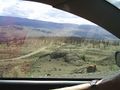
Starting up the switchbacks
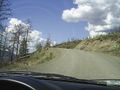
Steep, winding, good surface
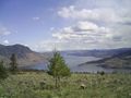
Kamloops Lake
Street signs?!
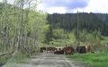
Cows
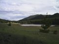
Red Lake
This was our turnoff???
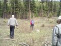
Robyn is not so sure about this
But we have backup
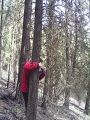
Time to hike
Preparing for the group photo
One of the seven lakes
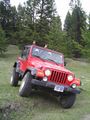
Jeep fun
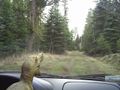
T-rex wants out!
Found the way out

Cow
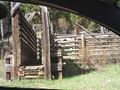
Cow loading docks
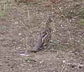
Bird that wouldn't fly


