2009-05-10 50 -120
| Sun 10 May 2009 in 50,-120: 50.9003955, -120.8551485 geohashing.info google osm bing/os kml crox |
Contents
Location
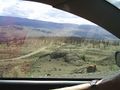
Up a hill, well into the logging road network just north of Kamloops Lake.
Participants
Preparation
We hadn't planned a Sunday geohash when we left Vancouver on this expedition, but we had the opportunity, so why not. Robyn's mother has Internet, so we looked up and noted the coordinates, then zoomed in on Google Maps to discover that the Kamloops graticule coordinates were accessible from highway one, via Sabiston Creek Road and another unnamed road that was both mapped and visible on Google Maps. Robyn's mother's printer didn't work, so Robyn drew a sketch map of the turnoff and the roads that would get there, getting us to within about 1.5 km of the geohash. We drove first to Kamloops itself, to visit Rhonda's mother, this being an appropriate thing to do on Mother's Day.
When we got to Rhonda's parents place, they had a more detailed backroads map, and it showed other roads, with symbols indicating the quality of each road. We planned out a course with a better road that went even closer to the geohash. On this map Sabiston Creek Road was Sabastion Creek Road, and lat long were indicated (although on our page they were misprinted). Rhonda's mother was much better equipped than Robyn's mother and was able to provide a colour photocopy of the map book page. Now we felt really prepared for the expedition.
We felt even more prepared when Rhonda's parents provided us with an amazingly delicious lunch of something called Kroketten which is breaded, deep fried soup. Yes, you wouldn't think you could bread and deep fry soup but the Dutch are very clever. Lunch in our bellies, water bottles filled, maps obtained. This might be the best prepared expedition ever for our team. Not a really high bar, but still.
Expedition
We even invited Rhonda's parents to join us, and they agreed. We couldn't go all in one vehicle because the back of RObyn's tiny car was loaded up with camping and geohashing stuff and Rhonda's parents had a two-seater Jeep. So Rhonda and Robyn led the convoy, with Robyn driving and Rhonda navigating, out of Kamloops, onto highway one, past Savona to Sabiston Creek Road. Yes, Sabiston. Sometimes Google Maps is right. We did not take this as an omen, we just took the road. It was easy to drive, with a good surface, not too much loose gravel and despite the twisty corners Robyn was driving about forty, with no need to scream and clutch her dinosaur.
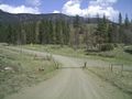
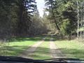
Big logging road
Small logging road
Hiking up
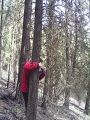
Success
Hiking down
Home
GPS Tracklog and Analysis
The tracklog tells the tale.
Photos
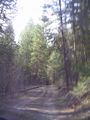
Starting up the switchbacks
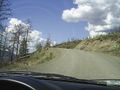
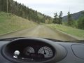
Steep, winding, good surface
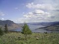
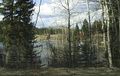
Kamloops Lake
Street signs?!
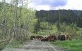
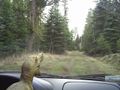
Cows
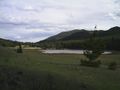
Red Lake
This was our turnoff???
Robyn is not so sure about this
But we have backup
Time to hike
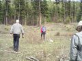
Preparing for the group photo
One of the seven lakes
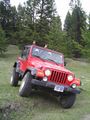
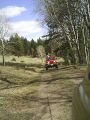
Jeep fun
T-rex wants out!
Found the way out

Cow
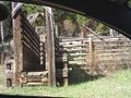
Cow loading docks
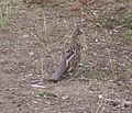
Bird that wouldn't fly


