2009-05-10 50 -120
| Sun 10 May 2009 in 50,-120: 50.9003955, -120.8551485 geohashing.info google osm bing/os kml crox |
Contents
Location
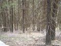
Up a hill, well into the logging road network just north of Kamloops Lake.
Participants
Preparation
We hadn't planned a Sunday geohash when we left Vancouver on this expedition, but we had the opportunity, so why not. Robyn's mother has Internet, so we looked up and noted the coordinates, then zoomed in on Google Maps to discover that the Kamloops graticule coordinates were accessible from highway one, via Sabiston Creek Road and another unnamed road that was both mapped and visible on Google Maps. Robyn's mother's printer didn't work, so Robyn drew a sketch map of the turnoff and the roads that would get there, getting us to within about 1.5 km of the geohash. We drove first to Kamloops itself, to visit Rhonda's mother, this being an appropriate thing to do on Mother's Day.
When we got to Rhonda's parents place, they had a more detailed backroads map, and it showed other roads, with symbols indicating the quality of each road. On this map Sabiston Creek Road was Sabastion Creek Road, and lat long were indicated (although on our page they were misprinted). It showed that the turnoff we had chosen from Sab-whatever Road was of lower quality, but that there was better road, not shown on Google Maps, called Seven Lakes Road, that went even closer to the geohash. Rhonda's mother was much better equipped than Robyn's mother and was able to provide a colour photocopy of the map book page. Now we felt really prepared for the expedition.
We felt even more prepared when Rhonda's parents provided us with an amazingly delicious lunch of something called Kroketten which is breaded, deep fried soup. Yes, you wouldn't think you could bread and deep fry soup but the Dutch are very clever. Lunch in our bellies, water bottles filled, maps obtained. This might be the best prepared expedition ever for our team. Not a really high bar, but still.
Expedition
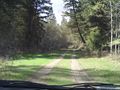
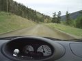
We even invited Rhonda's parents to join us, and they agreed. We couldn't go all in one vehicle because the back of Robyn's tiny car was loaded up with camping and geohashing stuff and Rhonda's parents had a two-seater Jeep. So Rhonda and Robyn led the convoy, with Robyn driving and Rhonda navigating, out of Kamloops, onto highway one, past Savona to Sabastion Creek Road. Does Google Maps ever get it right? We took the road. It was easy to drive, with a good surface, not too much loose gravel and despite the twisty corners Robyn was driving about forty, with no need to scream and clutch her dinosaur.
We ignored lots of turn offs of varying quality, because we knew that this road would lead us to Seven Lakes Road. The roads were all rated and both Sabastion Creek Road and Seven Lakes Road had the highest rating. Robyn concentrated on driving while Rhonda had the GPS and the maps. Rhonda's parents followed on behind in the Jeep. When we got to a signpost for Copper Creek, we turned left, away from Kamloops Lake.
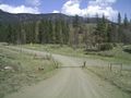
Animals on the road
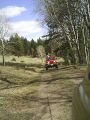
This is multi-purpose public land, so some people buy licences to cut trees on it and others lease the right to graze cows on it. They can build fences to keep their cows from wandering too far, but they can't block the road, so every so often along the road there is a cattleguard, designed so cars can cross, but not cows. We know from that, and from Watch for Livestock signs that we can expect to encounter cows. It's part of the adventure. The first cow we saw outside of fences was just standing by the side of the road. We slowed down to pass it, in case it suddenly decided to jump onto the road, but it didn't. Another group of cows were standing and lying beside the road, but also didn't block our path. And then we came around the corner to a cattle guard and there was a small herd of cattle lounging around the other side. I suppose they tended to wander along the road and just congregated at the point where they were blocked.
Robyn slowed the car to a walking pace and rolled slowly towards the cows to see what they would do. The standing ones stated to walk away, but along the road, not getting out of the way, and the ones that were lying down lumbered to their feet. Robyn bumped over the cattleguard and slowly herded the cows along the road until they moved off to the side and let us pass.
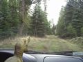
The next set of cows were not blocking the road, but they had company in the form of large deer. It was funny to see the deer walk up to the fences and bound over them effortlessly, without even taking a run at it. Rhonda tried to take pictures but even though the deer seemed to hang in the air as they floated over the fences her camera wasn't quick enough to capture anything but a deer landing on the other side.
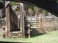
We also saw cattle chutes, loading docks for cows, and passed an apparently empty cattle truck coming the other way. There was lots of room for us to pass each other, as fortuitously we came upon the truck just as we reached a big pullout.
- Red Lake
- "My navigator informs me we need to turn around."
- Back to sharpest switchback for road leading off end
- Seven Lakes road, but nasty
- Accidental fork, to unexpected intersection
- scouting trip
- fallen tree
- Criss Creek road
- Deadman Vidette
- Indian Band "It had a seven in it"
- Trans Canada highway
- Dinner?
- Fire your navigator
- Coquihalla - Robyn sleep
- Merritt - change drivers
- No road lines
- Hope - everything closed
- TransCanada, home, sleep
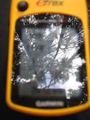
GPS Tracklog and Analysis
The tracklog tells the tale.
Photos
Starting up the switchbacks
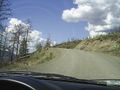
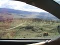
Steep, winding, good surface
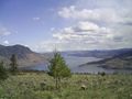
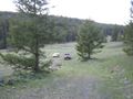
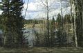
Kamloops Lake
Street signs?!
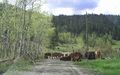
Cows
Red Lake
This was our turnoff???
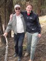
Robyn is not so sure about this
But we have backup
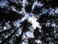
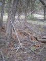
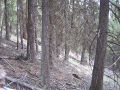
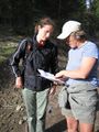
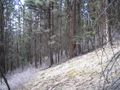
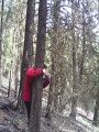
Time to hike
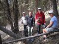
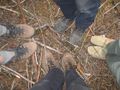
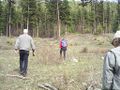
Preparing for the group photo
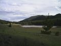
One of the seven lakes
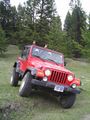
Jeep fun
T-rex wants out!
Found the way out

Cow
Cow loading docks
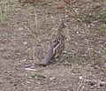
Bird that wouldn't fly