Difference between revisions of "2009-05-21 -33 149"
imported>Ephphatha m (Windows said the photo was taking at 00:20, the exif data actually says 00:40. Yay vista.) |
m (More specific location) |
||
| (4 intermediate revisions by 2 users not shown) | |||
| Line 13: | Line 13: | ||
==Report== | ==Report== | ||
| − | I was considering skipping this hash. I had no time to do it during daylight hours and when I got home I was feeling too sick to really do much. But, it's a special day, it's close, and I needed to go to the servo to get some lemonade to settle my stomach anyway. So I drove, which is a rarity these days. Parked on Limekilns Road, hopped a fence and walked there. I figured it was crown land and was expecting one fence on the boundary. I was rather puzzled when I wandered 100 metres through this field only to find another fence cutting right through the middle of the land, with a ten metre break in it for no apparent reason. | + | I was considering skipping this hash. I had no time to do it during daylight hours and when I got home I was feeling too sick to really do much. But, it's a special day, it's close, and I needed to go to the servo to get some lemonade to settle my stomach anyway. So I drove, which is a rarity these days. Parked on Limekilns Road, hopped a fence and walked there. I figured it was crown land and was expecting one fence on the boundary. I was rather puzzled when I wandered 100 metres through this field only to find another fence cutting right through the middle of the land, with a ten metre break in it for no apparent reason. I kept going. |
60 metres from the hash and I was regretting my choice of footwear when I nearly fell into a ditch. | 60 metres from the hash and I was regretting my choice of footwear when I nearly fell into a ditch. | ||
| Line 23: | Line 23: | ||
Total time elapsed: 0:30<br> | Total time elapsed: 0:30<br> | ||
Total distance traveled: 14km | Total distance traveled: 14km | ||
| + | |||
| + | {{Geohashing Day | ||
| + | | latitude = -33 | ||
| + | | longitude = 149 | ||
| + | | year = 2009 | ||
| + | | coorddate= 2009-05-21 | ||
| + | | name = Ephphatha | ||
| + | | celebration = trampling through unknown vegetation in sandals | ||
| + | }} | ||
==Photos== | ==Photos== | ||
| Line 32: | Line 41: | ||
[[Category:Expeditions with photos]] | [[Category:Expeditions with photos]] | ||
[[Category:Coordinates reached]] | [[Category:Coordinates reached]] | ||
| + | {{location|AU|NSW|BT}} | ||
Latest revision as of 11:43, 1 August 2020
| Thu 21 May 2009 in Bathurst: -33.4042194, 149.6254432 geohashing.info google osm bing/os kml crox |
Contents
Location
Heading out of kelso, in a block of land helpfully located between two roads.
Attendees
Report
I was considering skipping this hash. I had no time to do it during daylight hours and when I got home I was feeling too sick to really do much. But, it's a special day, it's close, and I needed to go to the servo to get some lemonade to settle my stomach anyway. So I drove, which is a rarity these days. Parked on Limekilns Road, hopped a fence and walked there. I figured it was crown land and was expecting one fence on the boundary. I was rather puzzled when I wandered 100 metres through this field only to find another fence cutting right through the middle of the land, with a ten metre break in it for no apparent reason. I kept going.
60 metres from the hash and I was regretting my choice of footwear when I nearly fell into a ditch.
20 metres from the hash and I was wishing I brought a fucking torch, when I got my foot snagged on a piece of wire or something and nearly lost a sandal.
4 metres past the hash, I did a bee dance and couldn't get any closer, so I snapped a photo and started on the way home. It was 23:40 or so and cloudy, there was nothing to see. (I just realised the exif data is funky, it's off by an hour for some reason.)
Total time elapsed: 0:30
Total distance traveled: 14km
Ephphatha earned the 2009 Geohashing Day achievement
|
Photos
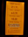
The proof is in the picture. (Shaky photo, it was a little chilly.)
