Difference between revisions of "2009-06-05 40 -73"
imported>Jevanyn (New page: {{subst:expedition|lat=40|lon=-73|date=2009-06-05 }}) |
imported>FippeBot m (Location) |
||
| (10 intermediate revisions by one other user not shown) | |||
| Line 1: | Line 1: | ||
| − | |||
<!-- If you did not specify these parameters in the template, please substitute appropriate things for IMAGE, LAT, LON, and DATE (YYYY-MM-DD format) --> | <!-- If you did not specify these parameters in the template, please substitute appropriate things for IMAGE, LAT, LON, and DATE (YYYY-MM-DD format) --> | ||
| − | |||
{{meetup graticule | {{meetup graticule | ||
| lat=40 | | lat=40 | ||
| Line 11: | Line 9: | ||
__NOTOC__ | __NOTOC__ | ||
== Participants == | == Participants == | ||
| + | *[[User:Jevanyn|Jevanyn]] | ||
| + | == Plans == | ||
| + | The geohash is between the northbound and southbound lanes of the Palisades Parkway. [[Speed Racer Geohash]] it is! | ||
| − | == | + | == Expedition == |
| + | Or not! While a location on the median of a highway practically begs for a high-speed geohash, doing so without a co-pilot to photograph an actual GPS device takes the fun out of it. | ||
| + | |||
| + | Besides, as it turns out, the offramp that lay so close to the geohash led to the Alpine Lookout, from which one can partake of a scenic view of <strike>the Alps</strike> [[wikipedia:Yonkers, New York|Yonkers, New York]]. Okay, it's not [[wikipedia:the Ginza|the Ginza]] or [[wikipedia:Times Square|Times Square]], but it would have been an ideal spot to watch Sully land that plane on the Hudson back in January. | ||
| + | It also gave be a nice place to park while I dashed across the road to the median and made funny faces at the camera, probably disturbing any number of mundanes as they drove north toward . . . whatever is north of there (sorry, I put the map away.) | ||
| − | + | I was not able to contact or meet up with [[User:Brandon|Brandon]], who was available for Thursday's geohash but not until much later than I could stay. | |
| + | After taking photos, I headed down the Turnpike to Linden, my old home town . . . . [[2009-06-06 40 -74]] | ||
| − | |||
== Photos == | == Photos == | ||
| − | + | Coming soon! | |
| − | <gallery | + | <gallery> |
| − | Image:2009- | + | Image:2009-06-05 40 -73 100 8256.JPG | A city skyline across the hudson. |
| − | Image:2009- | + | Image:2009-06-05 40 -73 100 8258.JPG | Exit sign for the scenic outlook. |
| + | Image:2009-06-05 40 -73 100 8259.JPG | Northbound traffic. Speed Racer geohash ribbons for all! | ||
| + | Image:2009-06-05 40 -73 100 8260.JPG | Moments before being run over! | ||
| + | Image:2009-06-05 40 -73 100 8262.JPG | Hey, wait, someone is sniffing around the van... | ||
</gallery> | </gallery> | ||
| − | + | == Ribbons == | |
| − | + | {{Minesweeper geohash | |
| − | [[ | + | |graticule=Newark, New Jersey |
| − | + | |date=2009-06-05 | |
| + | |ranknumber=3 | ||
| + | |n=true | ||
| + | |w=true | ||
| + | |e=true | ||
| + | |name=[[User:Jevanyn|Jevanyn]]}} | ||
| − | |||
| − | |||
| − | |||
[[Category:Expeditions]] | [[Category:Expeditions]] | ||
[[Category:Expeditions with photos]] | [[Category:Expeditions with photos]] | ||
| − | |||
[[Category:Expedition without GPS]] | [[Category:Expedition without GPS]] | ||
| − | |||
| − | |||
| − | |||
[[Category:Coordinates reached]] | [[Category:Coordinates reached]] | ||
| − | + | {{location|US|NJ|BE}} | |
| − | |||
| − | |||
| − | |||
| − | |||
| − | |||
| − | |||
| − | |||
| − | |||
| − | |||
Latest revision as of 03:44, 8 August 2019
| Fri 5 Jun 2009 in 40,-73: 40.9295027, -73.9279526 geohashing.info google osm bing/os kml crox |
Participants
Plans
The geohash is between the northbound and southbound lanes of the Palisades Parkway. Speed Racer Geohash it is!
Expedition
Or not! While a location on the median of a highway practically begs for a high-speed geohash, doing so without a co-pilot to photograph an actual GPS device takes the fun out of it.
Besides, as it turns out, the offramp that lay so close to the geohash led to the Alpine Lookout, from which one can partake of a scenic view of the Alps Yonkers, New York. Okay, it's not the Ginza or Times Square, but it would have been an ideal spot to watch Sully land that plane on the Hudson back in January.
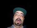
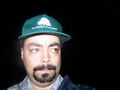
It also gave be a nice place to park while I dashed across the road to the median and made funny faces at the camera, probably disturbing any number of mundanes as they drove north toward . . . whatever is north of there (sorry, I put the map away.)
I was not able to contact or meet up with Brandon, who was available for Thursday's geohash but not until much later than I could stay.
After taking photos, I headed down the Turnpike to Linden, my old home town . . . . 2009-06-06 40 -74
Photos
Coming soon!
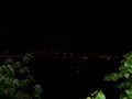
A city skyline across the hudson.
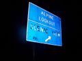
Exit sign for the scenic outlook.
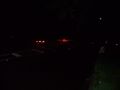
Northbound traffic. Speed Racer geohash ribbons for all!
Moments before being run over!
Hey, wait, someone is sniffing around the van...


Ribbons
Jevanyn achieved level 3 of the Minesweeper Geohash achievement
|