Difference between revisions of "2009-08-08 50 -2"
imported>Sermoa m (illustrate the main report with a few photos) |
imported>Macronencer (→Gallery: Add Macronencer photos) |
||
| Line 58: | Line 58: | ||
Image:2009-08-08_50_-2_3167.JPG | View of chesil bay and weymouth | Image:2009-08-08_50_-2_3167.JPG | View of chesil bay and weymouth | ||
Image:2009-08-08_50_-2_3169.JPG | A war memorial at the top of the hill | Image:2009-08-08_50_-2_3169.JPG | A war memorial at the top of the hill | ||
| + | </gallery> | ||
| + | |||
| + | <gallery perrow="4"> | ||
| + | Image:2009-08-08_50_-2_Macronencer_01.jpg | View down the causeway | ||
| + | Image:2009-08-08_50_-2_Macronencer_02.jpg | GPS co-ordinates | ||
| + | Image:2009-08-08_50_-2_Macronencer_03.jpg | Chuck has found some botany to study! | ||
| + | Image:2009-08-08_50_-2_Macronencer_04.jpg | Chesil beach | ||
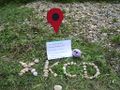
| + | Image:2009-08-08_50_-2_Macronencer_05.jpg | Macronencer made the XKCD part, then Sermoa texted to say she would be 20 minutes so he filled the time by finishing the rest! | ||
| + | Image:2009-08-08_50_-2_Macronencer_06.jpg | Sermoa planting her Google marker | ||
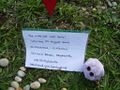
| + | Image:2009-08-08_50_-2_Macronencer_07.jpg | Saturday Meetup! Hopefully we'll have more than two next time. | ||
| + | Image:2009-08-08_50_-2_Macronencer_08.jpg | You could see the marker from the top of the stones. I wonder how many people will walk down to investigate? | ||
| + | Image:2009-08-08_50_-2_Macronencer_09.jpg | Sermoa enjoying the seaside | ||
| + | Image:2009-08-08_50_-2_Macronencer_10.jpg | The culvert where the map reference was posted | ||
| + | Image:2009-08-08_50_-2_Macronencer_11.jpg | The Heights Hotel, where the bus stops at the top of Portland | ||
| + | Image:2009-08-08_50_-2_Macronencer_12.jpg | Embedded in tarmac on the way back down the causeway. They stole my idea! And they must have had a time machine too! | ||
| + | Image:2009-08-08_50_-2_Macronencer_13.jpg | Beautiful view from the bridge at the Weymouth end of the causeway | ||
| + | Image:2009-08-08_50_-2_Macronencer_14.jpg | Sermoa working on her ActiveGeohasher Ruby app, on the way back on the train. | ||
</gallery> | </gallery> | ||
Revision as of 10:02, 9 August 2009
| Sat 8 Aug 2009 in 50,-2: 50.5645846, -2.4527411 geohashing.info google osm bing/os kml crox |
Contents
Location

On portland beach! Just over the causeway from weymouth!
Participants
Plans
As far as i know it'll be a normal xkcd saturday meetup at 4pm! i will take the train there and be on the beach for fun and frivolity!
Looks like i can take the train from Winchester at 13:33 and go directly to Weymouth for 15:13. Chance for some coding on the train, win! then i'll walk from weymouth station to the geohash point in time for 16:00.
- update: google maps says it'll take an hour and a half to walk from the station. so i'll take the train an hour earlier and still be there for 4pm. i hope some local weymouth people are coming ...? --sermoa 08:21, 8 August 2009 (UTC)
- another update: i think the First Bus number 1 goes from weymouth railway station to portland. follow me on twitter for updates of where i am this afternoon!
Expedition
Sermoa's journey

I took the train from Winchester at 13:06, coding all the way on my laptop (win!) and arrived in Weymouth at just gone 15:00. I walked down to the beach, faffed a while trying to find the right bus stop, ended up getting on the 501 which was an open-top bus so i got some great photos of Weymouth beach (which was PACKED!!)
As you get closer to Portland you see it looming out of the sea in the distance, like a big loomy mountain. one thing you don't get from google maps satellite view is the elevation. i imagined portland would be quite flat but in fact it's a very steep hill.

I got off the bus just over the causeway, mostly because i was afraid there wouldn't be another bus stop and i didn't want to go too far into portland. as i walked closer to the geohash i saw mike already busy arranging an xkcd marker with stones. we took some photos of the hash together and then climbed over the steep bank of pebbles to see the beach the other side. WOW!! the view was just astounding! the sun was shining on the water just like Secondlife with the Windlight viewer! the sea was a beautiful shade of blue. we walked down the other side of the bank and just sat on the beach chatting and enjoying the sun and water for about half an hour.
One thing i love about geohashing is you get to see places you might never see otherwise. When most people go to weymouth they probably stay on the overcrowded main beach. this beach was almost deserted and much more pleasant.
We had seen some buses going up the hill into portland. i had a bus day ticket so i quite liked the idea of going up to the top. which we did! my gosh, was the view incredible! we actually only went up as far as Fortuneswell so there's a lot of portland still to see. you could really spend a holiday there. From the top of the hill we had a fantastic view of the geohash point, and chesil cove and weymouth.
Haha cool, i just noticed there is a road on portland called Leet Close! We should have gone there!!
Macronencer's journey
Due to unaccustomed cycling, knackered as a supernova-surviving whelk right now: will write something and post photos tomorrow. My thanks to Sermoa for turning up, and for handling this page!
Gallery
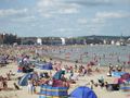
Weymouth beach full of people soaking up the sunshine

Weymouth marina
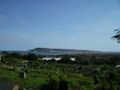
First glimpse of Portland island
Kite surfing in chesil bay

The 501 bus i took to get to Portland
Nearly at the geohash, i can see mike already there
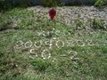
Stones mark the occasion
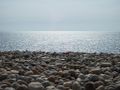
The amazing view from the top of the pebble bank
Looking back down towards the geohash

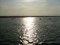
Someone out sailing
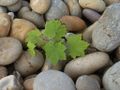
A lone plant growing among the pebbles
Google pin and Monica, my hashcot
The internet was here!
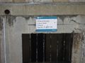
OS grid reference proves the location: SY 6800 3799
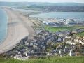
View of the geohash from the top of Fortuneswell

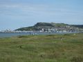
View of chesil bay and weymouth

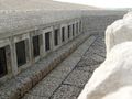
A war memorial at the top of the hill


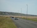
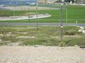
View down the causeway
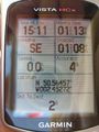
GPS co-ordinates

Chuck has found some botany to study!

Chesil beach
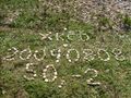
Macronencer made the XKCD part, then Sermoa texted to say she would be 20 minutes so he filled the time by finishing the rest!
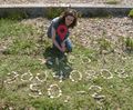
Sermoa planting her Google marker
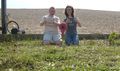
Saturday Meetup! Hopefully we'll have more than two next time.
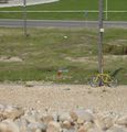
You could see the marker from the top of the stones. I wonder how many people will walk down to investigate?

Sermoa enjoying the seaside
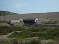
The culvert where the map reference was posted
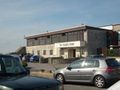
The Heights Hotel, where the bus stops at the top of Portland
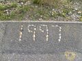
Embedded in tarmac on the way back down the causeway. They stole my idea! And they must have had a time machine too!
Beautiful view from the bridge at the Weymouth end of the causeway

Sermoa working on her ActiveGeohasher Ruby app, on the way back on the train.


