Difference between revisions of "2009-08-24 50 -1"
(New page: <!-- If you did not specify these parameters in the template, please substitute appropriate things for IMAGE, LAT, LON, and DATE (YYYY-MM-DD format) --> <!-- [[Image:{{{image|IMAGE}}}|thum...) |
imported>FippeBot m (Location) |
||
| (11 intermediate revisions by 4 users not shown) | |||
| Line 12: | Line 12: | ||
__NOTOC__ | __NOTOC__ | ||
== Location == | == Location == | ||
| − | Isle of Wight, | + | Near to Osborne House on the Isle of Wight. From the [http://maps.google.co.uk/?q=50.75257239301458,-1.2592734043710418&z=16 Google maps satellite photos], we couldn't tell whether the co-ordinates actually lie within the grounds of Osborne House. Not wanting to spend £8.40 per person to enter (although we could have won the Admit One achievement!), we planned a route avoiding the main entrance to the house. |
== Participants == | == Participants == | ||
[[User:04housemat|04housemat]] | [[User:04housemat|04housemat]] | ||
<br>[[User:Mahahahaneapneap|Mahahahaneapneap]] | <br>[[User:Mahahahaneapneap|Mahahahaneapneap]] | ||
| − | <br> | + | <br>[[User:Owenrowland|Owenrowland]] |
| + | == Plans == | ||
| + | Get the train to Moreton (to be joined by Owen at Wareham) then cycle approximately 5 miles to [http://maps.google.co.uk/?q=50.75257239301458,-2.2592734043710418&z=16 the Weymouth graticule's geohash]. | ||
| + | |||
| + | Get the train from Moreton to Brockenhurst, then change for Lymington pier. Take the ferry across to Yarmouth then cycle approximately 15 miles from the ferry terminal to the geohash, via the chain ferry in Cowes. | ||
| − | == | + | == Expedition == |
| − | + | Matt got the train from Hamworthy expecting Ali to already be on it. He wasn't. He was in bed. At Wareham, Matt and Owen went to get some food from the only shop in the entire town. Ali then phoned and said that he was going to be even later as he had forgotten the satnav. Owen and Matt got on a train to Poole, where Ali got on and told us that he had it in his bag all along. | |
| − | |||
| − | |||
| + | We then decided not to visit the Weymouth geohash, so as not to miss the last train from Lymington to Brockenhurst, or still be cycling in the dark. We went to the Isle of Wight as planned. The ride was long and very hilly but we continued with determination. We cycled down a road past several signs advising us to turn back. We then left our bikes next to a clump of trees in the middle of a field and made our way into the adjacent field. From here, we "scaled" another thin wire fence to enter the grounds of Osborne House. | ||
| − | + | It was a pleasant stroll along the well kept paths towards the forest in which the co-ordinates were located. Hurdling another fence, we entered the nearby golf course. We then proceeded to wonder round the forest for a while (see the tracklog screenshot), constantly checking the satnav. We then rode back and got the ferry and trains home. | |
| − | |||
| + | This geohash had huge potential - we could have earned the Admit One, Golf and Multihash achievements, but we did not. However, it really was a great day out :) | ||
== Photos == | == Photos == | ||
<gallery perrow="4"> | <gallery perrow="4"> | ||
| − | + | Image:2009-08-24 50 -1 04housemat (1).JPG|GeoTrain | |
| + | Image:2009-08-24 50 -1 04housemat (2).JPG|GeoGroupshot | ||
| + | Image:2009-08-24 50 -1 04housemat (3).JPG|GeoHead | ||
| + | Image:2009-08-24 50 -1 04housemat (4).JPG|GeoFerry | ||
| + | Image:2009-08-24 50 -1 04housemat (5).JPG|GeoQuassie | ||
| + | Image:2009-08-24 50 -1 04housemat (6).JPG|GeoCrossing | ||
| + | Image:2009-08-24 50 -1 04housemat (7).JPG|GeoGays | ||
| + | Image:2009-08-24 50 -1 04housemat (8).JPG|GeoRoute | ||
| + | Image:2009-08-24 50 -1 04housemat (9).JPG|GeoPose | ||
| + | Image:2009-08-24 50 -1 04housemat (10).JPG|GeoPiss | ||
| + | Image:2009-08-24 50 -1 04housemat (11).JPG|GeoPose | ||
| + | Image:2009-08-24 50 -1 04housemat (12).JPG|GeoPose | ||
| + | Image:2009-08-24 50 -1 04housemat (13).JPG|GeoGoTrain | ||
| + | Image:2009-08-24 50 -1 04housemat (14).JPG|Free GeoFood | ||
| + | Image:2009-08-24 50 -1 04housemat (16).JPG|GeoFlood | ||
| + | Image:2009-08-24 50 -1 04housemat (17).JPG|GeoCreams | ||
| + | Image:2009-08-24 50 -1 04housemat (18).JPG|No entry for Geohashers | ||
| + | Image:2009-08-24 50 -1 04housemat (19).JPG|GeoHouse | ||
| + | Image:2009-08-24 50 -1 04housemat (20).JPG|GeoBreak | ||
| + | Image:2009-08-24 50 -1 04housemat (21).JPG|Ridiculously powerful GeoTide | ||
| + | Image:2009-08-24 50 -1 04housemat (22).JPG|Nice GeoViews | ||
| + | Image:2009-08-24 50 -1 04housemat (23).JPG|Chocolate bar. | ||
| + | Image:2009-08-24 50 -1 04housemat (24).JPG|GeoPose | ||
| + | Image:2009-08-24 50 -1 04housemat (25).JPG|GeoGaze | ||
| + | Image:2009-08-24 50 -1 04housemat (26).PNG|GeoEvidence | ||
</gallery> | </gallery> | ||
| Line 43: | Line 70: | ||
[[Category:Coordinates reached]] | [[Category:Coordinates reached]] | ||
| + | {{location|GB|ENG|IOW}} | ||
Latest revision as of 05:22, 8 August 2019
| Mon 24 Aug 2009 in 50,-1: 50.7525724, -1.2592734 geohashing.info google osm bing/os kml crox |
Location
Near to Osborne House on the Isle of Wight. From the Google maps satellite photos, we couldn't tell whether the co-ordinates actually lie within the grounds of Osborne House. Not wanting to spend £8.40 per person to enter (although we could have won the Admit One achievement!), we planned a route avoiding the main entrance to the house.
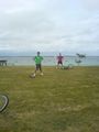
Participants
04housemat
Mahahahaneapneap
Owenrowland
Plans
Get the train to Moreton (to be joined by Owen at Wareham) then cycle approximately 5 miles to the Weymouth graticule's geohash.
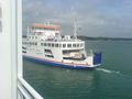
Get the train from Moreton to Brockenhurst, then change for Lymington pier. Take the ferry across to Yarmouth then cycle approximately 15 miles from the ferry terminal to the geohash, via the chain ferry in Cowes.
Expedition
Matt got the train from Hamworthy expecting Ali to already be on it. He wasn't. He was in bed. At Wareham, Matt and Owen went to get some food from the only shop in the entire town. Ali then phoned and said that he was going to be even later as he had forgotten the satnav. Owen and Matt got on a train to Poole, where Ali got on and told us that he had it in his bag all along.
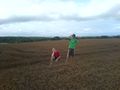
We then decided not to visit the Weymouth geohash, so as not to miss the last train from Lymington to Brockenhurst, or still be cycling in the dark. We went to the Isle of Wight as planned. The ride was long and very hilly but we continued with determination. We cycled down a road past several signs advising us to turn back. We then left our bikes next to a clump of trees in the middle of a field and made our way into the adjacent field. From here, we "scaled" another thin wire fence to enter the grounds of Osborne House.
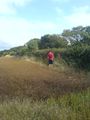
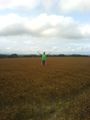
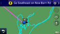
It was a pleasant stroll along the well kept paths towards the forest in which the co-ordinates were located. Hurdling another fence, we entered the nearby golf course. We then proceeded to wonder round the forest for a while (see the tracklog screenshot), constantly checking the satnav. We then rode back and got the ferry and trains home.
This geohash had huge potential - we could have earned the Admit One, Golf and Multihash achievements, but we did not. However, it really was a great day out :)
Photos
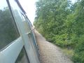
GeoTrain
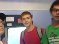
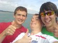
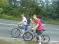
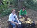
GeoGroupshot
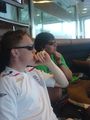
GeoHead
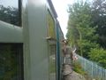
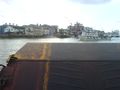
GeoFerry
GeoQuassie
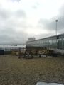
GeoCrossing
GeoGays
GeoRoute
GeoPose
GeoPiss
GeoPose
GeoPose
GeoGoTrain
Free GeoFood
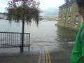
GeoFlood
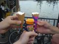
GeoCreams
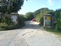
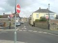
No entry for Geohashers
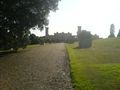
GeoHouse
GeoBreak
Ridiculously powerful GeoTide
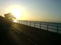
Nice GeoViews
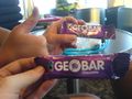
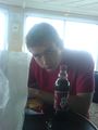
Chocolate bar.

GeoPose
GeoGaze
GeoEvidence
.JPG)
.JPG)
.JPG)
.JPG)
.JPG)
.JPG)
.JPG)
.JPG)
.JPG)
.JPG)
.JPG)
.JPG)
.JPG)
.JPG)
.JPG)
.JPG)
.JPG)
.JPG)
.JPG)
.JPG)
.JPG)
.JPG)
.JPG)
.JPG)
.PNG)