Difference between revisions of "2009-09-05 -37 145"
imported>Felix Dance (Wrote short version - stay tuned for the long one!) |
imported>Felix Dance (Added camping geohash award) |
||
| Line 62: | Line 62: | ||
| date = 2009-09-03 | | date = 2009-09-03 | ||
| name = [[User:Felix Dance|Felix Dance]] | | name = [[User:Felix Dance|Felix Dance]] | ||
| + | |||
| + | }} | ||
| + | |||
| + | {{Camping geohash | ||
| + | |||
| + | | latitude = -37 | ||
| + | | longitude = 145 | ||
| + | | date = 2009-09-05 | ||
| + | | name = Felix Dance | ||
| + | | arrival = sunset | ||
| + | | departure = sunrise | ||
| + | | residence = a tent | ||
| + | | distance = 150m from | ||
| + | | image = Geohash 2009 09 05 -37 145 Camping right near the hashpoint.jpg | ||
| + | |||
}} | }} | ||
Revision as of 13:28, 6 September 2009
| Sat 5 Sep 2009 in -37,145: -37.9588002, 145.8889434 geohashing.info google osm bing/os kml crox |
The Place
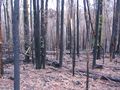
Just to the east of Bunyip State Park, near Neerim South, deep in forest.
Expedition
Felix Dance
Short Version
Having camped in the hills above Traralgon the night before I spent the day cycling towards the geohash location embedded in the depths of the aftermath of Victoria's devastating Black Saturday bushfires. Part III of a four day consecutive geohash. 2009-09-03 -37 145 is the first and 2009-09-06 -37 145 is the next.
Long Version
Here's the Google Maps link to my whole route. Saturday's section is between C and D - 79 kms.
Rest coming soon...
Photos
Camping site in morning
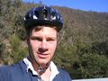
Felix over Tyers River
Yan Yean Power Station
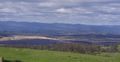
The Latrobe Valley
Southern Alps foothills
Torago River valley
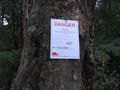
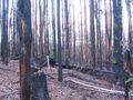
Danger!
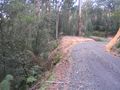
The road to the hash
Tarago River valley
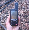
GPS at hashpoint
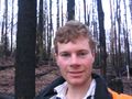
Felix at hashpoint
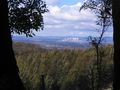
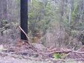
View north at hash
East view from hash
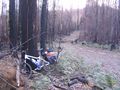
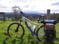
Bike near hashpoint
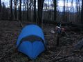
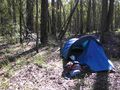
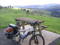
Camping near the hashpoint
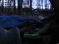
Reading Heinlein


Felix Dance earned the Bicycle geohash achievement
|
Felix Dance earned the Consecutive geohash achievement
|
Felix Dance earned the Camping geohash achievement
|