Difference between revisions of "2009-09-15 52 13"
imported>HiroProtagonist |
imported>Davidc |
||
| Line 32: | Line 32: | ||
== Photos == | == Photos == | ||
| − | |||
| − | |||
| − | |||
| − | |||
| − | |||
<gallery perrow="3"> | <gallery perrow="3"> | ||
| − | + | Image:2009-09-15_52_13_IMG_1444.JPG|Entrance to the forest | |
| + | Image:2009-09-15_52_13_IMG_1445.JPG|Forest path | ||
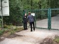
| + | Image:2009-09-15_52_13_IMG_1446.JPG|The first hurdle. "Please shut this gate behind you"... but a padlock. | ||
| + | Image:2009-09-15_52_13_IMG_1447.JPG|"I can feel the hash!" | ||
| + | Image:2009-09-15_52_13_IMG_1452.JPG|The adjacent golf course | ||
| + | Image:2009-09-15_52_13_IMG_1451.JPG|behind a fence. | ||
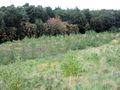
| + | Image:2009-09-15_52_13_IMG_1482.JPG|About the area and plantation. | ||
| + | Image:2009-09-15_52_13_IMG_1456.JPG|A convenient stile grants access. | ||
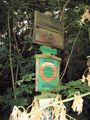
| + | Image:2009-09-15_52_13_IMG_1457.JPG|The sign reads something like "Please don't come in". Not forbidden, just asking nicely. | ||
| + | Image:2009-09-15_52_13_IMG_1458.JPG|Up the bluff to the hashpoint? | ||
| + | Image:2009-09-15_52_13_IMG_1461.JPG|Why exactly does a golf course needs such a huge satellite dish? | ||
| + | Image:2009-09-15_52_13_IMG_1462.JPG|Back down the bluff to the hashpoint? | ||
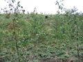
| + | Image:2009-09-15_52_13_IMG_1463.JPG|Hash "field" | ||
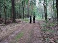
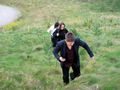
| + | Image:2009-09-15_52_13_IMG_1464.JPG|Slowpokes | ||
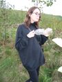
| + | Image:2009-09-15_52_13_IMG_1467.JPG|Coordinates reached! | ||
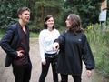
| + | Image:2009-09-15_52_13_IMG_1471.JPG|Two fresh silly grin recruits. | ||
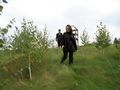
| + | Image:2009-09-15_52_13_IMG_1472.JPG|Hash sapling. | ||
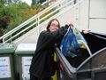
| + | Image:2009-09-15_52_13_IMG_1473.JPG|The reverse geotrash begins. | ||
| + | Image:2009-09-15_52_13_IMG_1478.JPG|An office portacabin by the entrance. | ||
| + | Image:2009-09-15_52_13_IMG_1475.JPG|Contents: Book, coffee cup, first aid kit, gas pipe, and a calendar dated 1990. | ||
| + | Image:2009-09-15_52_13_IMG_1480.JPG|The mysterious bunker. | ||
| + | Image:2009-09-15_52_13_IMG_1483.JPG|Reverse geotrash completed! | ||
</gallery> | </gallery> | ||
Revision as of 18:19, 15 September 2009
| Tue 15 Sep 2009 in 52,13: 52.4057106, 13.1249051 geohashing.info google osm bing/os kml crox |
Location
On a landfill site next to a golf course in Wannsee.
Participants
Plans
S-bahn to Wannsee (zone B) or Griebnitzsee (zone C) and a 5 or 3km walk respectively.
Name a time if you're going!
- Just decided to meet at S Wannsee at 4pm :) Anyone else joining? -HiroProtagonist 11:34, 15 September 2009 (UTC)
Expedition
Tracklog
Photos
Entrance to the forest
Forest path
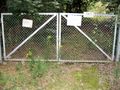
The first hurdle. "Please shut this gate behind you"... but a padlock.
"I can feel the hash!"
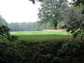
The adjacent golf course
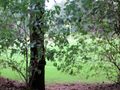
behind a fence.
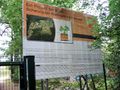
About the area and plantation.
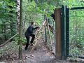
A convenient stile grants access.
The sign reads something like "Please don't come in". Not forbidden, just asking nicely.
Up the bluff to the hashpoint?
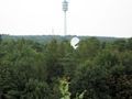
Why exactly does a golf course needs such a huge satellite dish?
Back down the bluff to the hashpoint?
Hash "field"
Slowpokes
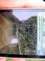
Coordinates reached!

Two fresh silly grin recruits.
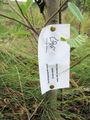
Hash sapling.
The reverse geotrash begins.
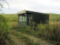
An office portacabin by the entrance.
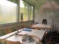
Contents: Book, coffee cup, first aid kit, gas pipe, and a calendar dated 1990.
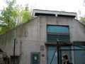
The mysterious bunker.
Reverse geotrash completed!


