Difference between revisions of "2009-10-11 51 -0"
imported>Macronencer (Success - report, photos, video and tracklog hopefully to follow soon.) |
imported>Macronencer (→Photos: Add photos) |
||
| Line 32: | Line 32: | ||
== Photos == | == Photos == | ||
| − | |||
<gallery perrow="4"> | <gallery perrow="4"> | ||
| − | Image:2009- | + | Image:2009-10-11_51_-0_Macronencer_01.jpg | The kind of amazing road on which I drove today |
| + | Image:2009-10-11_51_-0_Macronencer_02.jpg | I had hoped to park at this camp site, but the gate was shut | ||
| + | Image:2009-10-11_51_-0_Macronencer_03.jpg | Made do with a lay-by. Probably a good move, as the trees kept the rain off as I prepared my gear | ||
| + | Image:2009-10-11_51_-0_Macronencer_04.jpg | Very old oak tree growing through an ancient wall | ||
| + | Image:2009-10-11_51_-0_Macronencer_05.jpg | Very picturesque road on the way to the hash point | ||
| + | Image:2009-10-11_51_-0_Macronencer_06.jpg | My path was clear... | ||
| + | Image:2009-10-11_51_-0_Macronencer_07.jpg | ...but wet :) | ||
| + | Image:2009-10-11_51_-0_Macronencer_08.jpg | Getting a little overgrown | ||
| + | Image:2009-10-11_51_-0_Macronencer_09.jpg | It's in there | ||
| + | Image:2009-10-11_51_-0_Macronencer_10.jpg | 1m - yay! | ||
| + | Image:2009-10-11_51_-0_Macronencer_11.jpg | Stupid grin shot from inside the stupidity radius | ||
| + | Image:2009-10-11_51_-0_Macronencer_12.jpg | Maybe my weakest marker yet - there were no good stones about to carve with | ||
| + | Image:2009-10-11_51_-0_Macronencer_13.jpg | Are you having fun, guy? | ||
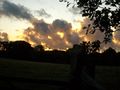
| + | Image:2009-10-11_51_-0_Macronencer_14.jpg | This looked AWESOME in reality. Cameras sometimes lie | ||
| + | Image:2009-10-11_51_-0_Macronencer_15.jpg | Me with the awesome light. Camera still lying | ||
| + | Image:2009-10-11_51_-0_Macronencer_16.jpg | Another beautiful old oak | ||
| + | Image:2009-10-11_51_-0_Macronencer_17.jpg | Treescape | ||
| + | Image:2009-10-11_51_-0_Macronencer_18.jpg | This was next to a road junction - it's about 1.5m tall. A disused railway for hobbits? | ||
| + | Image:2009-10-11_51_-0_Macronencer_19.jpg | Extraordinary topiary. This was near where I expected to find the monastery - it might possibly be the boundary? | ||
| + | Image:2009-10-11_51_-0_Macronencer_20.jpg | Whoa, what's that? | ||
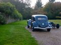
| + | Image:2009-10-11_51_-0_Macronencer_21.jpg | Amazing old car. I'm not an expert so I don't know the make | ||
| + | Image:2009-10-11_51_-0_Macronencer_22.jpg | River | ||
| + | Image:2009-10-11_51_-0_Macronencer_23.jpg | Very peaceful | ||
| + | Image:2009-10-11_51_-0_Macronencer_24.jpg | I chased this Earthturn all the way to Portsmouth, hoping to pull over and get a proper photo, but it eluded me | ||
</gallery> | </gallery> | ||
| − | |||
Revision as of 21:50, 11 October 2009
| Sun 11 Oct 2009 in 51,-0: 51.0091162, -0.7777181 geohashing.info google osm bing/os kml crox |
Location
Looks like heathland, near Midhurst.
Participants
Plans
Macronencer is planning this as a drive, arriving around 4pm (weather looks less wet at that time, by current reports). Anyone who can get a train to Petersfield around that time is welcome to a lift!
Hmmm... this Buddhist monastery is just down the road. They allow visitors. I've not visited one before, so I might look into that. This would necessitate an earlier start. --macronencer 18:55, 9 October 2009 (UTC)
Expedition
A short summary (detail and photos/video later): Co-ordinates reached in fascinating terrain with plenty of rural charm. Couldn't locate the monastery - should have found it on satellite photo and got an exact location before leaving :(
Tracklog
TBU
Photos
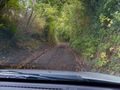
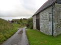
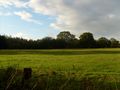
The kind of amazing road on which I drove today
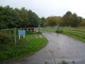
I had hoped to park at this camp site, but the gate was shut
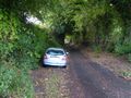
Made do with a lay-by. Probably a good move, as the trees kept the rain off as I prepared my gear
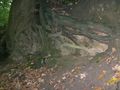
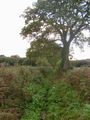
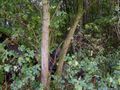
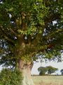
Very old oak tree growing through an ancient wall
Very picturesque road on the way to the hash point
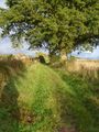
My path was clear...
...but wet :)
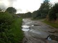
Getting a little overgrown
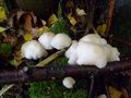
It's in there
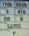
1m - yay!

Stupid grin shot from inside the stupidity radius
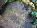
Maybe my weakest marker yet - there were no good stones about to carve with
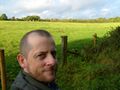
Are you having fun, guy?
This looked AWESOME in reality. Cameras sometimes lie
Me with the awesome light. Camera still lying
Another beautiful old oak
Treescape
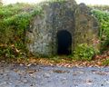
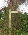
This was next to a road junction - it's about 1.5m tall. A disused railway for hobbits?
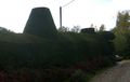
Extraordinary topiary. This was near where I expected to find the monastery - it might possibly be the boundary?
Whoa, what's that?
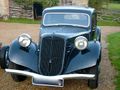
Amazing old car. I'm not an expert so I don't know the make
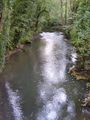
River
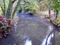
Very peaceful
I chased this Earthturn all the way to Portsmouth, hoping to pull over and get a proper photo, but it eluded me


