Difference between revisions of "2009-11-07 48 7"
From Geohashing
imported>Ekorren (skeleton only, rest will follow) |
imported>Ekorren (→Gallery: Ekorren's photos) |
||
| Line 20: | Line 20: | ||
<gallery> | <gallery> | ||
| + | Image:2009-11-07_48_7_e_Emmendingen_Bf.jpg|Station of Emmendingen | ||
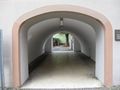
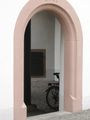
| + | Image:2009-11-07_48_7_e_Emmendingen_Tor.jpg|Emmendingen gates and passages | ||
| + | Image:2009-11-07_48_7_e_Emmendingen_Pfarrhaus.jpg | ||
| + | Image:2009-11-07_48_7_e_Emmendingen_Tuer.JPG | ||
| + | Image:2009-11-07_48_7_e_Bus.jpg|Bus into direction of hash | ||
| + | Image:2009-11-07_48_7_e_Rohrlache_Busstop.jpg|Leave here | ||
| + | Image:2009-11-07_48_7_e_Lake.JPG|A lake between the bus stop and the hash | ||
| + | Image:2009-11-07_48_7_e_Swan.jpg|Which was even inhabited | ||
| + | Image:2009-11-07_48_7_e_Track.jpg|This way | ||
| + | Image:2009-11-07_48_7_e_GPS.jpg|Coordinates reached | ||
| + | Image:2009-11-07_48_7_e_Hashtree.jpg|The hash tree | ||
| + | Image:2009-11-07_48_7_e_Hashscot.jpg|Koepfels hashscot helps with the forest work | ||
| + | Image:2009-11-07_48_7_e_Triangles.jpg|Triangles | ||
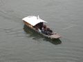
| + | Image:2009-11-07_48_7_e_Basel_Bruecke.jpg|Rhine vessels at Basel | ||
| + | Image:2009-11-07_48_7_e_Basel_Ferry.jpg | ||
</gallery> | </gallery> | ||
Revision as of 11:58, 9 November 2009
| Sat 7 Nov 2009 in 48,7: 48.1274876, 7.7789729 geohashing.info google osm bing/os kml crox |
Contents
Location
A forest in the Teningen municipality, close to the Kaiserstuhl hills in the upper Rhine valley.
Participants
Expedition
Gallery
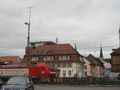
Station of Emmendingen
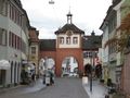
Emmendingen gates and passages
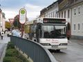
Bus into direction of hash
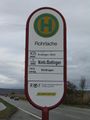
Leave here
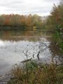
A lake between the bus stop and the hash
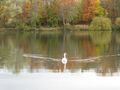
Which was even inhabited
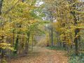
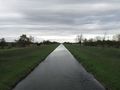
This way
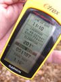
Coordinates reached

The hash tree
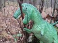
Koepfels hashscot helps with the forest work
Triangles
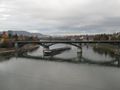
Rhine vessels at Basel