Difference between revisions of "2009-11-08 48 8"
From Geohashing
imported>Ekorren (skeleton only, rest will follow) |
imported>Thepiguy (+pi pictures) |
||
| Line 11: | Line 11: | ||
== Participants == | == Participants == | ||
| − | * [[User: | + | * [[User:thepiguy|thepiguy]] |
* [[User:Ekorren|Ekorren]] | * [[User:Ekorren|Ekorren]] | ||
* [[User:Koepfel|Koepfel]] | * [[User:Koepfel|Koepfel]] | ||
| Line 21: | Line 21: | ||
<gallery> | <gallery> | ||
| + | Image:2009-11-08_48_8_feet.JPG|Walking along the forest trail. | ||
| + | Image:2009-11-08_48_8_gps.JPG|Geohash confirmed! | ||
| + | Image:2009-11-08_48_8_hashers.JPG|Geohashers unite! | ||
| + | Image:2009-11-08_48_8_flag.JPG|thepiguy finds the final piece... | ||
| + | Image:2009-11-08_48_8_shades.JPG|... and gets out the shades! | ||
</gallery> | </gallery> | ||
Revision as of 21:44, 8 November 2009
| Sun 8 Nov 2009 in 48,8: 48.6808936, 8.7485891 geohashing.info google osm bing/os kml crox |
Contents
Location
A field at the westernmost margin of the Oberes Gäu hills, between the villages of Stammheim and Holzbronn, which both are incorporated to Calw.
Participants
Expedition
Gallery
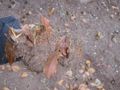
Walking along the forest trail.
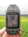
Geohash confirmed!
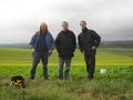
Geohashers unite!
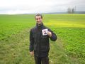
thepiguy finds the final piece...
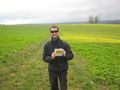
... and gets out the shades!


