Difference between revisions of "2010-01-30"
From Geohashing
imported>AperfectBot m (Ook.) |
imported>ReletBot m (moving from Template:auto gallery to Template:auto gallery2) |
||
| Line 1: | Line 1: | ||
<noinclude>{{date navigation}}</noinclude> | <noinclude>{{date navigation}}</noinclude> | ||
{{auto coordinates|2010-01-30}} | {{auto coordinates|2010-01-30}} | ||
| − | {{auto | + | {{auto gallery2|2010-01-30}} |
<noinclude>{{expedition summaries|2010-01-30}}</noinclude> | <noinclude>{{expedition summaries|2010-01-30}}</noinclude> | ||
Latest revision as of 22:38, 23 August 2010
Expedition Archives from January 2010
Friday 29 January 2010 | Saturday 30 January 2010 | Sunday 31 January 2010
See also: Category:Meetup on 2010-01-30
Coordinates
All locations: .0325600, .9027781
Globalhash:
-84.139205034711,145.000133856830
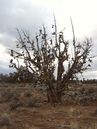
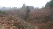
Photo Gallery
Expeditions and Plans
| 2010-01-30 | ||
|---|---|---|
| Melbourne West, Australia | Kozz | In a field just south of the Puckapanyal military base, close to Heathcote ... |
| Carolina, Puerto Rico | Katsushiro | Somewhere between Yabucoa and Maunabo |
| Borrego Springs, California | Richard Soderberg | A field just south of Ramona Airport in Ramona, California. |
| Prineville, Oregon | Nn2s2u | In the Millican OHV trail system, on some well used range land, about 200m ... |
| Mt. St. Helens, Washington | aperfectring, Jim | Gobel, Oregon, near the Columbia River - in the woods. Near power lines th... |