Difference between revisions of "2010-03-02 45 -75"
(→Plans) |
m (More specific location) |
||
| (8 intermediate revisions by 4 users not shown) | |||
| Line 1: | Line 1: | ||
| − | |||
<!-- If you did not specify these parameters in the template, please substitute appropriate things for IMAGE, LAT, LON, and DATE (YYYY-MM-DD format) | <!-- If you did not specify these parameters in the template, please substitute appropriate things for IMAGE, LAT, LON, and DATE (YYYY-MM-DD format) | ||
| Line 18: | Line 17: | ||
== Participants == | == Participants == | ||
| − | Mr | + | [[User:Mr_Ax|Mr Ax]] |
Ms M | Ms M | ||
| Line 25: | Line 24: | ||
== Plans == | == Plans == | ||
| − | Mr. | + | Mr. Ax to collect Ms. M and Ms. S and walk from Station Blvd and then down the path to the meetup point around 6:00. Post a small sign with greetings from The Internet at/near the point. |
== Expedition == | == Expedition == | ||
| − | + | We (Ms. M and myself) left home with puppy. Drove to Ms. S's house near Station Blvd to collect her. We abandoned the car and walked towards the pathway. Along the way I realized my automotive GPS device doesn't allow for coordinate accuracy past five decimal places, but we decided to wing it and recall the precise spot from memory. | |
| − | + | We ended up skirting a fence ostensibly erected to keep people from walking on the grass. The fence seemed to be an ineffective deterrent as there was a well trod side-path through the snow already. I posted the poster on a lamp post, hopeful it will amuse the regular travelers. | |
| − | + | ||
| + | We played fetch with puppy while Ms. S took documenting photos but none of the passersby approached us (most were staying on the main path). | ||
| + | |||
| + | After I got home I looked at the map again to gauge how close we were to the point and found we'd missed by about 5-8m. I'm calling it a success (though some may qualify it as a failure due to technology). | ||
== Photos == | == Photos == | ||
| Line 38: | Line 40: | ||
--> | --> | ||
<gallery perrow="4"> | <gallery perrow="4"> | ||
| + | Image:2010-03-02_45_-75_sign.jpg | Pancake Bunny visits from The Internet. | ||
</gallery> | </gallery> | ||
| + | == Achievements == | ||
| + | {{couch potato geohash | latitude = 45 | longitude = -75 | date = 2010-03-02 | name = Ms. S | honor = true }} | ||
| − | |||
| − | |||
| − | |||
| − | + | [[Category:Expeditions]] | |
| − | |||
| − | [[Category: | ||
| − | |||
| − | |||
| − | |||
| − | |||
[[Category:Expeditions with photos]] | [[Category:Expeditions with photos]] | ||
| − | + | ||
| − | |||
| − | |||
| − | |||
| − | |||
[[Category:Coordinates reached]] | [[Category:Coordinates reached]] | ||
| − | + | {{location|CA|ON|OT}} | |
| − | |||
| − | |||
| − | |||
| − | |||
| − | |||
| − | |||
| − | |||
| − | |||
| − | |||
Latest revision as of 23:17, 9 August 2020
| Tue 2 Mar 2010 in 45,-75: 45.4040985, -75.6494058 geohashing.info google osm bing/os kml crox |
Location
Along the walking path between the end of Station Blvd and the Ottawa General Hospital campus.
Participants
Ms M
Ms S
Plans
Mr. Ax to collect Ms. M and Ms. S and walk from Station Blvd and then down the path to the meetup point around 6:00. Post a small sign with greetings from The Internet at/near the point.
Expedition
We (Ms. M and myself) left home with puppy. Drove to Ms. S's house near Station Blvd to collect her. We abandoned the car and walked towards the pathway. Along the way I realized my automotive GPS device doesn't allow for coordinate accuracy past five decimal places, but we decided to wing it and recall the precise spot from memory.
We ended up skirting a fence ostensibly erected to keep people from walking on the grass. The fence seemed to be an ineffective deterrent as there was a well trod side-path through the snow already. I posted the poster on a lamp post, hopeful it will amuse the regular travelers.
We played fetch with puppy while Ms. S took documenting photos but none of the passersby approached us (most were staying on the main path).
After I got home I looked at the map again to gauge how close we were to the point and found we'd missed by about 5-8m. I'm calling it a success (though some may qualify it as a failure due to technology).
Photos
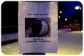
Pancake Bunny visits from The Internet.

Achievements
