Difference between revisions of "2010-03-11 -37 145"
imported>Kozz (→Participants) |
m (More specific location) |
||
| (8 intermediate revisions by 2 users not shown) | |||
| Line 1: | Line 1: | ||
| − | |||
<!-- If you did not specify these parameters in the template, please substitute appropriate things for IMAGE, LAT, LON, and DATE (YYYY-MM-DD format) | <!-- If you did not specify these parameters in the template, please substitute appropriate things for IMAGE, LAT, LON, and DATE (YYYY-MM-DD format) | ||
| Line 15: | Line 14: | ||
__NOTOC__ | __NOTOC__ | ||
== Location == | == Location == | ||
| − | + | Down someone's driveway in Box Hill South | |
== Participants == | == Participants == | ||
| − | [[user:kozz|Kozz]] | + | [[user:kozz|Kozz]]<br/> |
| + | [[user:kozz|Kozz]]'s dog | ||
== Plans == | == Plans == | ||
| − | + | [[user:kozz|Kozz]] will attempt a Walk Geohash from his house, which is 1.22km away. | |
== Expedition == | == Expedition == | ||
| − | + | After scoping the spot on Google Maps, I headed out from home with Kozz's dog. We had to detour north briefly to get onto a nearby path then from there it was plain sailing. | |
| + | |||
| + | We found the hashpoint without any difficulties, and Monday's straightforward Ambassador I felt bold enough to walk up the driveway of the property in question and knock on the door to ask permission to take a photo on the hashpoint. It didn't work out as planned. A suspicious-looking woman answered the door, looked at the dog with some concern, then flatly refused to allow me to walk to the hashpoint - all of 5 metres away albeit around the side of the house - and take photos. | ||
| + | |||
| + | So, bummer. Not sure what the homeowner's problem was, probably with weird guys turning up on their doorstep asking to stand next to the house and take photos. Fair play. According to the Garmin I was about 5 metres away from the hashpoint. Within the circle of probability, I guess, and technically there, but irritating nonetheless. | ||
| + | |||
| + | I tried to snap a photo of the GPS as I left but the photo is blurry as all heck. Curse you, poor focal length of phone camera! | ||
| − | + | So we walked back home. Yay. | |
| − | |||
== Photos == | == Photos == | ||
| − | + | ||
| − | |||
| − | |||
<gallery perrow="4"> | <gallery perrow="4"> | ||
| + | Image:2010-03-11 -37 145 On the trail.jpg | On the trail | ||
| + | Image:2010-03-11 -37 145 Eww, smelly creek.jpg | Just think, you could be drinking this | ||
| + | Image:2010-03-11 -37 145 Kozz's dog.jpg | Strangely attracted to trees. Wonder why. | ||
| + | Image:2010-03-11 -37 145 Golf course.jpg | Golf course nearby | ||
| + | Image:2010-03-11 -37 145 Nevermore.jpg | Will I find my lost Lenore? | ||
| + | Image:2010-03-11 -37 145 Trail splits off to Fochs Road.jpg | Leaving the trail | ||
| + | Image:2010-03-11 -37 145 Blurry proof.jpg | Proof, kinda. | ||
</gallery> | </gallery> | ||
| + | {{Walk geohash | ||
| + | | latitude = -37 | ||
| + | | longitude = 145 | ||
| + | | date = 2010-03-11 | ||
| + | | name = Kozz | ||
| + | | distance = 3.84km | ||
| + | }} | ||
| + | [[Category:Expeditions]] | ||
| − | |||
| − | |||
| − | |||
| − | |||
| − | |||
| − | |||
| − | |||
| − | |||
| − | |||
| − | |||
| − | |||
| − | |||
[[Category:Expeditions with photos]] | [[Category:Expeditions with photos]] | ||
| − | |||
| − | |||
| − | |||
| − | |||
| − | |||
[[Category:Coordinates reached]] | [[Category:Coordinates reached]] | ||
| − | + | {{location|AU|VIC|WH}} | |
| − | |||
| − | |||
| − | |||
| − | |||
| − | |||
| − | |||
| − | |||
| − | |||
| − | |||
Latest revision as of 11:58, 1 August 2020
| Thu 11 Mar 2010 in -37,145: -37.8358529, 145.1241861 geohashing.info google osm bing/os kml crox |
Location
Down someone's driveway in Box Hill South
Participants
Plans
Kozz will attempt a Walk Geohash from his house, which is 1.22km away.
Expedition
After scoping the spot on Google Maps, I headed out from home with Kozz's dog. We had to detour north briefly to get onto a nearby path then from there it was plain sailing.
We found the hashpoint without any difficulties, and Monday's straightforward Ambassador I felt bold enough to walk up the driveway of the property in question and knock on the door to ask permission to take a photo on the hashpoint. It didn't work out as planned. A suspicious-looking woman answered the door, looked at the dog with some concern, then flatly refused to allow me to walk to the hashpoint - all of 5 metres away albeit around the side of the house - and take photos.
So, bummer. Not sure what the homeowner's problem was, probably with weird guys turning up on their doorstep asking to stand next to the house and take photos. Fair play. According to the Garmin I was about 5 metres away from the hashpoint. Within the circle of probability, I guess, and technically there, but irritating nonetheless.
I tried to snap a photo of the GPS as I left but the photo is blurry as all heck. Curse you, poor focal length of phone camera!
So we walked back home. Yay.
Photos
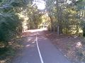
On the trail
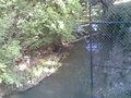
Just think, you could be drinking this
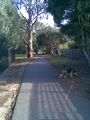
Strangely attracted to trees. Wonder why.
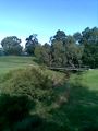
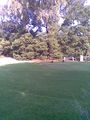
Golf course nearby
Will I find my lost Lenore?
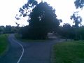
Leaving the trail
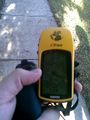
Proof, kinda.


Kozz earned the Walk geohash Achievement
|