Difference between revisions of "2010-03-24 52 13"
From Geohashing
imported>Syphonophorae |
imported>FippeBot m (Location) |
||
| (7 intermediate revisions by 2 users not shown) | |||
| Line 2: | Line 2: | ||
| lat=52 | | lat=52 | ||
| lon=13 | | lon=13 | ||
| − | | date=2010-03- | + | | date=2010-03-24 |
}} | }} | ||
| Line 8: | Line 8: | ||
== Location == | == Location == | ||
| − | + | Northwest of Berlin, in an area of (housing) allotments. | |
== Participants == | == Participants == | ||
| Line 15: | Line 15: | ||
== Expedition == | == Expedition == | ||
| + | I decided to go to the geohash by bicycle. Somehow it was a pain in the ass, literally, because I haven't been driving for years. :D | ||
| − | I | + | So i arrived about quarter before 4pm. I headed through the gate to the allotments and looked up the spot between the fifth and sixth bower. According to Google maps it was supposed to be somewhere right on the border of the adjoining bowers. |
| − | + | Of course, I couldn't meet the exact spot but I was like 10meters away. You can see it on the pictures, where the easter tree is. | |
| + | |||
| + | So this was my first trip. I enjoyed it very much. | ||
== Photos == | == Photos == | ||
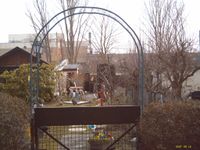
| − | + | [[File:2010-03-24_52_13.jpg|200px|thumb|left|The spot in on the hedge near the eastertree]] | |
| − | File:2010-03- | + | [[File:2010-03-24_52_13_2.jpg|200px|thumb|left|Me in front of the spot]] |
| − | |||
| − | File:2010-03- | ||
| − | |||
| − | |||
| − | |||
| − | |||
| − | |||
| − | |||
| − | |||
| − | |||
| − | |||
| − | |||
| − | |||
[[Category:Expeditions]] | [[Category:Expeditions]] | ||
[[Category:Expeditions with photos]] | [[Category:Expeditions with photos]] | ||
[[Category:Coordinates reached]] | [[Category:Coordinates reached]] | ||
| + | {{location|DE|BE}} | ||
Latest revision as of 06:48, 15 July 2019
| Wed 24 Mar 2010 in 52,13: 52.5853265, 13.3542353 geohashing.info google osm bing/os kml crox |
Location
Northwest of Berlin, in an area of (housing) allotments.
Participants
Expedition
I decided to go to the geohash by bicycle. Somehow it was a pain in the ass, literally, because I haven't been driving for years. :D
So i arrived about quarter before 4pm. I headed through the gate to the allotments and looked up the spot between the fifth and sixth bower. According to Google maps it was supposed to be somewhere right on the border of the adjoining bowers.
Of course, I couldn't meet the exact spot but I was like 10meters away. You can see it on the pictures, where the easter tree is.
So this was my first trip. I enjoyed it very much.

