Difference between revisions of "2010-04-04 60 9"
From Geohashing
imported>Relet (a live expedition message sent via geohashdroid for android.) |
m (2020-01-01 update) |
||
| (7 intermediate revisions by 3 users not shown) | |||
| Line 1: | Line 1: | ||
| − | |||
<!-- If you did not specify these parameters in the template, please substitute appropriate things for IMAGE, LAT, LON, and DATE (YYYY-MM-DD format) | <!-- If you did not specify these parameters in the template, please substitute appropriate things for IMAGE, LAT, LON, and DATE (YYYY-MM-DD format) | ||
| Line 56: | Line 55: | ||
*On my way back now. Might get to see a bit of the village of Nes before catching the 4pm bus. Hm, they had a church, iirc. -- [[User:relet|relet]] [http://www.openstreetmap.org/?lat=60.55370628833771&lon=9.923867583274841&zoom=16&layers=B000FTF @60.5537,9.9239] 14:05, 04 April 2010 (MESZ) | *On my way back now. Might get to see a bit of the village of Nes before catching the 4pm bus. Hm, they had a church, iirc. -- [[User:relet|relet]] [http://www.openstreetmap.org/?lat=60.55370628833771&lon=9.923867583274841&zoom=16&layers=B000FTF @60.5537,9.9239] 14:05, 04 April 2010 (MESZ) | ||
| + | |||
| + | *In the failbus home. The Easter traffic is pretty dense, but it's 'just' that one station. -- [[User:relet|relet]] [http://www.openstreetmap.org/?lat=60.56217133998871&lon=9.996582269668579&zoom=16&layers=B000FTF @60.5622,9.9966] 16:14, 04 April 2010 (MESZ) | ||
| + | |||
| + | *Oh. And yes, the village had a church. I spent the other 50 minutes at the bus stop/gatekjøkken chatting with a family whose car had to be towed. -- [[User:relet|relet]] [http://www.openstreetmap.org/?lat=60.54465651512146&lon=10.040055513381958&zoom=16&layers=B000FTF @60.5447,10.0401] 16:18, 04 April 2010 (MESZ) | ||
== Tracklog == | == Tracklog == | ||
<!-- if your GPS device keeps a log, you may post a link here --> | <!-- if your GPS device keeps a log, you may post a link here --> | ||
| Line 62: | Line 65: | ||
<gallery> | <gallery> | ||
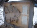
Image:2010-04-04_60_9_12-07-36-833.jpg | You've got to love this sign. [http://www.openstreetmap.org/?lat=60.55843234062195&lon=9.939671158790588&zoom=16&layers=B000FTF @60.5584,9.9397] | Image:2010-04-04_60_9_12-07-36-833.jpg | You've got to love this sign. [http://www.openstreetmap.org/?lat=60.55843234062195&lon=9.939671158790588&zoom=16&layers=B000FTF @60.5584,9.9397] | ||
| + | File:2010-04-04-59-9-P1050858.JPG | The lakes are still half frozen. | ||
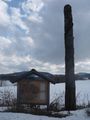
| + | File:2010-04-04-59-9-P1050859.JPG | This monument is the courtesy of an antique market. | ||
| + | File:2010-04-04-59-9-P1050860.JPG | On the road. | ||
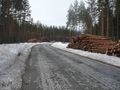
| + | File:2010-04-04-59-9-P1050861.JPG | There is logging going on, indeed. | ||
| + | File:2010-04-04-59-9-P1050863.JPG | And lots of melting as well. | ||
| + | File:2010-04-04-59-9-P1050866.JPG | Why do you think these trees lean so badly? | ||
| + | File:2010-04-04-59-9-P1050867.JPG | Cookies for hashes. | ||
| + | File:2010-04-04-59-9-P1050868.JPG | Rock. Bottom. | ||
| + | File:2010-04-04-59-9-P1050870.JPG | Games we play. | ||
| + | File:2010-04-04-59-9-P1050871.JPG | In spring, when the snow melts, you rediscover the things you thought long forgotten. | ||
| + | File:2010-04-04-59-9-P1050872.JPG | Another half-snowed-over brook. | ||
| + | File:2010-04-04-59-9-church_fused.jpg | A church indeed. | ||
| + | File:2010-04-04-59-9-P1050877.JPG | The other attraction is an old tree. | ||
| + | File:2010-04-04-59-9-P1050878.JPG | Which was hit by lightning thirty years ago. | ||
| + | File:2010-04-04-59-9-P1050879.JPG | But stems from 1500 years ago. | ||
</gallery> | </gallery> | ||
| − | |||
| − | |||
| − | |||
| − | |||
| − | |||
| − | |||
| − | |||
| − | |||
| − | |||
[[Category:Expeditions]] | [[Category:Expeditions]] | ||
| − | |||
[[Category:Expeditions with photos]] | [[Category:Expeditions with photos]] | ||
| − | [[Category: | + | [[Category:Not reached - Mother Nature]] |
| − | |||
| − | |||
| − | |||
| − | |||
| − | |||
| − | |||
| − | |||
| − | |||
[[Category:Coordinates not reached]] | [[Category:Coordinates not reached]] | ||
| − | + | {{location|NO|30}} | |
| − | |||
| − | |||
| − | |||
| − | |||
| − | |||
Latest revision as of 00:25, 16 February 2020
| Sun 4 Apr 2010 in 60,9: 60.5553332, 9.9117472 geohashing.info google osm bing/os kml crox |
Location
Participants
Plans
Expedition
- Here's the plan:
10:40 CEST Bus to Nes i Ådal - arrives 11:25 Walk. Buses back go 13:03; 16:03; 18:07. Let's see how much there is to do. -- relet @60.1613,10.2307 19:47, 03 April 2010 (MESZ)
- After some more careful surveying of the location (or should I say some first surveying at all), I'm not so sure that this is going to work out. There are some pretty steep hills and no paths to be seen on the map. But here I am in the bus to Nes i Ådal and bound for great adventures, or epic failures or both. -- relet @60.1686,10.2614 10:40, 04 April 2010 (MESZ)
- Hmm. And I frankly do not like the way some of these hillocks are... may I say "towering" over the road as we drive by. -- relet @60.3702,10.0814 11:06, 04 April 2010 (MESZ)
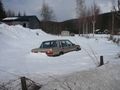
- Reached Nes. Based on a survey of the roadside, I give myself a 70% chance of success. The frozen lakes are lovely. -- relet @60.5622,9.9964 11:28, 04 April 2010 (MESZ)
- The walking along paved roads parts make me think I should have brought my longboard. Or some inline skates. -- relet @60.5583,9.9796 11:42, 04 April 2010 (MESZ)
- Buzzards buzzing over my head. -- relet @60.5600,9.9537 11:58, 04 April 2010 (MESZ)
- 300m to go. I should find a place to slip into my
batsuitwaterproof pants. -- relet @60.5540,9.9170 12:26, 04 April 2010 (MESZ)
- Stupidity distance is 253m. And that nice open accessible path is actually a river under the snow. -- relet @60.5531,9.9128 12:36, 04 April 2010 (MESZ)
- There is obviously a brook between me and the forest. I need to find a hillier place. -- relet @60.5540,9.9166 12:44, 04 April 2010 (MESZ)
- I got into the forest, but I don't think I will be going anywhere else. This has written 'wet' all over it. I had the idea of using a long stick to see where there is water below the snow, but what good is a wet stick? -- relet @60.5542,9.9192 13:06, 04 April 2010 (MESZ)
- But I am kind of happy to live in a more challenging graticule now. I'm going to celebrate this newfound adventurism by sitting on this exact rock, and eating cookies, before I head back. And I'll pretend to ignore the sound of the cars passibg just out of sight below me. -- relet @60.5541,9.9192 13:10, 04 April 2010 (MESZ)
- Glad I brought some water. -- relet @60.5542,9.9192 13:20, 04 April 2010 (MESZ)
- On my way back now. Might get to see a bit of the village of Nes before catching the 4pm bus. Hm, they had a church, iirc. -- relet @60.5537,9.9239 14:05, 04 April 2010 (MESZ)
- In the failbus home. The Easter traffic is pretty dense, but it's 'just' that one station. -- relet @60.5622,9.9966 16:14, 04 April 2010 (MESZ)
- Oh. And yes, the village had a church. I spent the other 50 minutes at the bus stop/gatekjøkken chatting with a family whose car had to be towed. -- relet @60.5447,10.0401 16:18, 04 April 2010 (MESZ)
Tracklog
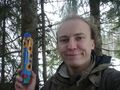
Photos
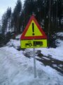
You've got to love this sign. @60.5584,9.9397
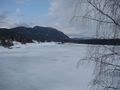
The lakes are still half frozen.
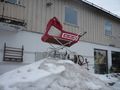
This monument is the courtesy of an antique market.
On the road.
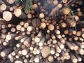
There is logging going on, indeed.

And lots of melting as well.

Why do you think these trees lean so badly?
Cookies for hashes.
Rock. Bottom.
Games we play.
In spring, when the snow melts, you rediscover the things you thought long forgotten.
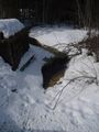
Another half-snowed-over brook.
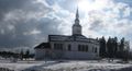
A church indeed.
The other attraction is an old tree.
Which was hit by lightning thirty years ago.
But stems from 1500 years ago.


