Difference between revisions of "2010-04-10 40 -86"
imported>Hat Guy (pics) |
imported>Hat Guy |
||
| Line 51: | Line 51: | ||
<!-- =============== USEFUL CATEGORIES FOLLOW ================ | <!-- =============== USEFUL CATEGORIES FOLLOW ================ | ||
Delete the next line ONLY if you have chosen the appropriate categories below. If you are unsure, don't worry. People will read your report and help you with the classification. --> | Delete the next line ONLY if you have chosen the appropriate categories below. If you are unsure, don't worry. People will read your report and help you with the classification. --> | ||
| − | |||
Revision as of 22:42, 10 April 2010
| Sat 10 Apr 2010 in 40,-86: 40.1513277, -86.6384178 geohashing.info google osm bing/os kml crox |
Location
A field (corn) just northwest of Thorntown
Participants
Plans
Alex will almost certainly be there at 4:00 with Jessi
Expedition
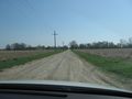
We set out to make the hash point around 3:30. According to Google, we had about an hour drive ahead of us, so we made sure that we had some sweet tunes for the trip. We ran into a detour about halfway, and while I was yelling at Jessi to slow down so I could get a picture of the sign, we missed the turn. People looked at us like we were crazy. After a bit more driving we turned off the main highway and were soon driving on gravel roads back to the field containing the hash.
When we arrived, we walked out to the point and, after setting up our picnic blanket, took the necessary photographs. We enjoyed some triscuits and vodka-soaked pineapple before leaving. On the way back, we stopped to say hello to some horses and to play on a tree that was falling over. All in all, it was a pretty successful first expedition.
Photos
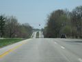
On the way
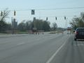
Oh noes!
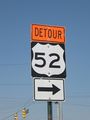
Notice how it says turn right? We didn't.
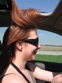
The sunroof was hungry
Almost there!

Aww...
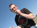
This was a hard picture to get..it was sunny
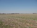
This is the only place in Indiana like this
Om nom nom
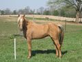
horsey!
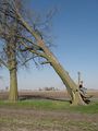
Timber...(in slow motion)
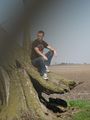
The foreboding shadow attacks!


