Difference between revisions of "2010-07-15 48 9"
imported>Ekorren (template only now, report to be written later) |
imported>Ekorren (Gallery) |
||
| Line 20: | Line 20: | ||
<gallery> | <gallery> | ||
| + | File:2010-07-15_48_9_AbzweigNehren.jpg|Creating arftificial hills for bicyclists, to make car driving more attractive. | ||
| + | File:2010-07-15_48_9_Hohenzollern.jpg|You can't visit Hechingen without shooting a view to Castle Hohenzollern. | ||
| + | File:2010-07-15_48_9_Tree.jpg|Random tree | ||
| + | File:2010-07-15_48_9_EndOfWay.jpg|The way ends here... | ||
| + | File:2010-07-15_48_9_Boxes.jpg|... at two boxes, of which one... | ||
| + | File:2010-07-15_48_9_Box_Corn.jpg|... contains corn, the other is closed and... | ||
| + | File:2010-07-15_48_9_Box_Clock.jpg|... carries a device that looks like a clock behind an almost blind window in the lid. WTF? | ||
| + | File:2010-07-15_48_9_GPS.jpg|Coordinates reached | ||
| + | File:2010-07-15_48_9_Hashpoint.jpg|The actual hashpoint | ||
| + | File:2010-07-15_48_9_Landfill_3.jpg|10 m from the hashpoint a fence blocks off the way into... | ||
| + | File:2010-07-15_48_9_Landfill_1.jpg|... a landfill which is now mostly abandoned. | ||
| + | File:2010-07-15_48_9_Landfill_2.jpg|After it got law that waste has to be processed and burned rather than stored in landfills, most of them got closed and are being recultivated. | ||
| + | File:2010-07-15_48_9_Dreifürstenstein.jpg|View from a peak near Beuren to the Dreifürstenstein - highest peak in the Tübingen district | ||
| + | File:2010-07-15_48_9_RoadClosed.jpg|No through way to Mössingen - after a recent landslide the road is still under repair. | ||
| + | File:2010-07-15_48_9_Road_Construction.jpg|A bike always finds a way, though. This is certainly good enough. | ||
</gallery> | </gallery> | ||
| Line 25: | Line 40: | ||
== Achievements == | == Achievements == | ||
| − | + | {{ Regional geohash | name = Ekorren | region = Zollernalbkreis | count = 2 }} | |
| − | + | {{ Regional geohash | name = Ekorren | region = Stadt Hechingen | count = 2 }} | |
[[Category:Expeditions]] | [[Category:Expeditions]] | ||
[[Category:Expeditions with photos]] | [[Category:Expeditions with photos]] | ||
[[Category:Coordinates reached]] | [[Category:Coordinates reached]] | ||
Revision as of 11:30, 16 July 2010
| Thu 15 Jul 2010 in 48,9: 48.3585818, 9.0108471 geohashing.info google osm bing/os kml crox |
Location
A dense forest at Hechingen
Participants
Expedition
Gallery
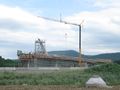
Creating arftificial hills for bicyclists, to make car driving more attractive.
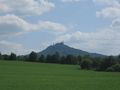
You can't visit Hechingen without shooting a view to Castle Hohenzollern.
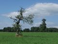
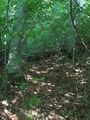
Random tree
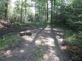
The way ends here...
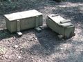
... at two boxes, of which one...
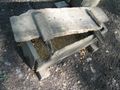
... contains corn, the other is closed and...
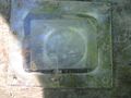
... carries a device that looks like a clock behind an almost blind window in the lid. WTF?
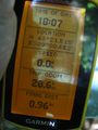
Coordinates reached
The actual hashpoint
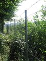
10 m from the hashpoint a fence blocks off the way into...
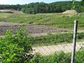
... a landfill which is now mostly abandoned.
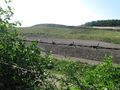
After it got law that waste has to be processed and burned rather than stored in landfills, most of them got closed and are being recultivated.
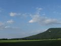
View from a peak near Beuren to the Dreifürstenstein - highest peak in the Tübingen district
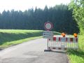
No through way to Mössingen - after a recent landslide the road is still under repair.
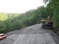
A bike always finds a way, though. This is certainly good enough.


Achievements
Ekorren earned the Regional geohashing achievement
|
Ekorren earned the Regional geohashing achievement
|