Difference between revisions of "2010-07-20 -37 144"
From Geohashing
imported>Talex ([live] Success!) |
m (More specific location) |
||
| (7 intermediate revisions by 6 users not shown) | |||
| Line 1: | Line 1: | ||
| − | |||
<!-- If you did not specify these parameters in the template, please substitute appropriate things for IMAGE, LAT, LON, and DATE (YYYY-MM-DD format) | <!-- If you did not specify these parameters in the template, please substitute appropriate things for IMAGE, LAT, LON, and DATE (YYYY-MM-DD format) | ||
| Line 15: | Line 14: | ||
__NOTOC__ | __NOTOC__ | ||
== Location == | == Location == | ||
| − | + | In some light vegetation, in Altona Coastal Park, in the inner south western suburbs of Melbourne. | |
== Participants == | == Participants == | ||
| − | + | * [[User:Talex]] | |
| + | * [[User:Stevage]] | ||
== Plans == | == Plans == | ||
| − | + | Drive there after an MUMC meeting. Walk a few hundred metres through the grass to the point. | |
== Expedition == | == Expedition == | ||
| − | + | As planned. Stuck Alex's bike in the back of my car, where it got friendly with my bike (still in there from a weekend mountain bike orienteering expedition). Used the geohashing app on Alex's phone to update this page live. The vegetation was very interesting...what looked like grass was actually a sort of very low lying succulent, like pigweed. At one point we had fears that the point would be in swampy wetlands, but it was actually relatively dry. A hundred metres further north would have been a different story. | |
*Success! -- [[User:Talex|Talex]] [http://www.openstreetmap.org/?lat=-37.85666048526764&lon=144.84883546829224&zoom=16&layers=B000FTF @-37.8567,144.8488] 21:08, 20 July 2010 (GMT+10:00) | *Success! -- [[User:Talex|Talex]] [http://www.openstreetmap.org/?lat=-37.85666048526764&lon=144.84883546829224&zoom=16&layers=B000FTF @-37.8567,144.8488] 21:08, 20 July 2010 (GMT+10:00) | ||
| − | == Tracklog == | + | <!-- == Tracklog == --> |
<!-- if your GPS device keeps a log, you may post a link here --> | <!-- if your GPS device keeps a log, you may post a link here --> | ||
| Line 36: | Line 36: | ||
--> | --> | ||
<gallery perrow="5"> | <gallery perrow="5"> | ||
| − | |||
Image:2010-07-20_-37_144_21-06-08-171.jpg | Made it! [http://www.openstreetmap.org/?lat=-37.856773138046265&lon=144.84880328178406&zoom=16&layers=B000FTF @-37.8568,144.8488] | Image:2010-07-20_-37_144_21-06-08-171.jpg | Made it! [http://www.openstreetmap.org/?lat=-37.856773138046265&lon=144.84880328178406&zoom=16&layers=B000FTF @-37.8568,144.8488] | ||
| − | |||
Image:2010-07-20_-37_144_21-07-41-640.jpg | [http://www.openstreetmap.org/?lat=-37.856773138046265&lon=144.84878718852997&zoom=16&layers=B000FTF @-37.8568,144.8488] | Image:2010-07-20_-37_144_21-07-41-640.jpg | [http://www.openstreetmap.org/?lat=-37.856773138046265&lon=144.84878718852997&zoom=16&layers=B000FTF @-37.8568,144.8488] | ||
</gallery> | </gallery> | ||
| Line 46: | Line 44: | ||
<!-- Add any achievement ribbons you earned below, or remove this section --> | <!-- Add any achievement ribbons you earned below, or remove this section --> | ||
| − | |||
| − | |||
| − | |||
| − | |||
| − | |||
| − | |||
| − | |||
| − | |||
| − | |||
| − | |||
| − | |||
[[Category:Expeditions]] | [[Category:Expeditions]] | ||
| − | |||
[[Category:Expeditions with photos]] | [[Category:Expeditions with photos]] | ||
| − | |||
| − | |||
| − | |||
| − | |||
| − | |||
[[Category:Coordinates reached]] | [[Category:Coordinates reached]] | ||
| − | + | {{location|AU|VIC|HB}} | |
| − | |||
| − | |||
| − | |||
| − | |||
| − | |||
| − | |||
| − | |||
| − | |||
| − | |||
Latest revision as of 12:02, 1 August 2020
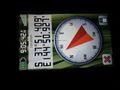
| Tue 20 Jul 2010 in -37,144: -37.8567894, 144.8487759 geohashing.info google osm bing/os kml crox |
Location
In some light vegetation, in Altona Coastal Park, in the inner south western suburbs of Melbourne.
Participants
Plans
Drive there after an MUMC meeting. Walk a few hundred metres through the grass to the point.
Expedition
As planned. Stuck Alex's bike in the back of my car, where it got friendly with my bike (still in there from a weekend mountain bike orienteering expedition). Used the geohashing app on Alex's phone to update this page live. The vegetation was very interesting...what looked like grass was actually a sort of very low lying succulent, like pigweed. At one point we had fears that the point would be in swampy wetlands, but it was actually relatively dry. A hundred metres further north would have been a different story.
- Success! -- Talex @-37.8567,144.8488 21:08, 20 July 2010 (GMT+10:00)
Photos
Made it! @-37.8568,144.8488

