2010-09-04 53 -0
Location
In a sweet corn field just north west of the village of Sibsey. The nearest town was Boston (Lincolnshire, UK).
| Sat 4 Sep 2010 in Hull: 53.0448326, -0.0126721 geohashing.info google osm bing/os kml crox |
Participants
Expedition
Sourcerer (Neil) spotted that the hash point was only 850 metres west of the Greenwich Meridian and there was another hashpoint 850 metres east. This was the ideal opportunity to collect two easy hashes within walking distance of each other. In the end he didn't walk because the siren call of a Bateman's pub was too strong. This involved a small detour by car. After that he needed petrol. For this hash point he only walked about 3.2km. Neil believes he was the first to visit a geohash in the Hull graticule. There were red deer hiding in the wood next to the hash point.
Image Gallery
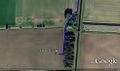
Google Earth Path
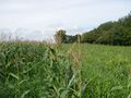
Sweet Corn Field
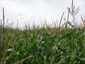
Sweet Corn Field
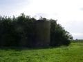
Silo Landmark Nearby
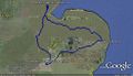
Google Earth Path for all four hash points.


