Difference between revisions of "2010-09-10 43 -79"
From Geohashing
imported>Splitdipless (Created page with '{{subst:Expedition |lat = 43 |lon = -79 |date = 2010-09-10 }}') |
m (More specific location) |
||
| (3 intermediate revisions by 3 users not shown) | |||
| Line 1: | Line 1: | ||
| − | |||
| − | |||
| − | |||
| − | |||
| − | |||
| − | |||
| − | |||
| − | |||
| − | |||
| − | |||
{{meetup graticule | {{meetup graticule | ||
| lat=43 | | lat=43 | ||
| Line 15: | Line 5: | ||
}} | }} | ||
| − | |||
| − | |||
== Location == | == Location == | ||
| − | + | As the actual position of the point for today was either in, or on the inaccessable side of the Rouge River, I decided to go on a Decihash instead. | |
| + | |||
| + | Went to 43.7, -79.2 instead. That placed it in a nice little park above the Scarborough bluffs. | ||
== Participants == | == Participants == | ||
| − | + | [[User:Splitdipless|Splitdipless]] | |
| − | == | + | == Expedition == |
| − | + | === [[User:Splitdipless|Splitdipless]] === | |
| + | There wasn't much in terms of effort on this one. Drove to the park, parked the car, wandered around the grass with my GPS on then snapped some pictures. Well, setting out with the GPS is better then not I guess. | ||
| − | + | On the plus side, another decihash has been claimed. This one I call Cliffside, named after the neighbourhood in the decicule that my grandmother lived in. | |
| − | |||
| − | |||
| − | |||
== Photos == | == Photos == | ||
| − | |||
| − | |||
| − | |||
<gallery perrow="5"> | <gallery perrow="5"> | ||
| + | Image:2010-09-10 43 -79 0.7 DA.jpg | 3/5 ain't bad. | ||
| + | Image:2010-09-10 43 -79 0.7 DB.jpg | Nice looking lawn. | ||
| + | Image:2010-09-10 43 -79 0.7 DC.jpg | Nice looking grin. | ||
</gallery> | </gallery> | ||
| − | |||
| − | |||
| − | |||
| − | |||
| − | |||
| − | |||
| − | |||
| − | |||
| − | |||
| − | |||
| − | |||
| − | |||
| − | |||
| − | |||
[[Category:Expeditions]] | [[Category:Expeditions]] | ||
| − | |||
[[Category:Expeditions with photos]] | [[Category:Expeditions with photos]] | ||
| − | |||
| − | |||
| − | |||
| − | |||
| − | |||
| − | |||
| − | |||
| − | |||
| − | |||
[[Category:Coordinates not reached]] | [[Category:Coordinates not reached]] | ||
| − | + | [[Category:Not reached - Attended alternate location]] | |
| − | [[Category:Not reached - | + | {{location|CA|ON|TO}} |
| − | |||
| − | |||
| − | |||
| − | |||
Latest revision as of 23:32, 9 August 2020
| Fri 10 Sep 2010 in 43,-79: 43.8059796, -79.1413736 geohashing.info google osm bing/os kml crox |
Location
As the actual position of the point for today was either in, or on the inaccessable side of the Rouge River, I decided to go on a Decihash instead.
Went to 43.7, -79.2 instead. That placed it in a nice little park above the Scarborough bluffs.
Participants
Expedition
Splitdipless
There wasn't much in terms of effort on this one. Drove to the park, parked the car, wandered around the grass with my GPS on then snapped some pictures. Well, setting out with the GPS is better then not I guess.
On the plus side, another decihash has been claimed. This one I call Cliffside, named after the neighbourhood in the decicule that my grandmother lived in.
Photos
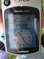
3/5 ain't bad.
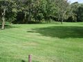
Nice looking lawn.

Nice looking grin.


