Difference between revisions of "2010-09-13 45 -122"
imported>Aperfectring (→Participants) |
imported>FippeBot m (Location) |
||
| (5 intermediate revisions by one other user not shown) | |||
| Line 1: | Line 1: | ||
| − | |||
<!-- If you did not specify these parameters in the template, please substitute appropriate values for IMAGE, LAT, LON, and DATE (YYYY-MM-DD format) | <!-- If you did not specify these parameters in the template, please substitute appropriate values for IMAGE, LAT, LON, and DATE (YYYY-MM-DD format) | ||
| Line 26: | Line 25: | ||
== Plans == | == Plans == | ||
<!-- what were the original plans --> | <!-- what were the original plans --> | ||
| + | I plan to head down to this almost assuredly inaccessible point today. Partially so that I will be getting myself out of the home, but also so that I can do other fun things in the parks down there, and also to get some yummy foods! --[[User:Aperfectring|aperfectring]] 00:24, 14 September 2010 (UTC) | ||
== Expedition == | == Expedition == | ||
<!-- how it all turned out. your narrative goes here. --> | <!-- how it all turned out. your narrative goes here. --> | ||
| + | |||
| + | I began this expedition, knowing very well that the chances of reaching the hashpoint were basically none. However, as a part of a separate online game, I wanted to bury something near a hashpoint I at least attempted to visit. I have a few pictures, including one of my new and shiny GPS, which I will post, but there really isn't much to say about this expedition. It was mostly an excuse to get out of the apartment for the night. | ||
| + | |||
| + | *Coords not reached, no public access. Will upload pics and brief report when i return to home base. -- [[User:Aperfectring|aperfectring]] [http://www.openstreetmap.org/?lat=45.6050861&lon=-122.75787506666667&zoom=16&layers=B000FTF @45.6051,-122.7579] 01:47, 14 September 2010 (UTC) | ||
== Tracklog == | == Tracklog == | ||
| Line 34: | Line 38: | ||
== Photos == | == Photos == | ||
| − | |||
| − | |||
| − | |||
<gallery perrow="5"> | <gallery perrow="5"> | ||
| + | File:2010-09-13_45_-122_apr_01.jpg|My new GPS unit showing my failure | ||
| + | File:2010-09-13_45_-122_apr_02.jpg|Me at the nearest approach | ||
| + | File:2010-09-13_45_-122_apr_03.jpg|Towards the hashpoint | ||
| + | File:2010-09-13_45_-122_apr_04.jpg|The nearby substation | ||
</gallery> | </gallery> | ||
| Line 45: | Line 50: | ||
| − | |||
| − | |||
| − | |||
| − | |||
| − | |||
| − | |||
| − | |||
| − | |||
| − | |||
| − | |||
[[Category:Expeditions]] | [[Category:Expeditions]] | ||
| − | |||
[[Category:Expeditions with photos]] | [[Category:Expeditions with photos]] | ||
| − | |||
| − | |||
| − | |||
| − | |||
| − | |||
| − | |||
| − | |||
| − | |||
[[Category:Coordinates not reached]] | [[Category:Coordinates not reached]] | ||
| − | |||
| − | |||
[[Category:Not reached - No public access]] | [[Category:Not reached - No public access]] | ||
| − | + | {{location|US|OR|MU}} | |
| − | |||
| − | |||
Latest revision as of 03:42, 9 August 2019
| Mon 13 Sep 2010 in 45,-122: 45.6115239, -122.7712915 geohashing.info google osm bing/os kml crox |
Location
Appears to be inside a building in the St. Johns area of Portland.
Participants
Plans
I plan to head down to this almost assuredly inaccessible point today. Partially so that I will be getting myself out of the home, but also so that I can do other fun things in the parks down there, and also to get some yummy foods! --aperfectring 00:24, 14 September 2010 (UTC)
Expedition
I began this expedition, knowing very well that the chances of reaching the hashpoint were basically none. However, as a part of a separate online game, I wanted to bury something near a hashpoint I at least attempted to visit. I have a few pictures, including one of my new and shiny GPS, which I will post, but there really isn't much to say about this expedition. It was mostly an excuse to get out of the apartment for the night.
- Coords not reached, no public access. Will upload pics and brief report when i return to home base. -- aperfectring @45.6051,-122.7579 01:47, 14 September 2010 (UTC)
Tracklog
Photos
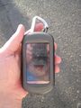
My new GPS unit showing my failure

Me at the nearest approach

Towards the hashpoint
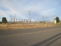
The nearby substation


