Difference between revisions of "2010-09-26 43 -79"
imported>Splitdipless (Created page with '{{subst:Expedition |lat = 43 |lon = -79 |date = 2010-09-26 }}') |
m (More specific location) |
||
| (5 intermediate revisions by 3 users not shown) | |||
| Line 1: | Line 1: | ||
| − | |||
| − | |||
| − | |||
| − | |||
| − | |||
| − | |||
| − | |||
| − | |||
| − | |||
| − | |||
{{meetup graticule | {{meetup graticule | ||
| lat=43 | | lat=43 | ||
| Line 15: | Line 5: | ||
}} | }} | ||
| − | |||
__NOTOC__ | __NOTOC__ | ||
== Location == | == Location == | ||
| − | + | ||
| + | Somewhere on the bottom of Lake Ontario. So I'm not going to go there... I'm going to go to a decihash instead. | ||
== Participants == | == Participants == | ||
| − | + | [[User:Splitdipless|Splitdipless]] | |
== Plans == | == Plans == | ||
| − | + | === [[User:Splitdipless|Splitdipless]] === | |
| + | So the plan is this... I have to go out to [[43,-78]] tomorrow anyhow, so afterwards I'm going to stop in a couple decicules that are on the way, and maybe one that is not. I should be working until mid afternoon, so the decission to take on the third will depend on how hungry I get. | ||
== Expedition == | == Expedition == | ||
| − | + | === [[User:Splitdipless|Splitdipless]] === | |
| + | So, I ended up having to pick up my brother and transport him and his girlfriend back to Toronto, and neither of them were interested in a stopover in multiple random stops. So, stops 1 and 2 in Ajax and Pickering where out. | ||
| − | + | After dropping them off, I did go to the back-up spot, as I had had supper by this point. The point was located in a neighbourhood called Norseman Heights, in Fairfield Park. By the time I got there, it was fairly dark, but I could still make out the playground. I resisted the urge to climb the geodesic dome looking thing. | |
| − | + | ||
| + | 43.6, -79.5 is hereby named Etobicoke, after the borough it mostly occupies. | ||
== Photos == | == Photos == | ||
| − | |||
| − | |||
| − | |||
<gallery perrow="5"> | <gallery perrow="5"> | ||
| + | Image:2010-09-26 43 -79 0.7 DA.jpg | A clear winner, if I had got to an actual hash point. | ||
| + | Image:2010-09-26 43 -79 0.7 DB.jpg | That looks like something that could be climbed! | ||
| + | Image:2010-09-26 43 -79 0.7 DC.jpg | Goofy grin. The best a man can get. | ||
</gallery> | </gallery> | ||
| − | |||
| − | |||
| − | |||
| − | |||
| − | |||
| − | |||
| − | |||
| − | |||
| − | |||
| − | |||
| − | |||
| − | |||
| − | |||
| − | |||
| − | |||
[[Category:Expeditions]] | [[Category:Expeditions]] | ||
| − | |||
[[Category:Expeditions with photos]] | [[Category:Expeditions with photos]] | ||
| − | |||
| − | |||
| − | |||
| − | |||
| − | |||
| − | |||
| − | |||
| − | |||
| − | |||
[[Category:Coordinates not reached]] | [[Category:Coordinates not reached]] | ||
| − | + | [[Category:Not reached - Attended alternate location]] | |
| − | [[Category:Not reached - | + | {{location|CA|ON|NG}} |
| − | |||
| − | |||
| − | |||
| − | |||
Latest revision as of 23:33, 9 August 2020
| Sun 26 Sep 2010 in 43,-79: 43.2387915, -79.4192035 geohashing.info google osm bing/os kml crox |
Location
Somewhere on the bottom of Lake Ontario. So I'm not going to go there... I'm going to go to a decihash instead.
Participants
Plans
Splitdipless
So the plan is this... I have to go out to 43,-78 tomorrow anyhow, so afterwards I'm going to stop in a couple decicules that are on the way, and maybe one that is not. I should be working until mid afternoon, so the decission to take on the third will depend on how hungry I get.
Expedition
Splitdipless
So, I ended up having to pick up my brother and transport him and his girlfriend back to Toronto, and neither of them were interested in a stopover in multiple random stops. So, stops 1 and 2 in Ajax and Pickering where out.
After dropping them off, I did go to the back-up spot, as I had had supper by this point. The point was located in a neighbourhood called Norseman Heights, in Fairfield Park. By the time I got there, it was fairly dark, but I could still make out the playground. I resisted the urge to climb the geodesic dome looking thing.
43.6, -79.5 is hereby named Etobicoke, after the borough it mostly occupies.
Photos
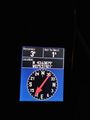
A clear winner, if I had got to an actual hash point.
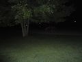
That looks like something that could be climbed!

Goofy grin. The best a man can get.


