2011-03-19 49 8
| Sat 19 Mar 2011 in 49,8: 49.2779449, 8.4288261 geohashing.info google osm bing/os kml crox |
Contents
Location
On a Rhine island somewhere near Mechtersheim, part of Römerberg.
Participants
Expedition
Koepfel
While packing for the expedition, I noticed my camera's batteries were dead. I could charge them for about 15 minutes unitl I had to leave, but they wouldn't survive the whole expedition.
From my home, I cycled to the Hagsfeld station, caught a local train to Mannheim, changed into another local train in Graben-Neudorf to Germersheim, from where I took a third train one more stop north to Lingenfeld. Maybe not the closest stop to the hash, but the last one my ticket was valid to.
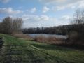
From the station in Lingenfeld, it would have been about 6-7 kilometers, if the spot wouldn't have been on an island. Well, not a real island, but the area between the old and the new Rhine. For those who don't know, the Rhine river was streightened in the 19th century. Before, the Rhine naturally went on a curved path through the flat land that is the upper Rhine valley, not very good for ships. So people came up with the idea to dig a new, less curved river, disconnecting the old, curved parts. Between those are now "islands", which can usually only be accessed via a narrow piece of land, forcing geohashers to larger detours.
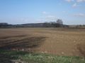
Before actually getting to the Rhine, I had to bike a few more kilometers through the fields, rather strong headwinds didn't make it very pleasant. I entered and drove through the village of Mechtersheim, through more fields and eventually ended up at the Rhine.
Right on the other side of the Rhine is the Philippsburg Nuclear Power Plant, which's cooling towers even turned out to be visible from the hashpoint. In the light of the events in Fukushima and in light of three state elections this and next weekend, the CDU/FDP-based government shut down a couple reactors earlier this week (including one of the two in Philippsburg) for campaigning reasons for three months.
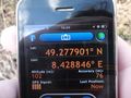
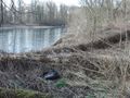
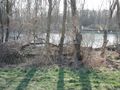
I crossed the narrow land section over to the island and continued hashwards. The path along the old Rhine branch however, was basicially just a very bumpy grass path, slowing me down and almost making me miss 16:00. When the clock hit 16:00, I just had parked my bike, a few steps away from the hashpoint.
(more to be written)
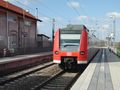
S-Bahn in Lingenfeld
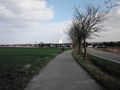
Biking ot Mechtersheim
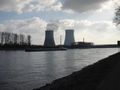
Philippsburg Nuclear Power Plant
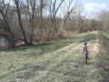
16:00, hashpoint is next to the trees down at the water
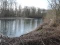
Found it.
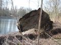
Last picture before my camera died


