Difference between revisions of "2011-03-27 59 10"
From Geohashing
imported>Relet ([live] Sandvika station, waiting for the connection to Avløs...) |
m (2020-01-01 update) |
||
| (9 intermediate revisions by 2 users not shown) | |||
| Line 1: | Line 1: | ||
| − | |||
<!-- If you did not specify these parameters in the template, please substitute appropriate values for IMAGE, LAT, LON, and DATE (YYYY-MM-DD format) | <!-- If you did not specify these parameters in the template, please substitute appropriate values for IMAGE, LAT, LON, and DATE (YYYY-MM-DD format) | ||
| Line 19: | Line 18: | ||
== Location == | == Location == | ||
<!-- where you've surveyed the hash to be --> | <!-- where you've surveyed the hash to be --> | ||
| + | |||
| + | A snowy field near Avløs station. | ||
| + | |||
| + | {{PBGH battleship | ||
| + | | lat = 59 | ||
| + | | lon = 10 | ||
| + | | date = 2011-03-27 | ||
| + | }} | ||
== Participants == | == Participants == | ||
<!-- who attended --> | <!-- who attended --> | ||
| + | |||
| + | * Anders | ||
| + | * Mona | ||
| + | * [[User:relet|relet]] | ||
== Plans == | == Plans == | ||
<!-- what were the original plans --> | <!-- what were the original plans --> | ||
| + | |||
| + | [[User:relet|relet]]: Take a bus to Avløs, walk a few steps, and then spend the rest of the day in Sandvika. | ||
== Expedition == | == Expedition == | ||
| Line 35: | Line 48: | ||
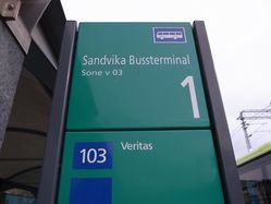
*Sandvika station, waiting for the connection to Avløs... -- [[User:relet|relet]] [http://www.openstreetmap.org/?lat=59.894288&lon=10.525119&zoom=16&layers=B000FTF @59,8943,10,5251] 13:03, 27 März 2011 (MESZ) | *Sandvika station, waiting for the connection to Avløs... -- [[User:relet|relet]] [http://www.openstreetmap.org/?lat=59.894288&lon=10.525119&zoom=16&layers=B000FTF @59,8943,10,5251] 13:03, 27 März 2011 (MESZ) | ||
| + | |||
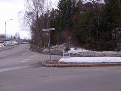
| + | *The sign 'danger of avalanches' near a road in the city is curious. -- [[User:relet|relet]] [http://www.openstreetmap.org/?lat=59.9146968126297&lon=10.551767349243164&zoom=16&layers=B000FTF @59,9147,10,5518] 13:22, 27 März 2011 (MESZ) | ||
| + | |||
| + | *Coordinates reached and met random people! Wooo! -- [[User:relet|relet]] [http://www.openstreetmap.org/?lat=59.91594672203064&lon=10.548768639564514&zoom=16&layers=B000FTF @59,9159,10,5488] 13:32, 27 März 2011 (MESZ) | ||
| + | |||
| + | *Hmmmm. Two buses that went missing. Weird and annoying. -- [[User:relet|relet]] [http://www.openstreetmap.org/?lat=59.89314794540405&lon=10.525224208831787&zoom=16&layers=B000FTF @59,8931,10,5252] 17:26, 27 März 2011 (MESZ) | ||
== Tracklog == | == Tracklog == | ||
<!-- if your GPS device keeps a log, you may post a link here --> | <!-- if your GPS device keeps a log, you may post a link here --> | ||
== Photos == | == Photos == | ||
| − | + | {{#vardefine:gaWidth|250}} | |
| − | + | {{#vardefine:gaHeight|187}} | |
| − | -- | + | {{#vardefine:gaLines|2}} |
| − | + | {{Gallery2| | |
| − | + | {{GalleryItem | File:2011-03-27 59 10 R1062440.JPG | Truth can be found for 40 kroner and 20 minutes driving. }} | |
| + | {{GalleryItem | File:2011-03-27 59 10 R1062441.JPG | Reaching the destination street }} | ||
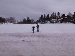
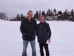
| + | {{GalleryItem | File:2011-03-27 59 10 R1062442.JPG | Who are these people. Could they be...? }} | ||
| + | {{GalleryItem | File:2011-03-27 59 10 R1062443.JPG | Definitely geohashers! }} | ||
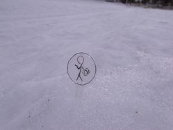
| + | {{GalleryItem | File:2011-03-27 59 10 R1062444.JPG | Marking the spot in biodegradable PLA }} | ||
| + | {{GalleryItem | File:2011-03-27 59 10 R1062445.JPG | Anders and [[User:relet|relet]], two stupid grins out of three }} | ||
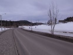
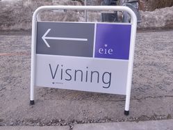
| + | {{GalleryItem | File:2011-03-27 59 10 R1062446.JPG | "Visitation" signs were (almost) pointing us to the geohash }} | ||
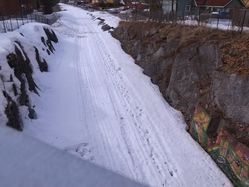
| + | {{GalleryItem | File:2011-03-27 59 10 R1062448.JPG | While the train is under construction, we lay ski tracks instead of rails. }} | ||
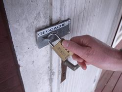
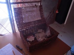
| + | {{GalleryItem | File:2011-03-27 59 10 R1062449.JPG | The entrance to a geocache. }} | ||
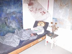
| + | {{GalleryItem | File:2011-03-27 59 10 R1062450.JPG | One of its inhabitants. }} | ||
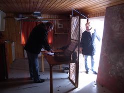
| + | {{GalleryItem | File:2011-03-27 59 10 R1062451.JPG | Not your regular box size. }} | ||
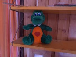
| + | {{GalleryItem | File:2011-03-27 59 10 R1062453.JPG | Another inhabitant. }} | ||
| + | {{GalleryItem | File:2011-03-27 59 10 R1062454.JPG | A box for the tradeables. }} | ||
| + | {{GalleryItem | File:2011-03-27 59 10 R1062455.JPG | Took a wrong left, and then up the hill. }} | ||
| + | }} | ||
| + | |||
== Achievements == | == Achievements == | ||
| Line 49: | Line 83: | ||
<!-- Add any achievement ribbons you earned below, or remove this section --> | <!-- Add any achievement ribbons you earned below, or remove this section --> | ||
| + | {{Earliest geohasher | ||
| + | | latitude = 59 | ||
| + | | longitude = 10 | ||
| + | | date = 2011-03-27 | ||
| + | | name = Mona and Anders | ||
| + | }} | ||
| + | {{Meet-up | ||
| + | | latitude = 59 | ||
| + | | longitude = 10 | ||
| + | | date = 2011-03-27 | ||
| + | | name = Mona, Anders and [[User:relet|relet]] | ||
| + | }} | ||
| − | |||
| − | |||
| − | |||
| − | |||
| − | |||
| − | |||
| − | |||
| − | |||
| − | |||
| − | |||
[[Category:Expeditions]] | [[Category:Expeditions]] | ||
| − | |||
[[Category:Expeditions with photos]] | [[Category:Expeditions with photos]] | ||
| − | |||
| − | |||
| − | |||
| − | |||
| − | |||
[[Category:Coordinates reached]] | [[Category:Coordinates reached]] | ||
| − | + | {{location|NO|30}} | |
| − | |||
| − | |||
| − | |||
| − | |||
| − | |||
| − | |||
| − | |||
| − | |||
| − | |||
Latest revision as of 00:28, 16 February 2020
| Sun 27 Mar 2011 in 59,10: 59.9159722, 10.5487657 geohashing.info google osm bing/os kml crox |
Location
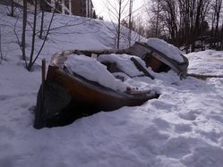
A snowy field near Avløs station.
Today's battleship location is: F 10
Participants
- Anders
- Mona
- relet
Plans
relet: Take a bus to Avløs, walk a few steps, and then spend the rest of the day in Sandvika.
Expedition
- In the bus to Sandvika. Yay for going hashing again! -- relet @60,1150,10,2825 12:13, 27 März 2011 (MESZ)
- It is kind of funny when the speakers on someone's phone are more audible than his own voice. -- relet @59,9476,10,3903 12:45, 27 März 2011 (MESZ)
- Sandvika station, waiting for the connection to Avløs... -- relet @59,8943,10,5251 13:03, 27 März 2011 (MESZ)
- The sign 'danger of avalanches' near a road in the city is curious. -- relet @59,9147,10,5518 13:22, 27 März 2011 (MESZ)
- Coordinates reached and met random people! Wooo! -- relet @59,9159,10,5488 13:32, 27 März 2011 (MESZ)
- Hmmmm. Two buses that went missing. Weird and annoying. -- relet @59,8931,10,5252 17:26, 27 März 2011 (MESZ)
Tracklog
Photos
|
Achievements
Mona and Anders earned the Earliest geohasher achievement
|
Mona, Anders and relet earned the Meet-up achievement
|
