Difference between revisions of "2011-04-21 -43 172"
From Geohashing
imported>ShadowHash |
imported>FippeBot m (Location) |
||
| (6 intermediate revisions by 2 users not shown) | |||
| Line 8: | Line 8: | ||
== Location == | == Location == | ||
| − | Christchurch, | + | [[Christchurch,_New_Zealand|Christchurch, NZ]] |
== Participants == | == Participants == | ||
| Line 21: | Line 21: | ||
== Expedition == | == Expedition == | ||
<!-- how it all turned out. your narrative goes here. --> | <!-- how it all turned out. your narrative goes here. --> | ||
| − | Piece of pi. Easy as cake. My hash marker (see photos) probably didn't last long - it was very windy, and sellotape doesn't stick to asphalt very well. | + | Piece of pi. Easy as cake. My hash marker (see photos) probably didn't last long - it was very windy, and sellotape doesn't stick to asphalt very well. I think I'll make a better one for next time. |
== Photos == | == Photos == | ||
{{gallery|width=200|height=200|lines=2 | {{gallery|width=200|height=200|lines=2 | ||
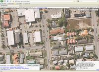
| + | |Image:2011-04-21--43-172Peeron.JPG|IRC Peeron generated map of the hashpoint. | ||
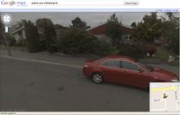
|Image:2011-04-21--43-172GoogleView.jpg|Google Maps street view of the hashpoint. | |Image:2011-04-21--43-172GoogleView.jpg|Google Maps street view of the hashpoint. | ||
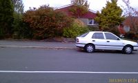
| − | | | + | |Image:2011-04-21--43-172Wideshot.jpg|For comparison with Google Maps street view. |
| + | |Image:2011-04-21--43-172Hashmarker.jpg|My simple Hashmarker. | ||
}} | }} | ||
| Line 35: | Line 37: | ||
{{land geohash | latitude = -43| longitude = 172 | date = 2011-04-21 | name = ShadowHash}} | {{land geohash | latitude = -43| longitude = 172 | date = 2011-04-21 | name = ShadowHash}} | ||
{{No_batteries_geohash | latitude = -43| longitude = 172 | date = 2011-04-21 | name = ShadowHash}} well, I didn't use GPS, only Googly maps... | {{No_batteries_geohash | latitude = -43| longitude = 172 | date = 2011-04-21 | name = ShadowHash}} well, I didn't use GPS, only Googly maps... | ||
| − | {{Easy_geohash | latitude = -43 | longitude = 172 | date = 2011-04-21 | name = ShadowHash}} sort of - I did have to drive out of my way to get there | + | {{Easy_geohash | latitude = -43 | longitude = 172 | date = 2011-04-21 | name = ShadowHash}} sort of - I did have to drive out of my way to get there, but it was just at the side of the road... |
| − | |||
| − | |||
| − | |||
| − | |||
| − | |||
| − | |||
| − | |||
[[Category:Expeditions]] | [[Category:Expeditions]] | ||
[[Category:Expeditions with photos]] | [[Category:Expeditions with photos]] | ||
[[Category:Coordinates reached]] | [[Category:Coordinates reached]] | ||
| − | + | {{location|NZ|CAN}} | |
| − | |||
| − | |||
| − | |||
| − | |||
| − | |||
| − | |||
| − | |||
| − | |||
| − | |||
Latest revision as of 06:14, 9 August 2019
| Thu 21 Apr 2011 in -43,172: -43.5303058, 172.6045881 geohashing.info google osm bing/os kml crox |
Location
Participants
Plans
As the hashpoint was on the side of a suburban street, I drove there after work.
Expedition
Piece of pi. Easy as cake. My hash marker (see photos) probably didn't last long - it was very windy, and sellotape doesn't stick to asphalt very well. I think I'll make a better one for next time.
Photos
|
Achievements
ShadowHash earned the Land geohash achievement
|
ShadowHash earned the No Batteries Geohash Achievement
|
well, I didn't use GPS, only Googly maps...
ShadowHash has visited an Easy Geohash
|
sort of - I did have to drive out of my way to get there, but it was just at the side of the road...


