Difference between revisions of "2011-07-27 45 -122"
imported>Michael5000 (→Photos) |
imported>Michael5000 m (→Photos) |
||
| Line 43: | Line 43: | ||
--> | --> | ||
<gallery perrow="5"> | <gallery perrow="5"> | ||
| − | File:2011-07-27 45 -122 me.JPG | + | File:2011-07-27 45 -122 me.JPG|An oddly flattering photo of me. Helmet strap lends me a chin. |
| − | File:2011-07-27 45 -122 street 1.JPG | + | File:2011-07-27 45 -122 street 1.JPG|Looking up the street. |
| − | File:2011-07-27 45 -122 street 2.JPG | + | File:2011-07-27 45 -122 street 2.JPG|Looking down the street. |
</gallery> | </gallery> | ||
Revision as of 06:15, 28 July 2011
| Wed 27 Jul 2011 in 45,-122: 45.4146480, -122.6271943 geohashing.info google osm bing/os kml crox |
Location
On SE Kronburg Avenue, near Highway 99E between Milwaukie and Gladstone
Participants
Expedition
This Expedition took place in three stages.
In the first stage, I bicycled roughly four miles east of home.
In the second stage, I spent eight-and-change hours doing a blend of clerical and administrative work, fielding telephone calls, and entering and cross-checking data in a spreadsheet and a specialized database.
In the third stage, I took the I-205 bike trail to the Springwater Trail, but found this got me no closer than three miles from the hashpoint. I knew that this would be the case when I hatched the plan in the morning, but had edited it to a single mile in my head during the day. Nevertheless, I pressed on, riding the surprisingly bicycle-tolerant Highway 99 almost to my destination, which turned out to be literally on a quiet street of attractive homes. Then, I did what one does: took a few pictures, and headed for home.
Expedition Success.
Although I didn't go anywhere especially memorable on this jaunt, it is always nice to have an expedition that does what I started out hoping geohashing would do: inspires me to exercise more than I would otherwise. 25.8 miles on the bike in this case, not exactly iron-man stuff but nothing to sneeze at.
Photos
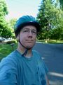
An oddly flattering photo of me. Helmet strap lends me a chin.
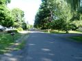
Looking up the street.
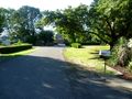
Looking down the street.


