2011-08-27 50 -119
| Sat 27 Aug 2011 in 50,-119: 50.1807526, -119.0797592 geohashing.info google osm bing/os kml crox |
Location
An old mining/logging area south of Lavington.
Participants
Plans
Drive, hike. Terrain looks suitable for the 1 km bushwhack.
Expedition
The road leading up was mostly lined with fences and signs. The area was largely private, but I managed to park in a location with no such deterrents. Dogs barked on both sides of me, and even though they were kilometers away, I knew they would be large and unleashed. As such, I took a straight and difficult line to try to avoid meeting them, or anyone else.
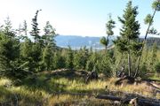
As I had surveyed, there was an odd mesh of old roads I crossed for most of the hike. Unfortunately, they always went perpendicular to my direction. My best guess is that they were used for selective logging a couple decades ago.
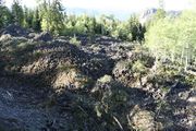
Closer to the coordinates was an equally as old mining or prospecting site. I would not of recognized it as such if I hadn't seen, and researched, the same thing when geohashing three years ago. In both cases I literally stumbled across them, not having arrived by the road they once used.


