Difference between revisions of "2011-11-16 45 -122"
From Geohashing
imported>Michael5000 m (→Achievements) |
imported>FippeBot m (Location) |
||
| (5 intermediate revisions by 2 users not shown) | |||
| Line 1: | Line 1: | ||
| − | |||
| − | |||
| − | |||
| − | |||
| − | |||
| − | |||
| − | |||
| − | |||
| − | |||
| − | |||
{{meetup graticule | {{meetup graticule | ||
| lat=45 | | lat=45 | ||
| Line 30: | Line 20: | ||
== Expedition == | == Expedition == | ||
| − | |||
| − | + | I drove up, parked, found the spot on the sidewalk, noticed a nearby plaque, spent a moment enjoying autumn leaves, and went on with my business. | |
| − | + | ||
| + | Expedition Succeeded. | ||
== Photos == | == Photos == | ||
| − | + | ||
| − | |||
| − | |||
<gallery perrow="5"> | <gallery perrow="5"> | ||
| + | File:2011-11-16 45 -122 plaque.JPG|Embedded in the sidewalk a couple of meters from the hashpoint. | ||
| + | File:2011-11-16 45 -122 street.JPG|Autumn! | ||
| + | File:2011-11-16 45 -122 sign.JPG|Nearby streetsign. | ||
</gallery> | </gallery> | ||
| Line 46: | Line 37: | ||
<!-- Add any achievement ribbons you earned below, or remove this section --> | <!-- Add any achievement ribbons you earned below, or remove this section --> | ||
| + | * Land Geohash | ||
| − | |||
| − | |||
| − | |||
| − | |||
| − | |||
| − | |||
| − | |||
| − | |||
[[Category:Expeditions]] | [[Category:Expeditions]] | ||
| − | |||
[[Category:Expeditions with photos]] | [[Category:Expeditions with photos]] | ||
| − | |||
| − | |||
| − | |||
| − | |||
| − | |||
[[Category:Coordinates reached]] | [[Category:Coordinates reached]] | ||
| − | + | {{location|US|WA|CR}} | |
| − | |||
| − | |||
| − | |||
| − | |||
| − | |||
| − | |||
| − | |||
| − | |||
| − | |||
Latest revision as of 01:32, 13 August 2019
| Wed 16 Nov 2011 in 45,-122: 45.6289073, -122.6313063 geohashing.info google osm bing/os kml crox |
Location
On a street corner in residential Vancouver.
Participants
Plans
This looks like very low-hanging fruit indeed. A few miles out of the way on my way from Point A to Point B should land me on this highly accessible spot.
Expedition
I drove up, parked, found the spot on the sidewalk, noticed a nearby plaque, spent a moment enjoying autumn leaves, and went on with my business.
Expedition Succeeded.
Photos
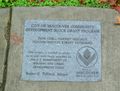
Embedded in the sidewalk a couple of meters from the hashpoint.
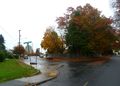
Autumn!
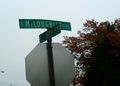
Nearby streetsign.


Achievements
- Land Geohash