Difference between revisions of "2011-12-17 42 -88"
imported>NWoodruff |
imported>Eldin |
||
| Line 1: | Line 1: | ||
| − | |||
| − | |||
| − | |||
| − | |||
| − | |||
| − | |||
| − | |||
| − | |||
| − | |||
{{meetup graticule | {{meetup graticule | ||
| lat=42 | | lat=42 | ||
| Line 14: | Line 5: | ||
}} | }} | ||
| − | |||
== Location == | == Location == | ||
| − | |||
A cul-de-sac in Franklin, WI | A cul-de-sac in Franklin, WI | ||
== Participants == | == Participants == | ||
| − | |||
* [[User:RocketMac|RocketMac]] - Going for a [[Midnight Geohash]] | * [[User:RocketMac|RocketMac]] - Going for a [[Midnight Geohash]] | ||
* MusicGirl - The non-hashing, non-caching wife of RocketMac | * MusicGirl - The non-hashing, non-caching wife of RocketMac | ||
== Plans == | == Plans == | ||
| − | |||
When I checked coordinates on Friday, I saw that both Friday and Sunday were unlikely to happen. The Saturday coordinates are easy to reach, but my wife and I are quadruple booked as it is, so I didn't know if I could make it. | When I checked coordinates on Friday, I saw that both Friday and Sunday were unlikely to happen. The Saturday coordinates are easy to reach, but my wife and I are quadruple booked as it is, so I didn't know if I could make it. | ||
| Line 36: | Line 23: | ||
== Expedition == | == Expedition == | ||
| − | |||
During dinner, we discussed plans for Saturday and everything we had to do. My wife asked if there was anything I wanted to do, so I mentioned the hashpoint. As the time I needed to leave to make it by midnight approached, I asked if we wanted to come along. I assumed she wouldn't, but she said, "Sure. Why not?" | During dinner, we discussed plans for Saturday and everything we had to do. My wife asked if there was anything I wanted to do, so I mentioned the hashpoint. As the time I needed to leave to make it by midnight approached, I asked if we wanted to come along. I assumed she wouldn't, but she said, "Sure. Why not?" | ||
| Line 47: | Line 33: | ||
== Tracklog == | == Tracklog == | ||
| − | |||
My log is available in [http://coldshadow.com/geohashing/2011-12-17.gpx GPX] and [http://coldshadow.com/geohashing/2011-12-17.kmz KMZ] formats | My log is available in [http://coldshadow.com/geohashing/2011-12-17.gpx GPX] and [http://coldshadow.com/geohashing/2011-12-17.kmz KMZ] formats | ||
== Photos == | == Photos == | ||
| − | |||
| − | |||
| − | |||
<gallery perrow="5"> | <gallery perrow="5"> | ||
Image:2011-12-17 42 -88 02.jpg | Stupid Grin | Image:2011-12-17 42 -88 02.jpg | Stupid Grin | ||
| Line 63: | Line 45: | ||
== Achievements == | == Achievements == | ||
{{#vardefine:ribbonwidth|800px}} | {{#vardefine:ribbonwidth|800px}} | ||
| − | |||
{{land geohash | {{land geohash | ||
| latitude = 42 | | latitude = 42 | ||
| Line 100: | Line 81: | ||
| image = | | image = | ||
}} | }} | ||
| − | |||
| − | |||
| − | |||
| − | |||
| − | |||
| − | |||
| − | |||
| − | |||
| − | |||
[[Category:Expeditions]] | [[Category:Expeditions]] | ||
[[Category:Expeditions with photos]] | [[Category:Expeditions with photos]] | ||
| − | |||
| − | |||
| − | |||
| − | |||
| − | |||
| − | |||
[[Category:Coordinates reached]] | [[Category:Coordinates reached]] | ||
| − | |||
| − | |||
| − | |||
| − | |||
| − | |||
| − | |||
| − | |||
| − | |||
| − | |||
Revision as of 16:16, 13 April 2013
| Sat 17 Dec 2011 in 42,-88: 42.9144076, -88.0034926 geohashing.info google osm bing/os kml crox |
Location
A cul-de-sac in Franklin, WI
Participants
- RocketMac - Going for a Midnight Geohash
- MusicGirl - The non-hashing, non-caching wife of RocketMac
Plans
When I checked coordinates on Friday, I saw that both Friday and Sunday were unlikely to happen. The Saturday coordinates are easy to reach, but my wife and I are quadruple booked as it is, so I didn't know if I could make it.
Then I remembered the Midnight Geohash award, and thought, "Hey! I could do that!"
We'll see if I make it.
RocketMac 16:31, 16 December 2011 (EST)
Expedition
During dinner, we discussed plans for Saturday and everything we had to do. My wife asked if there was anything I wanted to do, so I mentioned the hashpoint. As the time I needed to leave to make it by midnight approached, I asked if we wanted to come along. I assumed she wouldn't, but she said, "Sure. Why not?"
I started the track recorder on my GPS and put it away. I had already worked out the route, so off we went.
We made it to the spot with less than ten minutes to wait. The spot was easy to identify thanks to earlier satellite and street view scouting. There was an odd neighbor wandering around opening and closing his garage door and I started to wonder if I was going to earn a Police Geohash as well. Wasn't sure if I really wanted it or not, but we didn't have to find out.
Once midnight hit, I snapped a picture of the clock in the car and turned on the dome lights for a group photo and off we went.
Tracklog
My log is available in GPX and KMZ formats
Photos
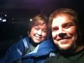
Stupid Grin
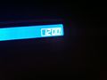
Midnight! (or a very dark noon)
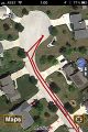
Post-trip GPS check
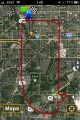
The full route


Achievements
RocketMac earned the Land geohash achievement
|
RocketMac earned the Midnight Geohash achievement
|
RocketMac earned the No Batteries Geohash Achievement
|
RocketMac has visited an Easy Geohash
|
RocketMac earned the Drag-along achievement
|