Difference between revisions of "2012-03-17 47 11"
imported>The T-Man (→Photos: Added pictures) |
imported>FippeBot m (Location) |
||
| (3 intermediate revisions by one other user not shown) | |||
| Line 25: | Line 25: | ||
== Photos == | == Photos == | ||
| − | <gallery perrow=" | + | <gallery perrow="7"> |
| − | Image:2012-03-17-TMan-02.jpg | | + | Image:2012-03-17-TMan-02.jpg | First, they took the subway |
| − | Image:2012-03-17-TMan-03.jpg | | + | Image:2012-03-17-TMan-03.jpg | Then a regional train service from the Deutsche Bahn |
| − | Image:2012-03-17-TMan-04.jpg | | + | Image:2012-03-17-TMan-04.jpg | And then the Bayerische RegionalBahn (not the "Be Right Back", unfortunately) |
| − | Image:2012-03-17-TMan-05.jpg | | + | Image:2012-03-17-TMan-05.jpg | Last, but not least, another train back to München |
| − | Image:2012-03-17-TMan-06.jpg | | + | Image:2012-03-17-TMan-06.jpg | The geohashers making their way through the woods |
| − | Image:2012-03-17-TMan-07.jpg | | + | Image:2012-03-17-TMan-07.jpg | There were lots of little streams in this forest |
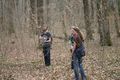
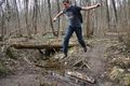
| − | Image:2012-03-17-TMan-08.jpg | | + | Image:2012-03-17-TMan-08.jpg | [[User:DerFlob|DerFlob]] (left) and [[User:Locationmaster|Locationmaster]] crossing... well, something |
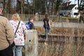
| − | Image:2012-03-17-TMan-09.jpg | | + | Image:2012-03-17-TMan-09.jpg | The drag-alongs catching up |
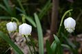
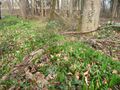
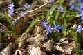
| − | Image:2012-03-17-TMan-10.jpg | | + | Image:2012-03-17-TMan-10.jpg | Some snowdrops along the way |
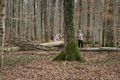
| − | Image:2012-03-17-TMan-11.jpg | | + | Image:2012-03-17-TMan-11.jpg | Is this possibly the hashpoint? |
| − | Image:2012-03-17-TMan-12.jpg | | + | Image:2012-03-17-TMan-12.jpg | Yes, it is! |
| − | Image:2012-03-17-TMan-01.jpg | | + | Image:2012-03-17-TMan-01.jpg | This time, my GPS could not be convinced to show a remaining distance of less than about one metre |
| − | Image:2012-03-17-TMan-13.jpg | | + | Image:2012-03-17-TMan-13.jpg | The coordinates |
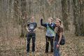
| − | Image:2012-03-17-TMan-14.jpg | | + | Image:2012-03-17-TMan-14.jpg | From left to right: [[User:Scherzkeks|Scherzkeks']] father, [[User:Locationmaster|Locationmaster's]] mum, Locationmaster, [[User:DerFlob|DerFlob]], [[User:The_T-Man|The_T-Man]] and Scherzkeks |
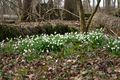
| − | Image:2012-03-17-TMan-15.jpg | | + | Image:2012-03-17-TMan-15.jpg | More snowdrops |
| − | Image:2012-03-17-TMan-16.jpg | | + | Image:2012-03-17-TMan-16.jpg | [[User:The_T-Man|The_T-Man]] conquering a mighty river |
| − | Image:2012-03-17-TMan-17.jpg | | + | Image:2012-03-17-TMan-17.jpg | More snowdrop impressions |
| − | Image:2012-03-17-TMan-18.jpg | | + | Image:2012-03-17-TMan-18.jpg | Lots of bear's garlic - very powerful smell at the place! |
| − | Image:2012-03-17-TMan-19.jpg | | + | Image:2012-03-17-TMan-19.jpg | More snowdrops |
| − | Image:2012-03-17-TMan-20.jpg | | + | Image:2012-03-17-TMan-20.jpg | Some other flowers announcing the oncoming spring |
| − | Image:2012-03-17-TMan-21.jpg | | + | Image:2012-03-17-TMan-21.jpg | More snowdrops |
| − | Image:2012-03-17-TMan-22.jpg | | + | Image:2012-03-17-TMan-22.jpg | Did I mention there were lots of snowdrops? |
| − | Image:2012-03-17-TMan-23.jpg | | + | Image:2012-03-17-TMan-23.jpg | The railroad track was very straight and good to view in both directions at the places we had to cross it |
| − | Image:2012-03-17-TMan-24.jpg | | + | Image:2012-03-17-TMan-24.jpg | A bee at work |
| − | Image:2012-03-17-TMan-25.jpg | | + | Image:2012-03-17-TMan-25.jpg | In German, this butterfly is called ''Kleiner Fuchs'', meaning "small fox", but there seems to be no english name for it |
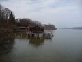
| − | Image:2012-03-17-TMan-26.jpg | | + | Image:2012-03-17-TMan-26.jpg | The view to the South at the lakeshore |
| − | Image:2012-03-17-TMan-27.jpg | | + | Image:2012-03-17-TMan-27.jpg | The geohashers at the lakeshore |
| − | Image:2012-03-17-TMan-28.jpg | | + | Image:2012-03-17-TMan-28.jpg | The view North |
| − | Image:2012-03-17-TMan-29.jpg | | + | Image:2012-03-17-TMan-29.jpg | Fortunately only mammal trails, no sign of Velociraptors |
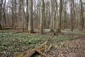
| − | Image:2012-03-17-TMan-30.jpg | | + | Image:2012-03-17-TMan-30.jpg | Now what could we possibly do with this pile of wood and that suspicious-looking canister next to it? |
</gallery> | </gallery> | ||
| Line 61: | Line 61: | ||
{{#vardefine:ribbonwidth|800px}} | {{#vardefine:ribbonwidth|800px}} | ||
{{land geohash | latitude = 47 | longitude = 11 | date = 2012-03-17 | name = [[User:Locationmaster|Locationmaster]] | image = }} | {{land geohash | latitude = 47 | longitude = 11 | date = 2012-03-17 | name = [[User:Locationmaster|Locationmaster]] | image = }} | ||
| − | + | {{Public transport geohash | latitude = 47 | longitude = 11 | date = 2012-03-17 | busline = subway and regional train services | name = [[User:Locationmaster|Locationmaster]] | image =2012-03-17-TMan-03.jpg}} | |
| + | {{drag-along | latitude = 47 | longitude = 11 | date = 2012-03-17 | partner = [[User:Locationmaster|Locationmaster's]] mum and [[User:Scherzkeks|Scherzkeks']] dad | name = [[User:Locationmaster|Locationmaster]], [[User:Scherzkeks|Scherzkeks]], [[User:DerFlob|DerFlob]] and [[User:The_T-Man|The_T-Man]] | image = 2012-03-17-TMan-14.jpg}} | ||
[[Category:Expeditions]] | [[Category:Expeditions]] | ||
[[Category:Expeditions with photos]] | [[Category:Expeditions with photos]] | ||
[[Category:Coordinates reached]] | [[Category:Coordinates reached]] | ||
| + | {{location|DE|BY|LL}} | ||
Latest revision as of 02:59, 13 August 2019
| Sat 17 Mar 2012 in 47,11: 47.9936191, 11.0928919 geohashing.info google osm bing/os kml crox |
Location
In a small forest at the shore of the Ammersee lake, between Utting and Dießen.
Participants
The_T-Man, DerFlob, Scherzkeks, her father, her neighbor Locationmaster and his mother
Plans
Planning to go there by train and arrive at shortly past 2 p.m.
Expedition
Scherzkeks, her father, her neighbor Locationmaster who, by the way, is new to geohashing, his mother, and The_T-Man started at around noon by taking the subway to München central station where they met DerFlob. From there on, they took a regional train service to Geltendorf, a small village outside of München. Although their journey was slowed down by technical difficulties with the train's doors, their follow-up train was kind enough to wait there. The small diesel railcoach then took the group to Riederau, a very small settlement at the shore of the Ammersee, one of the three large lakes associated with Munich. It was one of the first rather warm spring days with temperatures up to 20°C and some sunshine at and before noon. They continued into a impressive broad-leaved forest that was just starting to awake from its wintery slumber. The paths were lined with huge amounts of snowdrops throughout the forest. To reach the hashpoint, our group had to cross the railroad tracks and one or to small streams. The point was located about 300 metres away from their original path. Luckily, the area of the hashpoint was not under special protection and so access was possible, as opposed to the part of the forest between the hiking path and the lakeshore.
The group decided to continue N until Utting, the next train stop in that direction. After they left the forest, their path led them through mostly settled areas with some beautiful glimpses at the lake. At about 4 p.m., they took a train back to München.
Photos
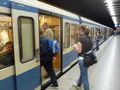
First, they took the subway
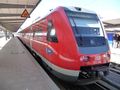
Then a regional train service from the Deutsche Bahn
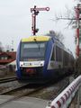
And then the Bayerische RegionalBahn (not the "Be Right Back", unfortunately)
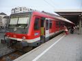
Last, but not least, another train back to München
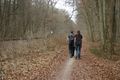
The geohashers making their way through the woods
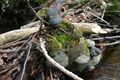
There were lots of little streams in this forest
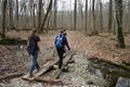
DerFlob (left) and Locationmaster crossing... well, something
The drag-alongs catching up
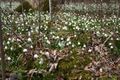
Some snowdrops along the way
Is this possibly the hashpoint?
Yes, it is!
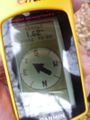
This time, my GPS could not be convinced to show a remaining distance of less than about one metre
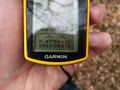
The coordinates
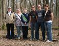
From left to right: Scherzkeks' father, Locationmaster's mum, Locationmaster, DerFlob, The_T-Man and Scherzkeks

More snowdrops
The_T-Man conquering a mighty river
More snowdrop impressions
Lots of bear's garlic - very powerful smell at the place!
More snowdrops

Some other flowers announcing the oncoming spring

More snowdrops
Did I mention there were lots of snowdrops?
The railroad track was very straight and good to view in both directions at the places we had to cross it
A bee at work

In German, this butterfly is called Kleiner Fuchs, meaning "small fox", but there seems to be no english name for it
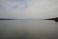
The view to the South at the lakeshore
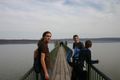
The geohashers at the lakeshore
The view North
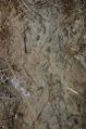
Fortunately only mammal trails, no sign of Velociraptors
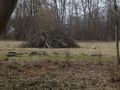
Now what could we possibly do with this pile of wood and that suspicious-looking canister next to it?


Achievements
Locationmaster earned the Land geohash achievement
|
Locationmaster earned the Public transport geohash achievement
|
Locationmaster, Scherzkeks, DerFlob and The_T-Man earned the Drag-along achievement
|