Difference between revisions of "2012-04-12 45 -122"
imported>Michael5000 m (→Plans) |
imported>FippeBot m (Location) |
||
| (5 intermediate revisions by one other user not shown) | |||
| Line 29: | Line 29: | ||
== Expedition == | == Expedition == | ||
| − | |||
| − | + | After work -- I stayed late to make up for the morning, actually -- I headed out on the road to Damascus. I never have any epiphanies on the road to Damascus, which seems a pity. Maybe I should try 212 instead of Foster Road. | |
| − | + | ||
| + | Oh well. It turned out that the mysterious patch of ground was just an unusually situated public park. It had a children's playground in one corner and a handsome gazebo and a hashpoint in the other. I found the hashpoint, basked in the glow of another successful mission, and left some cryptic evidence in the gazebo. Then I went for a five-mile run, doing a quick loop at the end of it to see if anyone else had come along. The cryptic evidence had not been disturbed, so I returned to the truck and set off for home. | ||
== Photos == | == Photos == | ||
| − | + | ||
| − | |||
| − | |||
<gallery perrow="5"> | <gallery perrow="5"> | ||
| + | File:2012-04-12 45 -122 sign.JPG|I made sure to be nice. | ||
| + | File:2012-04-12 45 -122 gazebo.JPG|View from the hashpoint. | ||
| + | File:2012-04-12 45 -122 Dr w5000.JPG|I alter the fabric of space and time with my mind. Apparently. | ||
</gallery> | </gallery> | ||
| Line 45: | Line 46: | ||
<!-- Add any achievement ribbons you earned below, or remove this section --> | <!-- Add any achievement ribbons you earned below, or remove this section --> | ||
| − | |||
| − | |||
| − | |||
| − | |||
| − | |||
| − | |||
| − | |||
| − | |||
| − | |||
| − | |||
| − | |||
[[Category:Expeditions]] | [[Category:Expeditions]] | ||
| − | |||
[[Category:Expeditions with photos]] | [[Category:Expeditions with photos]] | ||
| − | |||
| − | |||
| − | |||
| − | |||
| − | |||
[[Category:Coordinates reached]] | [[Category:Coordinates reached]] | ||
| − | + | {{location|US|OR|CC}} | |
| − | |||
| − | |||
| − | |||
| − | |||
| − | |||
| − | |||
| − | |||
| − | |||
| − | |||
Latest revision as of 03:28, 13 August 2019
| Thu 12 Apr 2012 in 45,-122: 45.4159086, -122.4559907 geohashing.info google osm bing/os kml crox |
Location
Centennial Park, Damascus.
Participants
Plans
As always, I started my day by checking the hashpoints. This location seemed so peculiar that me and Mrs.5000 spent a lot of time looking at it at different magnifications and from different streetview angles. What was going on in that unusual scrap of ground? Was that a gazebo? Was that playground equipment? We talked about it at length. Eventually, I realized I was late for work.
Expedition
After work -- I stayed late to make up for the morning, actually -- I headed out on the road to Damascus. I never have any epiphanies on the road to Damascus, which seems a pity. Maybe I should try 212 instead of Foster Road.
Oh well. It turned out that the mysterious patch of ground was just an unusually situated public park. It had a children's playground in one corner and a handsome gazebo and a hashpoint in the other. I found the hashpoint, basked in the glow of another successful mission, and left some cryptic evidence in the gazebo. Then I went for a five-mile run, doing a quick loop at the end of it to see if anyone else had come along. The cryptic evidence had not been disturbed, so I returned to the truck and set off for home.
Photos
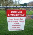
I made sure to be nice.
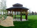
View from the hashpoint.
I alter the fabric of space and time with my mind. Apparently.


