Difference between revisions of "2012-07-27 59 12"
imported>Cjk ([live] Damn swamp, feet wet, deflowered) |
m (per Renaming Proposal) |
||
| (41 intermediate revisions by 5 users not shown) | |||
| Line 1: | Line 1: | ||
| − | |||
| − | |||
| − | |||
| − | |||
| − | |||
| − | |||
| − | |||
| − | |||
| − | |||
| − | |||
{{meetup graticule | {{meetup graticule | ||
| lat=59 | | lat=59 | ||
| Line 14: | Line 4: | ||
| date=2012-07-27 | | date=2012-07-27 | ||
}} | }} | ||
| − | |||
| − | |||
| − | |||
== Location == | == Location == | ||
| − | + | In the middle of nowhere, off the E18 towards Oslo, 450 meters a from logging road, beyond a swamp. | |
| − | |||
| − | |||
| − | |||
| − | |||
| − | == Plans == | + | == [[User:Cjk|Cjk]] == |
| + | [[Image:{{{image|2012-07-27_59_12_19-58-49-086.jpg}}}|thumb|left]] | ||
| + | === Plans === | ||
<!-- what were the original plans --> | <!-- what were the original plans --> | ||
| + | I was already driving from Stockholm to Fiskebäckskil so why not take a detour and geohash along the way. If I go north of the largest lake in Sweden, Vänern I could deflower a Virgin Graticule. | ||
| − | == Expedition == | + | === Expedition === |
<!-- how it all turned out. your narrative goes here. --> | <!-- how it all turned out. your narrative goes here. --> | ||
| + | Packed the car and drove out from Stockholm, turned towards Örebro in Södertälje, and towards Karlstad in Örebro. A lot of vacation traffic with motor homes and caravans. Got some burgers in Karlstad. | ||
| + | *In Karlstad -- [[User:Cjk|Cjk]] [http://www.openstreetmap.org/?lat=59.38341503&lon=13.47624304&zoom=16&layers=B000FTF @59.3834,13.4762] 18:46, 27 July 2012 (CEST) | ||
| + | |||
| + | Continued on the E18 towards Oslo and got off the "highway" at the right spot, onto a narrow road, then a gravel road and then a logging road. Stopped the car at the mininum distance to the hash. I jumped over a ditch and started making my way through what turned out to be a swamp. I turned back after like 7 m and tried to jump over the ditch to find a dry route around the swamp, but the rotten logs covered in moss gaveme no footing at all and I landed in the ditch with water up to my calves. | ||
| − | + | Fuck it, already wet, lets cross this swamp. Hiked up a hill along a logging road and ate some blueberries to get my mind off my soaking Converse. Crossed a few clearings that I had seen on google maps and found the hash which was locaded in a clearing on the side of asmall hill. Snapped some picks and painted the moss. | |
*Damn swamp, feet wet, deflowered -- [[User:Cjk|Cjk]] [http://www.openstreetmap.org/?lat=59.29106025&lon=12.63000484&zoom=16&layers=B000FTF @59.2911,12.6300] 19:41, 27 July 2012 (CEST) | *Damn swamp, feet wet, deflowered -- [[User:Cjk|Cjk]] [http://www.openstreetmap.org/?lat=59.29106025&lon=12.63000484&zoom=16&layers=B000FTF @59.2911,12.6300] 19:41, 27 July 2012 (CEST) | ||
| − | |||
| − | |||
| − | == Photos == | + | Started heading back to the car and realized just how wet this "summer" has been in sweden when the moss gave way and I started sliding down the hill. |
| + | |||
| + | Ate some common wood-sorrel, or [http://en.wikipedia.org/wiki/Common_wood_sorrel 'harsyra'], on the way back. | ||
| + | |||
| + | Found the dry route I should have taken and got backto my car. Removed shoes and socks and donned pink flip-flops. Headed back to the E45 and drove the rest of the way towards Fiskebäckskil. By the last turn off point a wanker in a SUV headed straight for me in my lane on the wrong side of an aboutment. Total tosser. | ||
| + | |||
| + | === Photos === | ||
<!-- Insert pictures between the gallery tags using the following format: | <!-- Insert pictures between the gallery tags using the following format: | ||
Image:2010-##-## ## ## Alpha.jpg | Witty Comment | Image:2010-##-## ## ## Alpha.jpg | Witty Comment | ||
--> | --> | ||
<gallery perrow="5"> | <gallery perrow="5"> | ||
| + | |||
| + | Image:2012-07-27_59_12_19-58-49-086.jpg | Made it, with Campanja T-shirt [http://www.openstreetmap.org/?lat=59.29110000&lon=12.62990000&zoom=16&layers=B000FTF @59.2911,12.6299] | ||
| + | |||
| + | Image:2012-07-27_59_12_00-13-00-628.jpg | Only 448 m to go from this unknown road [http://www.openstreetmap.org/?lat=59.29480000&lon=12.63280000&zoom=16&layers=B000FTF @59.2948,12.6328] | ||
| + | |||
| + | Image:2012-07-27_59_12_00-13-48-050.jpg | The car in these woods [http://www.openstreetmap.org/?lat=59.29480000&lon=12.63280000&zoom=16&layers=B000FTF @59.2948,12.6328] | ||
| + | |||
| + | Image:2012-07-27_59_12_00-14-33-334.jpg | It's in there somewhere [http://www.openstreetmap.org/?lat=59.29480000&lon=12.63280000&zoom=16&layers=B000FTF @59.2948,12.6328] | ||
| + | |||
| + | Image:2012-07-27_59_12_00-17-28-887.jpg | It was a swamp, tried it, tried to jump back, landed in this ditch and soaked my shoes so wtf, let's just cross this swamp! [http://www.openstreetmap.org/?lat=59.29460000&lon=12.63300000&zoom=16&layers=B000FTF @59.2946,12.6330] | ||
| + | |||
| + | Image:2012-07-27_59_12_00-18-36-498.jpg | Marsh, swamp, wet feet. [http://www.openstreetmap.org/?lat=59.29460000&lon=12.63300000&zoom=16&layers=B000FTF @59.2946,12.6330] | ||
| + | |||
| + | Image:2012-07-27_59_12_00-19-38-840.jpg | The logging machines have used this path [http://www.openstreetmap.org/?lat=59.29410000&lon=12.63300000&zoom=16&layers=B000FTF @59.2941,12.6330] | ||
| + | |||
| + | Image:2012-07-27_59_12_00-20-34-241.jpg | Oh look, blueberries!!! Yummy! [http://www.openstreetmap.org/?lat=59.29310000&lon=12.63280000&zoom=16&layers=B000FTF @59.2931,12.6328] | ||
| + | |||
| + | Image:2012-07-27_59_12_00-22-25-206.jpg | These leaves are my fav, tart and refreshing. 'Harsyra' [http://www.openstreetmap.org/?lat=59.29270000&lon=12.63290000&zoom=16&layers=B000FTF @59.2927,12.6329] | ||
| + | |||
| + | Image:2012-07-27_59_12_00-23-29-008.jpg | Made it. Marked it with orange(TM) [http://www.openstreetmap.org/?lat=59.29110000&lon=12.62990000&zoom=16&layers=B000FTF @59.2911,12.6299] | ||
| + | |||
| + | Image:2012-07-27_59_12_00-24-23-541.jpg | My soaked through converse at the spot [http://www.openstreetmap.org/?lat=59.29110000&lon=12.62990000&zoom=16&layers=B000FTF @59.2911,12.6299] | ||
| + | |||
| + | Image:2012-07-27_59_12_00-25-00-971.jpg | Panorama 1 | ||
| + | |||
| + | Image:2012-07-27_59_12_00-25-25-514.jpg | Panorama 2 | ||
| + | |||
| + | Image:2012-07-27_59_12_00-27-00-415.jpg | Wet moss doesn't have the best footing.slipped and almost fell. | ||
| + | |||
| + | Image:2012-07-27_59_12_00-28-04-660.jpg | Black slug, not the invading brown murder slug. [http://www.openstreetmap.org/?lat=59.29110000&lon=12.63060000&zoom=16&layers=B000FTF @59.2911,12.6306] | ||
| + | |||
| + | Image:2012-07-27_59_12_00-28-48-179.jpg | First clearing on the way back [http://www.openstreetmap.org/?lat=59.29120000&lon=12.63090000&zoom=16&layers=B000FTF @59.2912,12.6309] | ||
| + | |||
| + | Image:2012-07-27_59_12_00-29-24-179.jpg | Second clearing [http://www.openstreetmap.org/?lat=59.29150000&lon=12.63150000&zoom=16&layers=B000FTF @59.2915,12.6315] | ||
| + | |||
| + | Image:2012-07-27_59_12_00-29-54-061.jpg | Ooo, an egg. [http://www.openstreetmap.org/?lat=59.29180000&lon=12.63230000&zoom=16&layers=B000FTF @59.2918,12.6323] | ||
| + | |||
| + | Image:2012-07-27_59_12_00-30-32-251.jpg | Bugger, already empty [http://www.openstreetmap.org/?lat=59.29180000&lon=12.63230000&zoom=16&layers=B000FTF @59.2918,12.6323] | ||
| + | |||
| + | Image:2012-07-27_59_12_00-31-18-918.jpg | The creek that fills the swamp by the car [http://www.openstreetmap.org/?lat=59.29180000&lon=12.63250000&zoom=16&layers=B000FTF @59.2918,12.6325] | ||
| + | |||
| + | Image:2012-07-27_59_12_00-32-07-318.jpg | Sparse spruce trees [http://www.openstreetmap.org/?lat=59.29200000&lon=12.63290000&zoom=16&layers=B000FTF @59.2920,12.6329] | ||
| + | |||
| + | Image:2012-07-27_59_12_00-33-09-785.jpg | The route the logging machines have taken [http://www.openstreetmap.org/?lat=59.29220000&lon=12.63280000&zoom=16&layers=B000FTF @59.2922,12.6328] | ||
| + | |||
| + | Image:2012-07-27_59_12_00-33-40-527.jpg | Happy hasher [http://www.openstreetmap.org/?lat=59.29230000&lon=12.63290000&zoom=16&layers=B000FTF @59.2923,12.6329] | ||
| + | |||
| + | Image:2012-07-27_59_12_00-34-22-828.jpg | Some storm has made its mark [http://www.openstreetmap.org/?lat=59.29290000&lon=12.63350000&zoom=16&layers=B000FTF @59.2929,12.6335] | ||
| + | |||
| + | Image:2012-07-27_59_12_00-35-09-524.jpg | Getting closer to the car [http://www.openstreetmap.org/?lat=59.29370000&lon=12.63380000&zoom=16&layers=B000FTF @59.2937,12.6338] | ||
| + | |||
| + | Image:2012-07-27_59_12_00-36-09-909.jpg | This is the way I should have taken to keep my feet dry [http://www.openstreetmap.org/?lat=59.29450000&lon=12.63440000&zoom=16&layers=B000FTF @59.2945,12.6344] | ||
| + | |||
| + | Image:2012-07-27_59_12_00-36-39-385.jpg | And there's my car [http://www.openstreetmap.org/?lat=59.29480000&lon=12.63410000&zoom=16&layers=B000FTF @59.2948,12.6341] | ||
</gallery> | </gallery> | ||
| − | |||
| − | |||
| − | |||
| − | + | == [[User:the_ru | the ru]] and Anna == | |
| − | + | We were passing through the area on our way to the west coast. We first made an attempt at 59 14 (near Karlskoga), took a wrong turn, got lost and drove around for an hour until we ended up in Degerfors and decided to have lunch instead. | |
| − | + | ||
| + | A couple of hours later, we were rounding the north edge of Vänern. We weren't in any hurry and decided to try reaching 59 12. Preparations had been minimal with only checking the map and concluding "that's somewhat feasible" before leaving home in the morning. | ||
| + | |||
| + | We stopped briefly at Långseruds Kyrka just south of the lake Aspen. We continued north, past a couple of small farms, trying to get as close as possible (we had no access to proper maps). After a while we turned back and parked just within a kilometer from the hash. | ||
| + | |||
| + | "Let's go this way", the ru decided and we set off through some very dense bushes, blindly chasing the GPS pointer. After about 200 m, we emerged onto a logging road. Oh - ok. | ||
| + | |||
| + | The logging road passed only a few hundred meters from the hash. We came to a swampy area but decided to proceed a short distance and look for a better route. Just around the corner we found a large clearcut and started making our way up the hill. We found and ate plenty of wild raspberry. | ||
| + | |||
| + | We reached the hash. There were ''lots'' of small frogs scuttling about and in the distance some very aggressive croaking from a large bird. We only took a few pictures (the camera was too slow to capture the frogs properly) and decided to leave the animals in peace. | ||
| − | + | We headed back the same way we came, stopped to say hello to a flock of cows grazing near the road. | |
| − | |||
| − | |||
| − | |||
| − | + | (EXIF says we were there at 17:11, but I don't have any real proof so I'm not "challenging" the virgin graticule or anything.) | |
| − | |||
| − | |||
| − | |||
| − | |||
| − | |||
| − | |||
| − | |||
| − | |||
| − | |||
| + | === Photos === | ||
| + | <gallery perrow="4"> | ||
| + | Image:2012_07_27_59_12_langseruds_kyrka.jpg | Långseruds Kyrka | ||
| + | Image:2012_07_27_59_12_forest_1.jpg | "Let's go this way" | ||
| + | Image:2012_07_27_59_12_forest_2.jpg | ||
| + | Image:2012_07_27_59_12_raspberries.jpg | ||
| + | Image:2012_07_27_59_12_hashpoint.jpg | Hashpoint | ||
| + | Image:2012_07_27_59_12_cows.jpg | the mu | ||
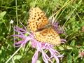
| + | Image:2012_07_27_59_12_moth.jpg | ||
| + | </gallery> | ||
| − | + | === Achievements === | |
| − | + | {{#vardefine:ribbonwidth|800px}} | |
| − | -- | + | <!-- Add any achievement ribbons you earned below, or remove this section --> |
| − | + | {{Graticule unlocked | latitude = 59 | longitude = 12 | date = 2012-07-27 | name = [[User:the_ru|the_ru]] and Anna}} | |
| − | [[ | ||
| − | |||
| − | |||
| − | |||
| − | |||
| − | |||
| − | |||
| − | |||
| − | |||
| − | + | [[Category:Expeditions]] | |
| + | [[Category:Expeditions with photos]] | ||
| + | [[Category:Coordinates reached]] | ||
| + | {{location|SE|S}} | ||
Latest revision as of 05:34, 20 March 2024
| Fri 27 Jul 2012 in 59,12: 59.2910436, 12.6299855 geohashing.info google osm bing/os kml crox |
Contents
Location
In the middle of nowhere, off the E18 towards Oslo, 450 meters a from logging road, beyond a swamp.
Cjk

Plans
I was already driving from Stockholm to Fiskebäckskil so why not take a detour and geohash along the way. If I go north of the largest lake in Sweden, Vänern I could deflower a Virgin Graticule.
Expedition
Packed the car and drove out from Stockholm, turned towards Örebro in Södertälje, and towards Karlstad in Örebro. A lot of vacation traffic with motor homes and caravans. Got some burgers in Karlstad.
- In Karlstad -- Cjk @59.3834,13.4762 18:46, 27 July 2012 (CEST)
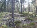
Continued on the E18 towards Oslo and got off the "highway" at the right spot, onto a narrow road, then a gravel road and then a logging road. Stopped the car at the mininum distance to the hash. I jumped over a ditch and started making my way through what turned out to be a swamp. I turned back after like 7 m and tried to jump over the ditch to find a dry route around the swamp, but the rotten logs covered in moss gaveme no footing at all and I landed in the ditch with water up to my calves.
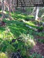
Fuck it, already wet, lets cross this swamp. Hiked up a hill along a logging road and ate some blueberries to get my mind off my soaking Converse. Crossed a few clearings that I had seen on google maps and found the hash which was locaded in a clearing on the side of asmall hill. Snapped some picks and painted the moss.
- Damn swamp, feet wet, deflowered -- Cjk @59.2911,12.6300 19:41, 27 July 2012 (CEST)
Started heading back to the car and realized just how wet this "summer" has been in sweden when the moss gave way and I started sliding down the hill.
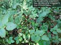
Ate some common wood-sorrel, or 'harsyra', on the way back.
Found the dry route I should have taken and got backto my car. Removed shoes and socks and donned pink flip-flops. Headed back to the E45 and drove the rest of the way towards Fiskebäckskil. By the last turn off point a wanker in a SUV headed straight for me in my lane on the wrong side of an aboutment. Total tosser.
Photos

Made it, with Campanja T-shirt @59.2911,12.6299
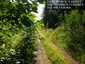
Only 448 m to go from this unknown road @59.2948,12.6328
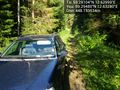
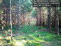
The car in these woods @59.2948,12.6328
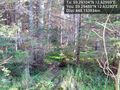
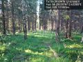
It's in there somewhere @59.2948,12.6328
It was a swamp, tried it, tried to jump back, landed in this ditch and soaked my shoes so wtf, let's just cross this swamp! @59.2946,12.6330
Marsh, swamp, wet feet. @59.2946,12.6330
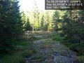
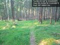
The logging machines have used this path @59.2941,12.6330
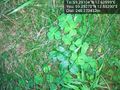
Oh look, blueberries!!! Yummy! @59.2931,12.6328
These leaves are my fav, tart and refreshing. 'Harsyra' @59.2927,12.6329
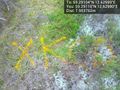
Made it. Marked it with orange(TM) @59.2911,12.6299
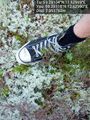
My soaked through converse at the spot @59.2911,12.6299
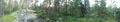
Panorama 1
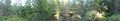
Panorama 2
Wet moss doesn't have the best footing.slipped and almost fell.
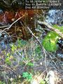
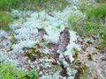
Black slug, not the invading brown murder slug. @59.2911,12.6306
First clearing on the way back @59.2912,12.6309
Second clearing @59.2915,12.6315
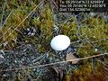
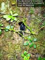
Ooo, an egg. @59.2918,12.6323
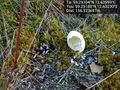
Bugger, already empty @59.2918,12.6323
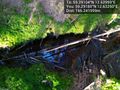
The creek that fills the swamp by the car @59.2918,12.6325
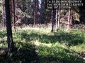
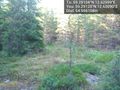
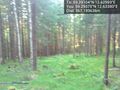
Sparse spruce trees @59.2920,12.6329
The route the logging machines have taken @59.2922,12.6328
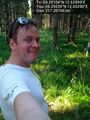
Happy hasher @59.2923,12.6329
Some storm has made its mark @59.2929,12.6335
Getting closer to the car @59.2937,12.6338
This is the way I should have taken to keep my feet dry @59.2945,12.6344
And there's my car @59.2948,12.6341


the ru and Anna
We were passing through the area on our way to the west coast. We first made an attempt at 59 14 (near Karlskoga), took a wrong turn, got lost and drove around for an hour until we ended up in Degerfors and decided to have lunch instead.
A couple of hours later, we were rounding the north edge of Vänern. We weren't in any hurry and decided to try reaching 59 12. Preparations had been minimal with only checking the map and concluding "that's somewhat feasible" before leaving home in the morning.
We stopped briefly at Långseruds Kyrka just south of the lake Aspen. We continued north, past a couple of small farms, trying to get as close as possible (we had no access to proper maps). After a while we turned back and parked just within a kilometer from the hash.
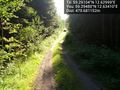
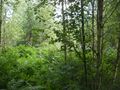
"Let's go this way", the ru decided and we set off through some very dense bushes, blindly chasing the GPS pointer. After about 200 m, we emerged onto a logging road. Oh - ok.
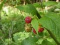
The logging road passed only a few hundred meters from the hash. We came to a swampy area but decided to proceed a short distance and look for a better route. Just around the corner we found a large clearcut and started making our way up the hill. We found and ate plenty of wild raspberry.
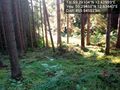
We reached the hash. There were lots of small frogs scuttling about and in the distance some very aggressive croaking from a large bird. We only took a few pictures (the camera was too slow to capture the frogs properly) and decided to leave the animals in peace.
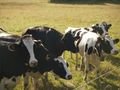
We headed back the same way we came, stopped to say hello to a flock of cows grazing near the road.
(EXIF says we were there at 17:11, but I don't have any real proof so I'm not "challenging" the virgin graticule or anything.)
Photos
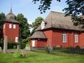
Långseruds Kyrka
"Let's go this way"
Hashpoint
the mu


Achievements
the_ru and Anna earned the Graticule Unlocked Achievement
|