Difference between revisions of "2012-08-16 31 34"
imported>LiNaK |
imported>FippeBot m (Location) |
||
| (9 intermediate revisions by 2 users not shown) | |||
| Line 17: | Line 17: | ||
__NOTOC__ | __NOTOC__ | ||
== Location == | == Location == | ||
| − | HaHistadrut Street at Askelon, near the entrance to a girl's | + | HaHistadrut Street at Askelon, near the entrance to a girl's Ulpena (religious school). |
== Participants == | == Participants == | ||
| − | Omri (LiNaK) | + | Omri ([[User:LiNaK|LinaK]]) |
Tal | Tal | ||
| Line 39: | Line 39: | ||
--> | --> | ||
<gallery perrow="5"> | <gallery perrow="5"> | ||
| + | Image:Image-2012-08-16_31_34_train.JPG | Hebrew moon-runes | ||
| + | Image:2012-08-16_31_34_synagogue.jpg | An oddly looking synagogue | ||
| + | Image:2012-08-16_31_34_cat.jpg | Hey look, a cat! | ||
| + | Image:2012-08-16_31_34_school.jpg | The Ulpena at the hash | ||
| + | Image:2012-08-16_31_34_hash.jpg | Also at the hash | ||
| + | Image:2012-08-16_31_34_proof.jpg | Best proof I could think of | ||
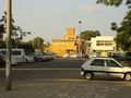
| + | Image:2012-08-16_31_34_ship.jpg | North Africa Judaism Junction | ||
| + | Image:2012-08-16_31_34_ship2.jpg | North Africa Judaism Junction | ||
| + | Image:2012-08-16_31_34_telaviv.jpg | Azrieli Towers, back at Tel Aviv | ||
</gallery> | </gallery> | ||
| Line 44: | Line 53: | ||
{{#vardefine:ribbonwidth|800px}} | {{#vardefine:ribbonwidth|800px}} | ||
<!-- Add any achievement ribbons you earned below, or remove this section --> | <!-- Add any achievement ribbons you earned below, or remove this section --> | ||
| + | {{No_batteries_geohash | ||
| + | | latitude = 31 | ||
| + | | longitude = 34 | ||
| + | | date = 2012-08-16 | ||
| + | | name = [[User:LiNaK|LinaK]] | ||
| + | }} | ||
| + | {{Public transport geohash | ||
| + | | latitude = 31 | ||
| + | | longitude = 34 | ||
| + | | date = 2012-08-16 | ||
| + | | busline = bus and train | ||
| + | | name = [[User:LiNaK|LinaK]] and Tal | ||
| + | }} | ||
| − | |||
| − | |||
| − | |||
| − | |||
| − | |||
| − | |||
| − | |||
| − | |||
| − | |||
| − | |||
| − | |||
[[Category:Expeditions]] | [[Category:Expeditions]] | ||
| − | |||
[[Category:Expeditions with photos]] | [[Category:Expeditions with photos]] | ||
| − | |||
[[Category:Expedition without GPS]] | [[Category:Expedition without GPS]] | ||
| − | |||
| − | |||
| − | |||
[[Category:Coordinates reached]] | [[Category:Coordinates reached]] | ||
| − | + | {{location|IL|D|AS}} | |
| − | |||
| − | |||
| − | |||
| − | |||
| − | |||
| − | |||
| − | |||
| − | |||
| − | |||
| − | |||
| − | |||
| − | |||
| − | |||
| − | |||
| − | |||
| − | |||
| − | |||
Latest revision as of 12:30, 14 July 2019
| Thu 16 Aug 2012 in 31,34: 31.6567681, 34.5583992 geohashing.info google osm bing/os kml crox |
Location
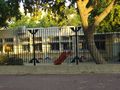
HaHistadrut Street at Askelon, near the entrance to a girl's Ulpena (religious school).
Participants
Omri (LinaK)
Tal
Plans
Like on our last hash, the plan was to get by public transport to Askelon through Tel Aviv and then use the GPS to find the correct spot so we can get home before the last train leaves. Unluckily for us, it didn't go as well as we planned.
Expedition
Started by biking from my home in Monoson to Tal's at Kiryat Ono, from which we took bus 68 to the Tel Aviv train station and there switched to the train down south all the way to Askelon. Along the way we also saw camels (but didn't manage to take pictures of them from the train window so you'll just have to believe us). Taking the second bus that left the train station (the first one was so full the driver didn't let everyone on), we were on our way to the central bus station of the city, near the Brazilai medical center and about a KM from the hash, along the way making up a whole story to explain two kids we met on the bus what people from center of Israel were doing down here at the far flung south.
And that was when we found out the GPS we brought with us was out of Batteries (though I'm sure I recharged it before leaving home), so we just king of had to navigate using the direction of the sun and the knowledge that the hash was somewhere south to the hospital. That actually manged to work and we found ourselves near what we assumed was the North Africa Judaism Junction, which we remembered as being close to the hash from the map. From that point we spent some time just wandering around, looking for something that looks like a religious girls' school. Finally we had to ask for directions from one of the kids near a synagogue for directions. That we didn't get and ended up walking up and down the street for some more time, until meeting him again an hour later and being led by him all the way to the spot, that was actually not on the main street but on an ally that had the same name that branched out of it (for showing us the way twice and for pretending like he believed our fake story for why we were so eager to find that girls' school at the first place, that kid wins the honor of being our hero for today).
And than we had just two hours more of a bus, a train, another bus and (for me) biking before arriving back home, tired but satisfied.
Photos
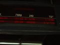
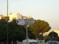
Hebrew moon-runes
An oddly looking synagogue
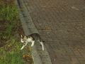
Hey look, a cat!
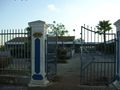
The Ulpena at the hash
Also at the hash
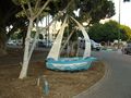
Best proof I could think of
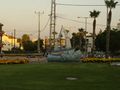
North Africa Judaism Junction
North Africa Judaism Junction
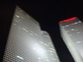
Azrieli Towers, back at Tel Aviv


Achievements
LinaK earned the No Batteries Geohash Achievement
|
LinaK and Tal earned the Public transport geohash achievement
|