Difference between revisions of "2012-08-25 58 12"
From Geohashing
imported>Cjk ([live picture] [http://www.openstreetmap.org/?lat=58.56040000&lon=12.36130000&zoom=16&layers=B000FTF @58.5604,12.3613]) |
imported>FippeBot m (Location) |
||
| (3 intermediate revisions by one other user not shown) | |||
| Line 1: | Line 1: | ||
| − | + | [[Image:{{{image|2012-08-25_58_12_10-07-58-762.jpg}}}|thumb|left]] | |
| − | |||
| − | |||
| − | [[Image:{{{image| | ||
| − | |||
| − | |||
| − | |||
| − | |||
| − | |||
| − | |||
{{meetup graticule | {{meetup graticule | ||
| lat=58 | | lat=58 | ||
| Line 19: | Line 10: | ||
== Location == | == Location == | ||
<!-- where you've surveyed the hash to be --> | <!-- where you've surveyed the hash to be --> | ||
| + | On the E45 in the middle of the road south of Mellerud. | ||
== Participants == | == Participants == | ||
<!-- who attended: If you link to your wiki user name in this section, your expedition will be picked up by the various statistics generated for geohashing. You may use three tildes ~ as a shortcut to automatically insert the user signature of the account you are editing with. | <!-- who attended: If you link to your wiki user name in this section, your expedition will be picked up by the various statistics generated for geohashing. You may use three tildes ~ as a shortcut to automatically insert the user signature of the account you are editing with. | ||
--> | --> | ||
| − | + | [[User:Cjk|Cjk]] | |
| − | |||
| − | |||
| − | |||
== Expedition == | == Expedition == | ||
<!-- how it all turned out. your narrative goes here. --> | <!-- how it all turned out. your narrative goes here. --> | ||
| + | I had driven through this spot around 23:00 the day before from the [[2012-08-24_59_13]] hash the day before while going to Trollhättan, all without knowing about todays hash. So the next morning I just had to drive back to get it. | ||
| + | Have a short tracklog below, just the part going through the hash and walking and marking it. It was in the middle of the road. | ||
*Speed deja vu -- [[User:Cjk|Cjk]] [http://www.openstreetmap.org/?lat=58.56039793&lon=12.36134816&zoom=16&layers=B000FTF @58.5604,12.3613] 10:04, 25 August 2012 (CEST) | *Speed deja vu -- [[User:Cjk|Cjk]] [http://www.openstreetmap.org/?lat=58.56039793&lon=12.36134816&zoom=16&layers=B000FTF @58.5604,12.3613] 10:04, 25 August 2012 (CEST) | ||
| + | |||
| + | I'll scan the receipt from the gas station a few km north from the day before at some point. | ||
| + | |||
| + | Deja vu anyway. | ||
| + | |||
== Tracklog == | == Tracklog == | ||
<!-- if your GPS device keeps a log, you may post a link here --> | <!-- if your GPS device keeps a log, you may post a link here --> | ||
| + | https://maps.google.com/maps/ms?msa=0&msid=209560846421673743077.0004c846592f7b41256ab | ||
== Photos == | == Photos == | ||
| Line 46: | Line 43: | ||
Image:2012-08-25_58_12_10-07-17-010.jpg | [http://www.openstreetmap.org/?lat=58.56040000&lon=12.36130000&zoom=16&layers=B000FTF @58.5604,12.3613] | Image:2012-08-25_58_12_10-07-17-010.jpg | [http://www.openstreetmap.org/?lat=58.56040000&lon=12.36130000&zoom=16&layers=B000FTF @58.5604,12.3613] | ||
| + | |||
| + | Image:2012-08-25_58_12_10-07-58-762.jpg | Deja vu [http://www.openstreetmap.org/?lat=58.56040000&lon=12.36130000&zoom=16&layers=B000FTF @58.5604,12.3613] | ||
</gallery> | </gallery> | ||
| Line 52: | Line 51: | ||
<!-- Add any achievement ribbons you earned below, or remove this section --> | <!-- Add any achievement ribbons you earned below, or remove this section --> | ||
| − | + | {{Déjà vu geohash | |
| + | | latitude = 58 | ||
| + | | longitude = 12 | ||
| + | | date = 2012-08-25 | ||
| + | | olddate = 2012-08-24 | ||
| + | | name = [[User:Cjk|Cjk]] | ||
| + | | image = 2012-08-25_58_12_10-07-58-762.jpg | ||
| + | }} | ||
| + | {{Speed racer | latitude = 58 | longitude = 12 | date = 2012-08-25 | name = [[User:Cjk|Cjk]] }} | ||
<!-- =============== USEFUL CATEGORIES FOLLOW ================ | <!-- =============== USEFUL CATEGORIES FOLLOW ================ | ||
Delete the next line ONLY if you have chosen the appropriate categories below. If you are unsure, don't worry. People will read your report and help you with the classification. --> | Delete the next line ONLY if you have chosen the appropriate categories below. If you are unsure, don't worry. People will read your report and help you with the classification. --> | ||
| − | |||
<!-- Potential categories. Please include all the ones appropriate to your expedition --> | <!-- Potential categories. Please include all the ones appropriate to your expedition --> | ||
| Line 69: | Line 75: | ||
[[Category:Expedition without GPS]] | [[Category:Expedition without GPS]] | ||
--> | --> | ||
| − | + | [[Category:Expeditions]] | |
| − | + | [[Category:Expeditions with photos]] | |
| + | |||
[[Category:Coordinates reached]] | [[Category:Coordinates reached]] | ||
| − | + | <!-- or if you failed :( | |
[[Category:Coordinates not reached]] | [[Category:Coordinates not reached]] | ||
-- and a reason -- | -- and a reason -- | ||
| Line 90: | Line 97: | ||
(Don't forget to delete this final close comment marker) --> | (Don't forget to delete this final close comment marker) --> | ||
| + | {{location|SE|O}} | ||
Latest revision as of 05:48, 13 August 2019

| Sat 25 Aug 2012 in 58,12: 58.5604246, 12.3612976 geohashing.info google osm bing/os kml crox |
Location
On the E45 in the middle of the road south of Mellerud.
Participants
Expedition
I had driven through this spot around 23:00 the day before from the 2012-08-24_59_13 hash the day before while going to Trollhättan, all without knowing about todays hash. So the next morning I just had to drive back to get it.
Have a short tracklog below, just the part going through the hash and walking and marking it. It was in the middle of the road.
- Speed deja vu -- Cjk @58.5604,12.3613 10:04, 25 August 2012 (CEST)
I'll scan the receipt from the gas station a few km north from the day before at some point.
Deja vu anyway.
Tracklog
https://maps.google.com/maps/ms?msa=0&msid=209560846421673743077.0004c846592f7b41256ab
Photos
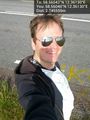
Deja vu @58.5604,12.3613


Achievements
Cjk earned the Déjà Vu Geohash Achievement
|

Cjk earned the Speed racer achievement
by passing through the (58, 12) geohash on 2012-08-25 at the maximum legal speed.