Difference between revisions of "2012-10-22 47 -122"
imported>Thomcat ([live] Left work) |
imported>FippeBot m (Location) |
||
| (4 intermediate revisions by one other user not shown) | |||
| Line 18: | Line 18: | ||
== Expedition == | == Expedition == | ||
| − | + | *Left work -- [[User:Thomcat|Thomcat]] [http://www.openstreetmap.org/?lat=47.79694103&lon=-122.19831203&zoom=16&layers=B000FTF @47.7969,-122.1983] 15:05, 22 October 2012 (PDT) | |
| + | Pouring rain as I headed south, traffic very much affected. You see, Seattle drivers can't drive in the rain. Or the snow, or at night. Or in the sun for that matter. | ||
| − | + | On the way in, I passed buildings A, B, and C of the Google Kirkland campus. The proper street was quite easily found. I parked in the driveway of the spot, nobody home, and did the GPS dance with the car. I didn't find any historical mention of Feriton, and the railroad tracks looked quite disused. | |
| − | + | ||
| − | + | Decided not to take the toll bridge in the rain, but instead headed home my usual route, making just one stop - for Fish and Chips. | |
== Photos == | == Photos == | ||
| Line 30: | Line 31: | ||
--> | --> | ||
<gallery perrow="5"> | <gallery perrow="5"> | ||
| + | |||
| + | Image:2012-10-22_47_-122_15-32-03-121.jpg | Under a damp tree. [http://www.openstreetmap.org/?lat=47.67125764&lon=-122.19497873&zoom=16&layers=B000FTF @47.6713,-122.1950] | ||
| + | |||
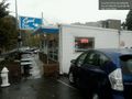
| + | Image:2012-10-22_47_-122_15-33-01-341.jpg | Success! [http://www.openstreetmap.org/?lat=47.67125932&lon=-122.19497773&zoom=16&layers=B000FTF @47.6713,-122.1950] | ||
| + | |||
| + | Image:2012-10-22_47_-122_15-52-35-476.jpg | Another geohash with Spud! [http://www.openstreetmap.org/?lat=47.70522912&lon=-122.21280577&zoom=16&layers=B000FTF @47.7052,-122.2128] | ||
</gallery> | </gallery> | ||
| Line 37: | Line 44: | ||
| − | |||
| − | |||
| − | |||
[[Category:Expeditions]] | [[Category:Expeditions]] | ||
| − | |||
[[Category:Expeditions with photos]] | [[Category:Expeditions with photos]] | ||
| − | |||
| − | |||
| − | |||
| − | |||
| − | |||
[[Category:Coordinates reached]] | [[Category:Coordinates reached]] | ||
| − | + | {{location|US|WA|KN}} | |
| − | |||
| − | |||
| − | |||
| − | |||
| − | |||
| − | |||
| − | |||
| − | |||
| − | |||
| − | |||
| − | |||
| − | |||
| − | |||
| − | |||
| − | |||
| − | |||
| − | |||
Latest revision as of 06:38, 13 August 2019
| Mon 22 Oct 2012 in Seattle: 47.6712662, -122.1950194 geohashing.info google osm bing/os kml crox |
Location
Just off 7th Street South in Kirkland, a neighborhood called Feriton.
Participants
Plans
Stop by after work, call it 3:30, then take the toll bridge back to Seattle.
Expedition
- Left work -- Thomcat @47.7969,-122.1983 15:05, 22 October 2012 (PDT)
Pouring rain as I headed south, traffic very much affected. You see, Seattle drivers can't drive in the rain. Or the snow, or at night. Or in the sun for that matter.
On the way in, I passed buildings A, B, and C of the Google Kirkland campus. The proper street was quite easily found. I parked in the driveway of the spot, nobody home, and did the GPS dance with the car. I didn't find any historical mention of Feriton, and the railroad tracks looked quite disused.
Decided not to take the toll bridge in the rain, but instead headed home my usual route, making just one stop - for Fish and Chips.
Photos
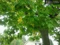
Under a damp tree. @47.6713,-122.1950

Success! @47.6713,-122.1950
Another geohash with Spud! @47.7052,-122.2128


