Difference between revisions of "2013-01-29 50 11"
imported>Paintedhell |
imported>Paintedhell (→Expedition) |
||
| Line 13: | Line 13: | ||
== Expedition == | == Expedition == | ||
| − | When I saw where today's Geohash point was, my first reaction was "That's near enough to run there" - which was | + | When I saw where today's Geohash point was, my first reaction was "That's near enough to run there" - which was a pretty stupid idea, but actually the forestways were still too bad for a decent bike tour, so why not? |
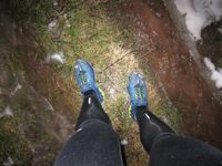
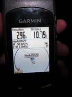
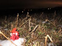
| − | The bigger streets were okay but most of the forest ways were a bad mix of mud, melting snow and ice, so biking would have been a bad idea indeed. I wasn't too fast running either, but anyway I reached the Geohash point - with wet feet of course. Surprisingly, the field was less muddy and bumpy than the way that led there, so I went back directly over the field, through the wet forest and home. Not the fastest half marathon ever run, but anyway it was my first try, most of the time I was busy not stumbling and avoiding all the hidden and obvious puddles on the way and didn't even touch my emergency food. Yay! | + | The bigger streets were okay but most of the forest ways were a bad mix of mud, melting snow and ice, so biking would have been a bad idea indeed. I wasn't too fast running either, but anyway I reached the Geohash point - with wet feet of course. Surprisingly, the field was less muddy and bumpy than the way that led there, so I went back directly over the field, through the wet forest and home. Not the fastest half marathon ever run, but anyway it was my first try, most of the time I was busy not stumbling and avoiding all the hidden and obvious puddles on the way and didn't even touch my emergency food. Yay! |
== Photos == | == Photos == | ||
Revision as of 20:56, 29 January 2013
| Tue 29 Jan 2013 in 50,11: 50.9055459, 11.7045597 geohashing.info google osm bing/os kml crox |
Location
20 meters into a probably muddy field near Mennewitz (Schlöben), Thuringia.
Participants
- Davey and Juja
Expedition
When I saw where today's Geohash point was, my first reaction was "That's near enough to run there" - which was a pretty stupid idea, but actually the forestways were still too bad for a decent bike tour, so why not?
The bigger streets were okay but most of the forest ways were a bad mix of mud, melting snow and ice, so biking would have been a bad idea indeed. I wasn't too fast running either, but anyway I reached the Geohash point - with wet feet of course. Surprisingly, the field was less muddy and bumpy than the way that led there, so I went back directly over the field, through the wet forest and home. Not the fastest half marathon ever run, but anyway it was my first try, most of the time I was busy not stumbling and avoiding all the hidden and obvious puddles on the way and didn't even touch my emergency food. Yay!
Photos
|
