Difference between revisions of "2013-04-16 52 1"
imported>MagicIan (Created page with "== Location == On Hickling Broad. {{meetup graticule | lat=52 | lon=1 | date=2013-04-16 | graticule_name=Norwich | graticule_link=Norwich, United Kingdom}} == Participants ...") |
imported>MagicIan m (→Photos) |
||
| Line 37: | Line 37: | ||
== Photos == | == Photos == | ||
<gallery perrow="4"> | <gallery perrow="4"> | ||
| − | Image: | + | Image:160413_kayak.JPG|Photo of the fence and sign blocking my way to the hashpoint for Thursday 2013-02-21, 52.590684° 1.243271° (Norwich, United Kingdom) |
| − | Image: | + | Image:160413_boatyard.JPG|Photo of the fence and sign blocking my way to the hashpoint for Thursday 2013-02-21, 52.590684° 1.243271° (Norwich, United Kingdom) |
| + | Image:160413_sign.JPG|Photo of the fence and sign blocking my way to the hashpoint for Thursday 2013-02-21, 52.590684° 1.243271° (Norwich, United Kingdom) | ||
| + | Image:160413_Droid.png|PPhone screenshot showing proximity of the hashpoint for Thursday 2013-02-21, 52.590684° 1.243271° (Norwich, United Kingdom) | ||
</gallery> | </gallery> | ||
Revision as of 18:38, 17 April 2013
Location
On Hickling Broad.
| Tue 16 Apr 2013 in Norwich: 52.7227043, 1.6105782 geohashing.info google osm bing/os kml crox |
Participants
Expedition
Today's hash was an opportunity for MagicIan to try and achieve the Water Geohash achievement. He had a Scout meeting in the early evening, and it was already dark before he set off. And annoyingly he was half way there before realising he'd forgotten his camera, so would have to take photos using his phone and a head torch. This was a pity as it was a beautiful evening - just a crescent moon, but plenty light enough to navigate by, and the location was isolated enough that there was a superb view of stars to be gazed at on his way. He reached Martham at around 22:00 and launched shortly afterwards from the dyke on Ferrygate Lane. From there he turned left along the river Thurne before turning right to access the Broad. Unfortunately as it widened he spotted a floating crane which meant one thing: dredging. Sure enough, it emerged that his way was blocked and he would be unable to reach the hashpoint. So he turned around and headed home, slightly disappointed but still happy to have had a lovely evening paddle.
Achievements
MagicIan earned the No trespassing consolation prize
|
Photos

Photo of the fence and sign blocking my way to the hashpoint for Thursday 2013-02-21, 52.590684° 1.243271° (Norwich, United Kingdom)
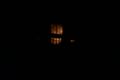
Photo of the fence and sign blocking my way to the hashpoint for Thursday 2013-02-21, 52.590684° 1.243271° (Norwich, United Kingdom)
Photo of the fence and sign blocking my way to the hashpoint for Thursday 2013-02-21, 52.590684° 1.243271° (Norwich, United Kingdom)
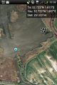
PPhone screenshot showing proximity of the hashpoint for Thursday 2013-02-21, 52.590684° 1.243271° (Norwich, United Kingdom)


