Difference between revisions of "2013-09-01 33 -117"
imported>Scerruti ([live] Gated , foiled..!) |
imported>FippeBot m (Location) |
||
| (14 intermediate revisions by one other user not shown) | |||
| Line 18: | Line 18: | ||
__NOTOC__ | __NOTOC__ | ||
== Location == | == Location == | ||
| − | + | On a street in a gated community of the Ivey Ranch subdivision of Oceanside, CA. | |
== Participants == | == Participants == | ||
| − | + | * [[User:Scerruti|Stephen Cerruti]] ([[User talk:Scerruti|talk]]), and family | |
| − | |||
== Plans == | == Plans == | ||
| − | + | I originally wanted to walk this without crossing my path. I even worked a way to visit the squishy store on the way. However I was brutally attacked by a gang of yellow jackets a few days ago and one of my feet wouldn't have handled it. So I improvised. | |
== Expedition == | == Expedition == | ||
| − | |||
| + | We left home with a plan to visit the hash during our errands. After a wrong turn we managed to visit the local Squishy vendor and acquired supplies for the trip. It was with dismay that I reached the gates of the community and realized that this was indeed a gated community. | ||
| + | |||
| + | *Gated , foiled! -- [[User:Scerruti|Stephen Cerruti]] ([[User talk:Scerruti|talk]]) [http://www.openstreetmap.org/?lat=33.21818614&lon=-117.30995874&zoom=16&layers=B000FTF @33.2182,-117.3100] 14:21, 1 September 2013 (PDT) | ||
| + | |||
| + | However, I was encouraged by my wife to continue on and we entered the community. '''Success!''' I proceeded down the street and made a u-turn to line the car up over the point for a gratuitous photo. Squishies are clearly visible in collector squishy cups with special squishy straws that were acquired on a previous trip. | ||
| − | |||
== Tracklog == | == Tracklog == | ||
<!-- if your GPS device keeps a log, you may post a link here --> | <!-- if your GPS device keeps a log, you may post a link here --> | ||
| Line 40: | Line 42: | ||
--> | --> | ||
<gallery perrow="5"> | <gallery perrow="5"> | ||
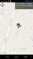
| + | Image:2013-09-01_33_-117_14-26-16-260.jpg | Screenshot | ||
| + | |||
| + | Image:2013-09-01_33_-117_15-51-38-995.jpg | Squishies in the back seat, spouse not shown (default setting). | ||
</gallery> | </gallery> | ||
== Achievements == | == Achievements == | ||
{{#vardefine:ribbonwidth|800px}} | {{#vardefine:ribbonwidth|800px}} | ||
| − | + | {{drag-along | latitude = 33 | longitude = -117 | date = 2013-09-01 | partner = Susan, spouse of Geohasher, | name = [[User:Scerruti|Stephen Cerruti]]}} | |
| − | + | {{GeoSquishy FirstSip | latitude = 33| longitude = -117 | date = 2013-09-01 | name = [[User:Scerruti|Stephen Cerruti]]}} | |
| − | |||
| − | |||
| − | |||
| − | [[ | ||
| − | |||
| − | |||
| − | |||
| − | [[ | ||
| − | |||
| − | |||
[[Category:Expeditions]] | [[Category:Expeditions]] | ||
| − | |||
[[Category:Expeditions with photos]] | [[Category:Expeditions with photos]] | ||
| − | + | ||
| − | |||
| − | |||
| − | |||
[[Category:Coordinates reached]] | [[Category:Coordinates reached]] | ||
| − | + | {{location|US|CA|SD}} | |
| − | |||
| − | |||
| − | |||
| − | |||
| − | |||
| − | |||
| − | |||
| − | |||
| − | |||
| − | |||
| − | |||
| − | |||
| − | |||
| − | |||
| − | |||
| − | |||
| − | |||
Latest revision as of 03:47, 14 August 2019
| Sun 1 Sep 2013 in 33,-117: 33.2189827, -117.3094025 geohashing.info google osm bing/os kml crox |
Location
On a street in a gated community of the Ivey Ranch subdivision of Oceanside, CA.
Participants
- Stephen Cerruti (talk), and family
Plans
I originally wanted to walk this without crossing my path. I even worked a way to visit the squishy store on the way. However I was brutally attacked by a gang of yellow jackets a few days ago and one of my feet wouldn't have handled it. So I improvised.
Expedition
We left home with a plan to visit the hash during our errands. After a wrong turn we managed to visit the local Squishy vendor and acquired supplies for the trip. It was with dismay that I reached the gates of the community and realized that this was indeed a gated community.
- Gated , foiled! -- Stephen Cerruti (talk) @33.2182,-117.3100 14:21, 1 September 2013 (PDT)
However, I was encouraged by my wife to continue on and we entered the community. Success! I proceeded down the street and made a u-turn to line the car up over the point for a gratuitous photo. Squishies are clearly visible in collector squishy cups with special squishy straws that were acquired on a previous trip.
Tracklog
Photos
Screenshot

Squishies in the back seat, spouse not shown (default setting).


Achievements
Stephen Cerruti earned the Drag-along achievement
|
Stephen Cerruti earned the First Sip GeoSquishy Achievement
|