Difference between revisions of "2013-09-03 51 9"
imported>GeorgDerReisende (new expedition to Kassel) |
m (Replacing http://wiki.xkcd.com/wgh/images/1/12/2013-09-03_51_9_GeorgDerReisende_gpx.jpg with {{filepath:2013-09-03_51_9_GeorgDerReisende_gpx.jpg}}) |
||
| (4 intermediate revisions by 2 users not shown) | |||
| Line 20: | Line 20: | ||
== Expedition == | == Expedition == | ||
| − | + | ||
| + | Due to the privacy policy I have started at the bus stop ''Arnimstraße''. I have taken the bus 27 until the stop ''Wolfsgraben'', where I changed to the tram 6. At the stop ''Dennhäuser Straße'' I changed to the bus 39. I left the bus at the stop ''Kraftwerk Kassel'', the next stop ''Neue Mühle'' had been too far, so I couldn't have went to the right street without breaking Tron's rule. Arriving at the field I decided at once to walk along the edge of the field and not to take the road, because the hedge between the road and the field didn't look to be passable. For Tron's rule this had been the right decision. I have found the hash and have taken some photos. | ||
| + | |||
| + | Then I stepped back to the road with a gap in the hedge. I walked along the way until the top of hill, from where I have taken another lot of photos. Then I walked to the tram stop ''Brüder-Grimm-Straße''. Then I have taken the tram 6 to ''Brückenhof'', the tram 4 to ''Friedenskirche'', the bus 27 to ''Mülhauser Platz'' and the tram 3 to the stop ''Arnimstraße''. | ||
== Tracklog == | == Tracklog == | ||
| Line 30: | Line 33: | ||
--> | --> | ||
<gallery perrow="5"> | <gallery perrow="5"> | ||
| + | Image:2013-09-03 51 9 GeorgDerReisende 9373.jpg | the bus stop ''Arnimstraße'' in Kassel | ||
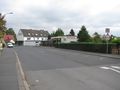
| + | Image:2013-09-03 51 9 GeorgDerReisende 9382.jpg | the bus stop ''Kraftwerk Kassel'' in Kassel | ||
| + | Image:2013-09-03 51 9 GeorgDerReisende 9383.jpg | ''Dennhäuser Straße'' and ''Am Sandweg'' in Kassel at the ''Neue Mühle'' | ||
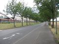
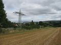
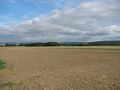
| + | Image:2013-09-03 51 9 GeorgDerReisende 9391.jpg | the field behind the power station | ||
| + | Image:2013-09-03 51 9 GeorgDerReisende 9396.jpg | proof1 | ||
| + | Image:2013-09-03 51 9 GeorgDerReisende 9400.jpg | proof2 | ||
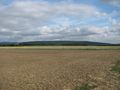
| + | Image:2013-09-03 51 9 GeorgDerReisende 9402.jpg | the quarter ''Neue Mühle'' of Kassel, in the back the quarter ''Bergshausen'' of Fuldabrück | ||
| + | Image:2013-09-03 51 9 GeorgDerReisende 9403.jpg | view to the east | ||
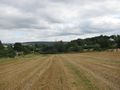
| + | Image:2013-09-03 51 9 GeorgDerReisende 9405.jpg | view to the south from the hash | ||
| + | Image:2013-09-03 51 9 GeorgDerReisende 9406.jpg | view to the west | ||
| + | Image:2013-09-03 51 9 GeorgDerReisende 9407.jpg | the power station ''Kraftwerk Kassel'' | ||
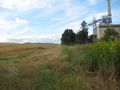
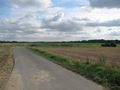
| + | Image:2013-09-03 51 9 GeorgDerReisende 9411.jpg | the ditch at the end of the field | ||
| + | Image:2013-09-03 51 9 GeorgDerReisende 9423.jpg | from the top of the hill: view to the northeast: far behind the Kaufunger Wald | ||
| + | Image:2013-09-03 51 9 GeorgDerReisende 9422.jpg | from the top of the hill: view to the east: the Söhrewald | ||
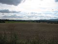
| + | Image:2013-09-03 51 9 GeorgDerReisende 9424.jpg | from the top of the hill: view to the southeast: the ''Langes Feld'' | ||
| + | Image:2013-09-03 51 9 GeorgDerReisende 9425.jpg | from the top of the hill: view to the south: the VW-factory at the horizon | ||
| + | Image:2013-09-03 51 9 GeorgDerReisende 9426.jpg | from the top of the hill: view to the south: the Baunsberg | ||
| + | Image:2013-09-03 51 9 GeorgDerReisende 9428.jpg | from the top of the hill: view to the southwest: in the foreground the quarter Brückenhof, in the background the Habichtswald | ||
| + | Image:2013-09-03 51 9 GeorgDerReisende 9429.jpg | from the top of the hill: view to the west: only a way to Niederzwehren | ||
| + | Image:2013-09-03 51 9 GeorgDerReisende 9430.jpg | from the top of the hill: view to the northwest: part of Kassel | ||
| + | Image:2013-09-03 51 9 GeorgDerReisende 9431.jpg | from the top of the hill: view to the north: the eastern part of Kassel | ||
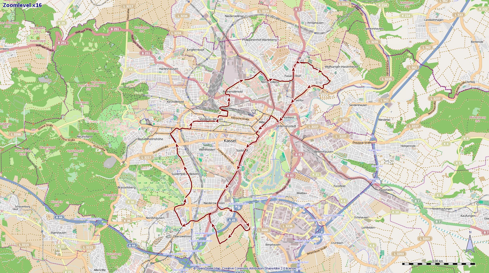
| + | IMage:2013-09-03 51 9 GeorgDerReisende gpx.jpg | the gps log | ||
</gallery> | </gallery> | ||
| Line 36: | Line 61: | ||
<!-- Add any achievement ribbons you earned below, or remove this section --> | <!-- Add any achievement ribbons you earned below, or remove this section --> | ||
| + | {{Tron | latitude = 51 | longitude = 9 | date = 2013-09-03 | tracklog = {{filepath:2013-09-03_51_9_GeorgDerReisende_gpx.jpg}} | possessive = his | name = GeorgDerReisende }} | ||
| − | + | {{Public transport geohash | latitude = 51 | longitude = 9 | date = 2013-08-28 | busline = bus 27 & 39 & trams 6 & 4 | name = GeorgDerReisende }} | |
| − | |||
| − | |||
| − | + | [[Category:Expeditions]] | |
| − | |||
| − | [[Category: | ||
| − | |||
| − | |||
| − | |||
| − | |||
[[Category:Expeditions with photos]] | [[Category:Expeditions with photos]] | ||
| − | + | ||
| − | |||
| − | |||
| − | |||
| − | |||
[[Category:Coordinates reached]] | [[Category:Coordinates reached]] | ||
| − | + | {{location|DE|HE|KS|city=true}} | |
| − | |||
| − | |||
| − | |||
| − | |||
| − | |||
| − | |||
| − | |||
| − | |||
| − | |||
| − | |||
| − | |||
| − | |||
| − | |||
| − | |||
| − | |||
| − | |||
| − | |||
Latest revision as of 12:51, 19 February 2020
| Tue 3 Sep 2013 in 51,9: 51.2765677, 9.4844792 geohashing.info google osm bing/os kml crox |
Location
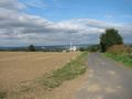
The hash lies on the western side of the power plant at the Dennhäuser Straße in Kassel
Participants
Plans
To go there by public transport and try a Tron achievement.
Expedition
Due to the privacy policy I have started at the bus stop Arnimstraße. I have taken the bus 27 until the stop Wolfsgraben, where I changed to the tram 6. At the stop Dennhäuser Straße I changed to the bus 39. I left the bus at the stop Kraftwerk Kassel, the next stop Neue Mühle had been too far, so I couldn't have went to the right street without breaking Tron's rule. Arriving at the field I decided at once to walk along the edge of the field and not to take the road, because the hedge between the road and the field didn't look to be passable. For Tron's rule this had been the right decision. I have found the hash and have taken some photos.
Then I stepped back to the road with a gap in the hedge. I walked along the way until the top of hill, from where I have taken another lot of photos. Then I walked to the tram stop Brüder-Grimm-Straße. Then I have taken the tram 6 to Brückenhof, the tram 4 to Friedenskirche, the bus 27 to Mülhauser Platz and the tram 3 to the stop Arnimstraße.
Tracklog
Photos
the bus stop Arnimstraße in Kassel
the bus stop Kraftwerk Kassel in Kassel
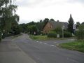
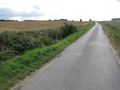
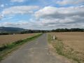
Dennhäuser Straße and Am Sandweg in Kassel at the Neue Mühle
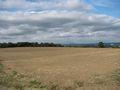
the field behind the power station
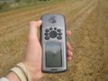
proof1
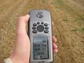
proof2
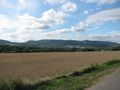
the quarter Neue Mühle of Kassel, in the back the quarter Bergshausen of Fuldabrück
view to the east
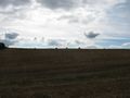
view to the south from the hash
view to the west
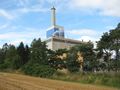
the power station Kraftwerk Kassel
the ditch at the end of the field
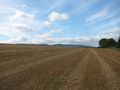
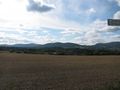
from the top of the hill: view to the northeast: far behind the Kaufunger Wald
from the top of the hill: view to the east: the Söhrewald
from the top of the hill: view to the southeast: the Langes Feld
from the top of the hill: view to the south: the VW-factory at the horizon
from the top of the hill: view to the south: the Baunsberg
from the top of the hill: view to the southwest: in the foreground the quarter Brückenhof, in the background the Habichtswald
from the top of the hill: view to the west: only a way to Niederzwehren
from the top of the hill: view to the northwest: part of Kassel
from the top of the hill: view to the north: the eastern part of Kassel
the gps log


Achievements
GeorgDerReisende earned the Tron achievement
|
GeorgDerReisende earned the Public transport geohash achievement
|