Difference between revisions of "2013-09-17 -43 171"
imported>Quaternary |
imported>Quaternary (→Photos) |
||
| Line 33: | Line 33: | ||
== Photos == | == Photos == | ||
| − | Image:2013_09_17_-43_171_Arrived.jpg | | + | Image:2013_09_17_-43_171_Arrived.jpg | l |
| − | Image:2013_09_17_-43_171_Date and Time.png | | + | Image:2013_09_17_-43_171_Date and Time.png | l |
| − | Image:2013_09_17_-43_171_Onsite.jpg | | + | Image:2013_09_17_-43_171_Onsite.jpg | l |
| − | Image:2013_09_17_-43_171_The Marker.jpg | | + | Image:2013_09_17_-43_171_The Marker.jpg | l |
<gallery perrow="5"> | <gallery perrow="5"> | ||
Revision as of 10:46, 17 September 2013
| Tue 17 Sep 2013 in -43,171: -43.7514902, 171.9974819 geohashing.info google osm bing/os kml crox |
Location
Rakaia, New Zealand
Participants
Plans
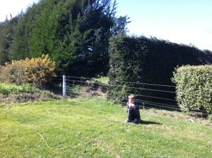
A happy convergence of fate! Looking at the Geohashing Coordinate Calculator it was apparent that in the neighbouring graticule to where I live, there was a publically accessible geohash location PLUS we had to go and pick up a Trademe (online auction) purchase about one kilometre away from it. This calls for some geohashing! (Son, you'd better take the day off school - otherwise there would be no-one to be in the photo).
Expedition
With the Trademe item successfully picked up (a beehive) it was off to find the geohash. It was found without too much of a problem. One of the neighbours came out and shared a yarn with us - he thought it was pretty cool concept and was a little sad that it wasn't on his property :)
Tracklog
Photos
Image:2013_09_17_-43_171_Arrived.jpg | l Image:2013_09_17_-43_171_Date and Time.png | l Image:2013_09_17_-43_171_Onsite.jpg | l Image:2013_09_17_-43_171_The Marker.jpg | l
