2014-01-15 43 -79
From Geohashing
| Wed 15 Jan 2014 in 43,-79: 43.6848185, -79.9745769 geohashing.info google osm bing/os kml crox |
Location
Within the Silver Creek Conservation Area near Georgetown, ON.
Within a cluster of forest trees off of a road that runs near some residential homes.
Participants
Expedition
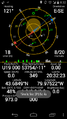
Visited this geohash, got within 40m or so before being defeated by 2 feet of snow and dense trees.
sbear's write-up here. Wasn't able to reach the exact location due to nighttime, deep snow, and heavy trees.
Photos
as close as sbear reached
