Difference between revisions of "2014-03-20 50 11"
From Geohashing
imported>Paintedhell (Created page with "{{meetup graticule | lat=50 | lon=11 | date=2014-03-20 }} __NOTOC__ == Location == In a small wood near Keßlar. == Participants == * Juja, Benjy and F...") |
imported>FippeBot m (Location) |
||
| (One intermediate revision by one other user not shown) | |||
| Line 16: | Line 16: | ||
== Photos == | == Photos == | ||
| − | {{gallery|width=200|height=200|lines= | + | {{gallery|width=200|height=200|lines=1 |
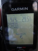
|Image:140320_50_11_1.jpg|Hashpoint reached! | |Image:140320_50_11_1.jpg|Hashpoint reached! | ||
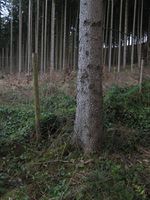
|Image:140320_50_11_2.jpg|Hash tree right outside the fence. | |Image:140320_50_11_2.jpg|Hash tree right outside the fence. | ||
| Line 27: | Line 27: | ||
[[Category:Expeditions with photos]] | [[Category:Expeditions with photos]] | ||
[[Category:Coordinates reached]] | [[Category:Coordinates reached]] | ||
| + | {{location|DE|TH|AP}} | ||
Latest revision as of 05:57, 14 August 2019
| Thu 20 Mar 2014 in 50,11: 50.8471492, 11.3828513 geohashing.info google osm bing/os kml crox |
Location
In a small wood near Keßlar.
Participants
- Juja, Benjy and Frankie Mouse
Expedition
Today was the first day of spring and it felt like the first day of summer, so I used my new freedom and left work a little early for a sunny Geohashing expedition by bike. I forgot to put a map on my GPS, but I remembered my planned route and also found the right way to the point without its help. It was no problem to use that forest road on my roadbike, I arrived near the point, but there was a small stretch of wood that was fenced (about 50x50m). Luckily, the point was right outside the fence, so I was successful and could enjoy the ride home (finally with tailwind).
Photos
|
