Difference between revisions of "2014-03-25 43 -121"
imported>Frogman (→Participants) |
imported>FippeBot m (Location) |
||
| (4 intermediate revisions by one other user not shown) | |||
| Line 32: | Line 32: | ||
== Expedition == | == Expedition == | ||
| − | + | After a day of shopping in Bend, we drove down 97 through La Pine and over to South Century Drive. Because Maggie's foot was injured, we tried to minimize the trail blazing as much as possible. Luckily, the nearby National Forest roads were easily accessible to foot traffic, so we parked the car on one of them and hiked the rest of the way. | |
| + | |||
| + | The hashpoint itself was a bit off the road, and in a very nasty patch of manzanita. This turned out to be a doable hike for Maggie, but unfortunately this trip was impromptu so Kate was not wearing adequate leg protection and got all scratched up. We did manage to get to the hashpoint and take some pictures. Nearby Wickiup Reservoir was visible from the top of the hill, but not from the hashpoint itself. | ||
== Tracklog == | == Tracklog == | ||
| Line 42: | Line 44: | ||
--> | --> | ||
<gallery perrow="5"> | <gallery perrow="5"> | ||
| + | Image:2014-03-25 43 -121 snow.jpg | Daisy finds snow. | ||
| + | Image:2014-03-25 43 -121 snow2.jpg | The rest of the ground was very muddy around there, so over snow turns out to be the best way to go! | ||
| + | Image:2014-03-25 43 -121 forest.jpg | The forest was gorgeous. | ||
| + | Image:2014-03-25 43 -121 stick.jpg | Daisy finds a stick. | ||
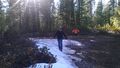
| + | Image:2014-03-25 43 -121 navigation.jpg | [[User:Benture|Benture]] makes sure that we're headed the right way. | ||
| + | Image:2014-03-25 43 -121 on the way.jpg | On the way there! | ||
| + | Image:2014-03-25 43 -121 hill.jpg | We climbed up a hill to get to the hashpoint. | ||
| + | Image:2014-03-25 43 -121 hill2.jpg | The hill was pretty rocky. | ||
| + | Image:2014-03-25 43 -121 hill3.jpg | Taking a breather amidst manzanita. | ||
| + | Image:2014-03-25 43 -121 view.jpg | The view from the hashpoint! | ||
| + | Image:2014-03-25 43 -121 hashpoint.jpg | Hanging out at the hashpoint. | ||
| + | Image:2014-03-25 43 -121 grins.jpg | Goofy grins! | ||
| + | Image:2014-03-25 43 -121 proof.jpg | After a couple minutes of trying to figure out how to take screenshots, we opt for a less elegant method of providing proof. | ||
| + | Image:2014-03-25 43 -121 walking back.jpg | Walking back. | ||
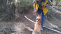
| + | Image:2014-03-25 43 -121 scratches.jpg | Velociraptors, disguised as plants, attacked Kate! | ||
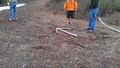
| + | Image:2014-03-25 43 -121 geotrash.jpg | Geotrashing. | ||
| + | Image:2014-03-25 43 -121 road sign.jpg | This road sign fell over, so I put it back up. | ||
| + | Image:2014-03-25 43 -121 arrows.jpg | Some members of our party were lagging behind, so we constructed some arrows to point them the right way. By the time the arrows were done, though, they had caught up. | ||
</gallery> | </gallery> | ||
| Line 47: | Line 67: | ||
{{#vardefine:ribbonwidth|800px}} | {{#vardefine:ribbonwidth|800px}} | ||
<!-- Add any achievement ribbons you earned below, or remove this section --> | <!-- Add any achievement ribbons you earned below, or remove this section --> | ||
| + | {{Velociraptor geohash | ||
| + | | latitude = 43 | ||
| + | | longitude = -121 | ||
| + | | date = 2014-03-25 | ||
| + | | name = Kate | ||
| + | | image = 2014-03-25 43 -121 scratches.jpg | ||
| + | }} | ||
| + | {{Geotrash | ||
| + | | latitude = 43 | ||
| + | | longitude = -121 | ||
| + | | date = 2014-03-25 | ||
| + | | image = 2014-03-25 43 -121 geotrash.jpg | ||
| + | }} | ||
| − | |||
| − | |||
| − | |||
| − | |||
| − | |||
| − | |||
| − | |||
| − | |||
| − | |||
| − | |||
| − | |||
| − | |||
| − | |||
[[Category:Expeditions]] | [[Category:Expeditions]] | ||
| − | |||
[[Category:Expeditions with photos]] | [[Category:Expeditions with photos]] | ||
| − | |||
| − | |||
| − | |||
| − | |||
| − | |||
[[Category:Coordinates reached]] | [[Category:Coordinates reached]] | ||
| − | + | {{location|US|OR|DE}} | |
| − | |||
| − | |||
| − | |||
| − | |||
| − | |||
| − | |||
| − | |||
| − | |||
| − | |||
| − | |||
| − | |||
| − | |||
| − | |||
| − | |||
| − | |||
| − | |||
| − | |||
Latest revision as of 05:59, 14 August 2019
| Tue 25 Mar 2014 in 43,-121: 43.7398427, -121.7032287 geohashing.info google osm bing/os kml crox |
Location
On a hill thick with manzanita, west of La Pine, Oregon in Deschutes National Forest.
Participants
Plans
Expedition
After a day of shopping in Bend, we drove down 97 through La Pine and over to South Century Drive. Because Maggie's foot was injured, we tried to minimize the trail blazing as much as possible. Luckily, the nearby National Forest roads were easily accessible to foot traffic, so we parked the car on one of them and hiked the rest of the way.
The hashpoint itself was a bit off the road, and in a very nasty patch of manzanita. This turned out to be a doable hike for Maggie, but unfortunately this trip was impromptu so Kate was not wearing adequate leg protection and got all scratched up. We did manage to get to the hashpoint and take some pictures. Nearby Wickiup Reservoir was visible from the top of the hill, but not from the hashpoint itself.
Tracklog
Photos
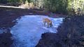
Daisy finds snow.
The rest of the ground was very muddy around there, so over snow turns out to be the best way to go!
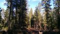
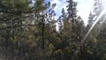
The forest was gorgeous.
Daisy finds a stick.
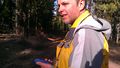
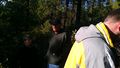
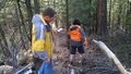
Benture makes sure that we're headed the right way.
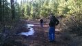
On the way there!
We climbed up a hill to get to the hashpoint.
The hill was pretty rocky.
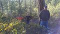
Taking a breather amidst manzanita.
The view from the hashpoint!
Hanging out at the hashpoint.

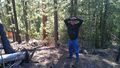
Goofy grins!
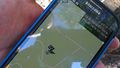
After a couple minutes of trying to figure out how to take screenshots, we opt for a less elegant method of providing proof.
Walking back.
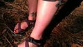
Velociraptors, disguised as plants, attacked Kate!
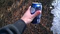
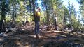
Geotrashing.
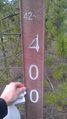
This road sign fell over, so I put it back up.
Some members of our party were lagging behind, so we constructed some arrows to point them the right way. By the time the arrows were done, though, they had caught up.


Achievements
Kate earned the Velociraptor Geohash Achievement
|
This user earned the GeoTrash Geohash Achievement
|